06/22 Ryan's "Cloudy & Damp" Monday Evening Forecast
Last week was hot and dry, while this one will be hot and damp as showers are expected nearly everyday.

Last week was hot and dry, while this one will be hot and damp as showers are expected nearly everyday.
It's feeling pretty good right now, but even higher humidity is on the way as summer begins this weekend.
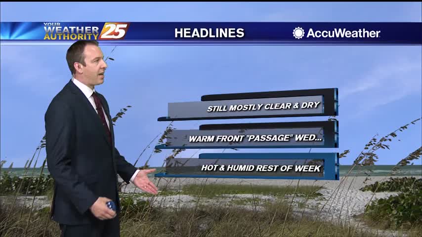
Not much has changed since last weekend, and won't be changing for the rest of the week.

Lower humidity in the region will continue through Thursday before subtle changes begin to occur. Thursday through Saturday will basically be a continuation of the first half of the week, characterized by above normal daytime temps, below normal lows, and…

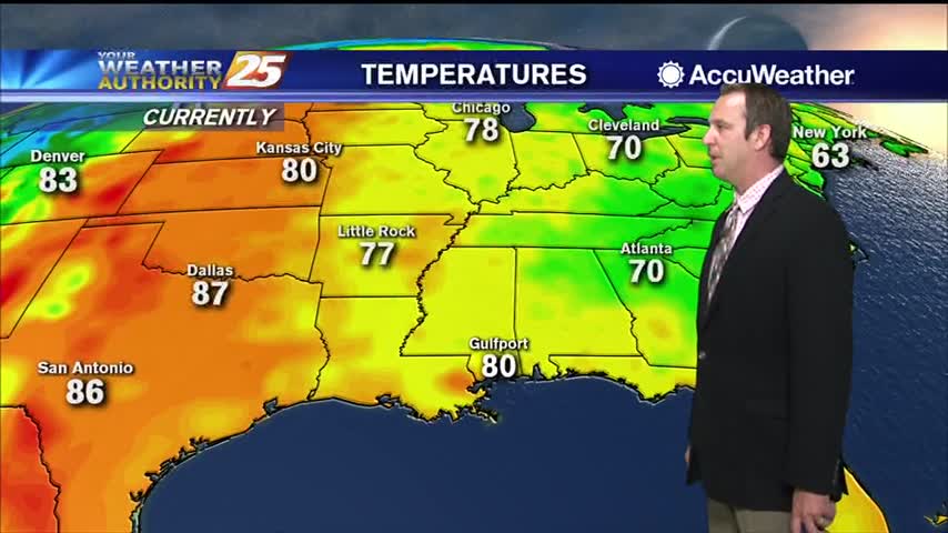
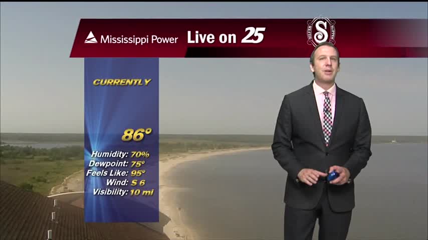
High temps on Wednesday will be in the mid and upper 80s with a few spots reaching 90. Lows tonight will be in the low to mid 60s inland to low 70s along the coast. Hot days with isolated showers…
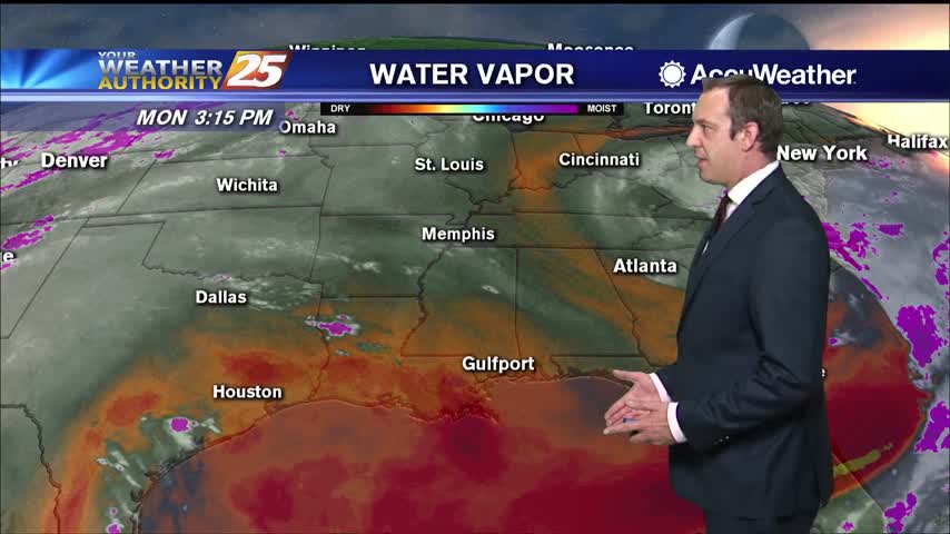
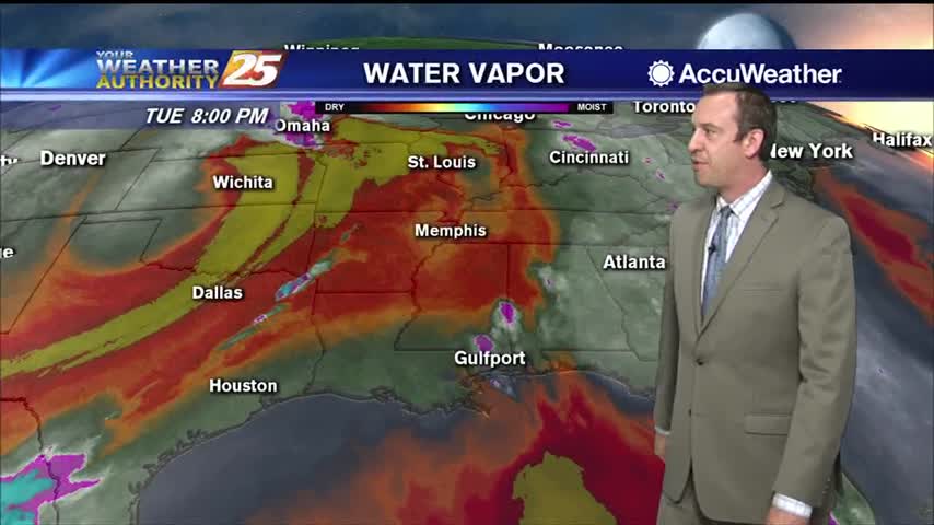
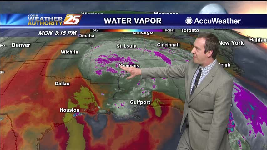
The upper level low over the Carolinas will continue to slowly lift northward through Wednesday. This feature will continue to usher dry mid-level air into the northern Gulf coast region. Despite the abundant dry air, there will be enough moisture…
We've begun the final week of Spring, so I guess it's appropriate it won't be very "spring-like."
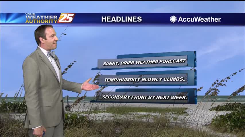
More sunny and drier weather is on the way, with very little cloud cover in the days ahead.
One last blast of rain this morning, but clearing skies and cooling air is on the way.
Drier air is finally on the way, but until it really takes hold it'll still be raining a little longer.
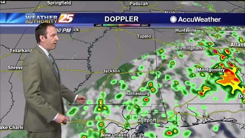
Scattered showers continue in South MS, but these wet, hot, and muggy days are almost over.
Cristobal has moved inland, but rain will continue for the next few days....

Today was nice and sunny with a couple of isolated showers, but tropical influences will bring heavy rain and strong storms to the Gulf Coast for the weekend.
Didn't see many afternoon showers today, but we'll rarely be completely rid of them as summer rolls around....
Our afternoon clouds and showers have cleared, and we're in for a long string of sunny days ahead.

It's been pretty cloudy all week, but we're finally starting to see some positive changes moving in.
Only a small spot of rain today in South MS, but we saw plenty of clouds and high humidity again.
Tonight, a gradual cool down is expected with temperatures only getting into the mid 70s by midnight and into the lower 70s by Friday morning. Clouds will filter into the region overnight, creating partly cloudy skies by sunrise. A few…
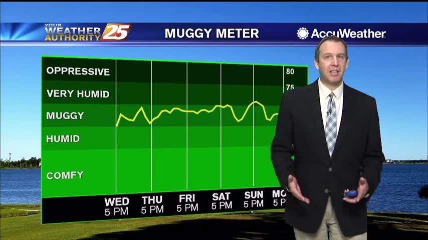
A stiff southerly breeze has increased dewpoints into "muggy" territory, and it doesn't get much better until next week.
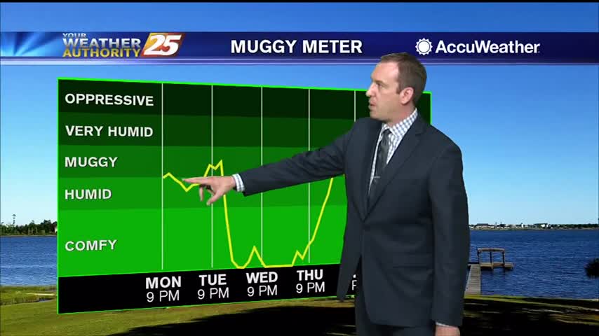
It's warmed steadily through the weekend, but the humidity hasn't risen much. That changes quickly later on this week.

It's been quite hot over the last few days and still was today, but cooler air is on the way.
The weather will remain nice, but heats up tomorrow before a slight cool-down and some end of week rain.

Strong storms moved through late last night, but not much happened in South MS other than a surge of drier air.
Hot and humid weather led to some mid 90 heat indices today, but cooler weather is on the way!