Steve's Workweek Kickoff Forecast
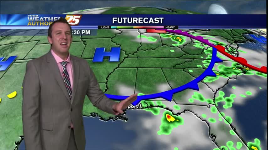
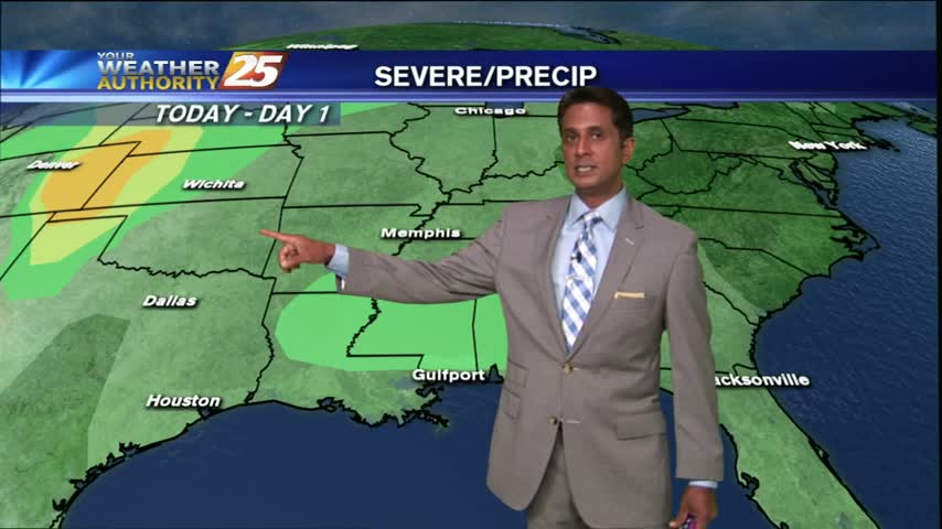
Will the rain chances end? Will Tropical Depression Four affect the Gulf of Mexico? Find out in Steve's Workweek Kickoff Forecast.
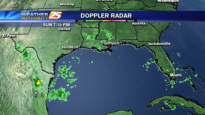
Will the rain chances end? Will Tropical Depression Four affect the Gulf of Mexico? Find out in Steve's Workweek Kickoff Forecast.
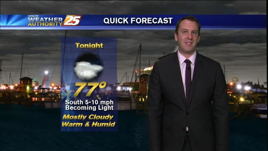
It started off as a hot Friday day, but quickly became a cooler, stormy Friday Night. We will warm up a bit more tonight due to cloudiness, our "low" near 78, and there is still a chance of seeing a…
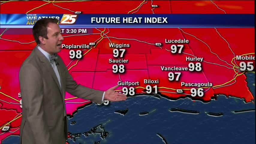
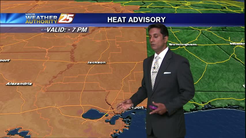
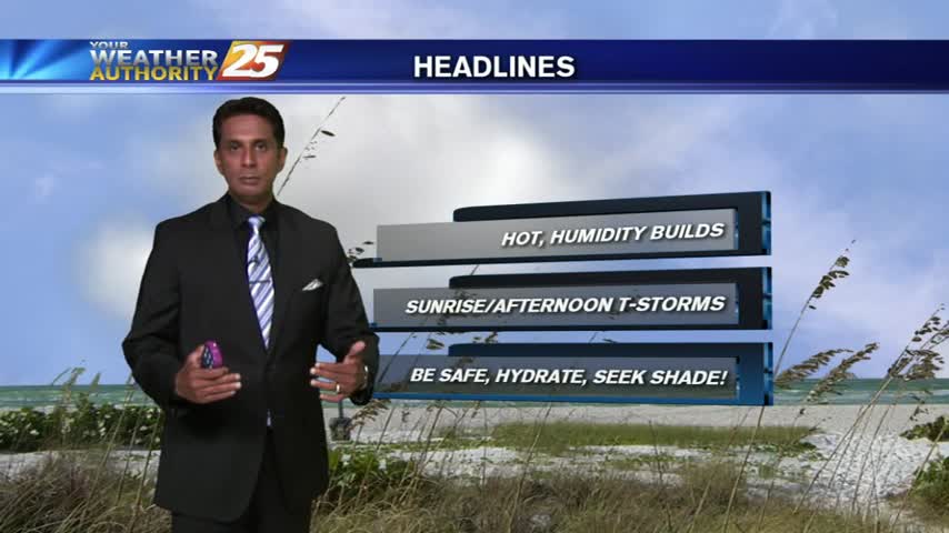
With today's heat advisory still in effect until 7 PM tonight, coastal residents should still be cautious if spending prolonged time outside as Friday comes to a close. We'll see another warm, humid night tonight with mostly cloudy skies and…
A VERY WARM & HUMID start with temperatures already in the low 80s, under mostly clear skies...

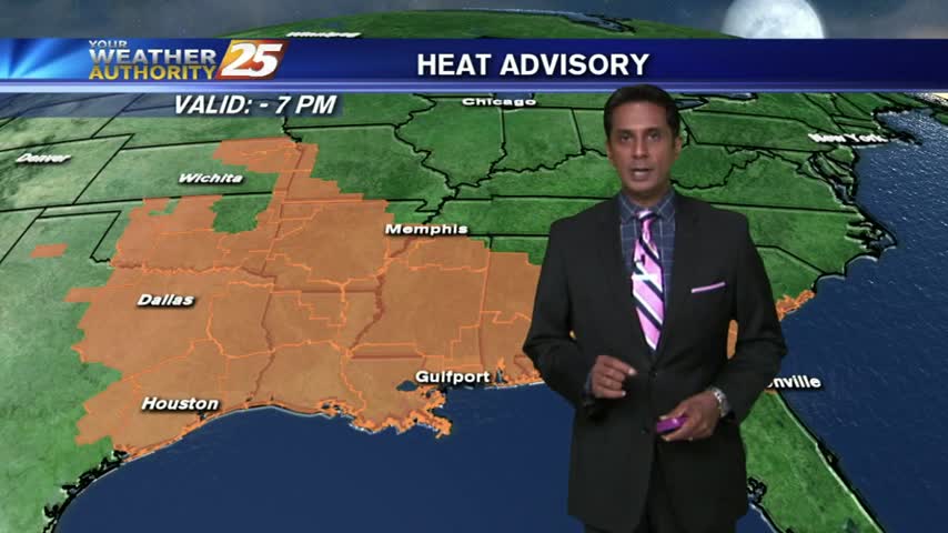
It has been a very hot Thursday afternoon so far with heat advisories being issued for much of South Mississippi through tonight and into tomorrow evening. You can expect a mostly clear, hot, and humid evening with light Westerly winds…
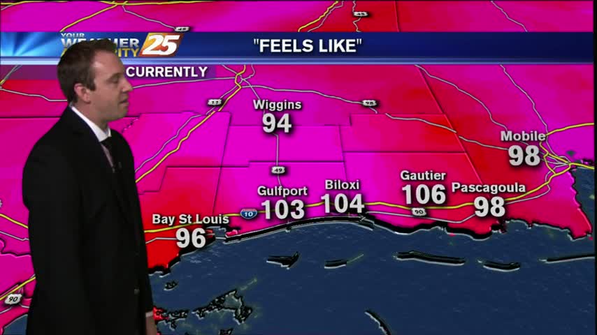
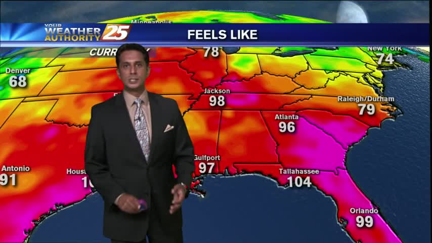
After a warm morning...the HEAT INDEX is around the 103° range...with DANGEROUS HEAT to continue!
A warm & humid morning as temps are already in the low 80s, A HEAT ADVISORY is in effect through this evening...
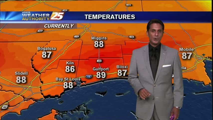
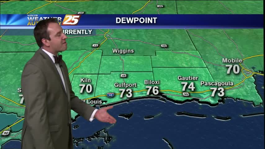
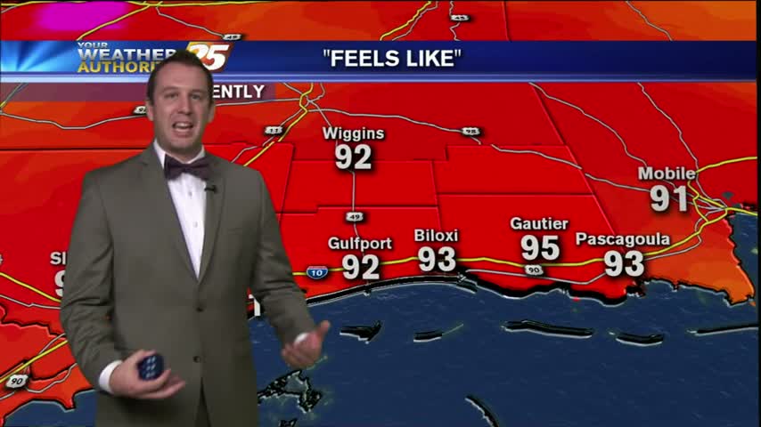
It has been a hot and sticky Wednesday so far, with dew points in the 80s in some areas and a heat index near 103 in Gulfport. We had less in the way of showers than we had the day…
Very isolated showers along with hot and humid conditions as the HEAT INDEX climbs into the mid/upper 90s...
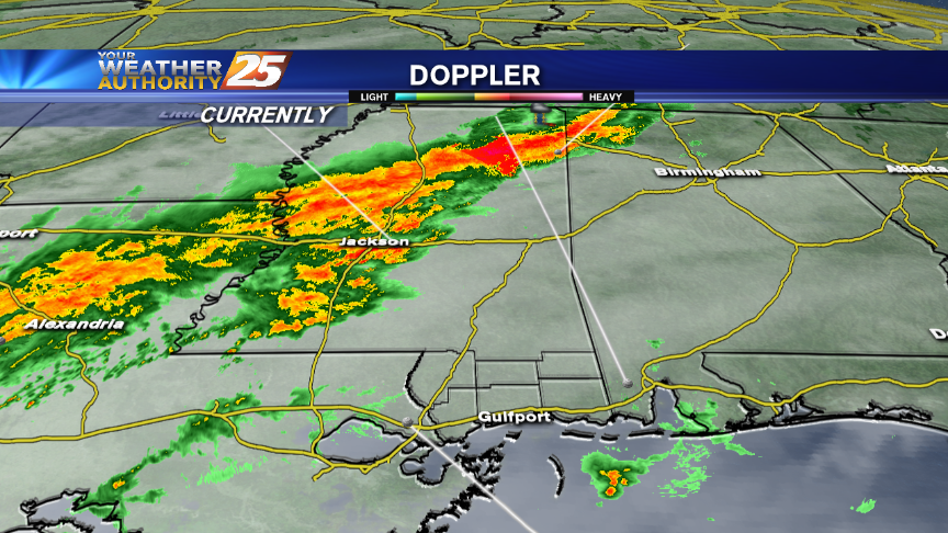
It's been a stormy Tuesday afternoon so far, and it's likely that we'll see a few more showers and thunderstorms through the rest of the evening. Expect tonight to cool down slightly due to the showers and cloud cover, low…
Isolated activity from this morning continuing to develop with the help of daytime heating...
The strong tropical air mass continues, with showers and thunderstorms developing and moving into the area...
It's been quite a rainy monday afternoon so far, and while the storms are beginning to weaken, showers will continue in South MS. We won't see many of them in the overnight hours, which are expected to be cloudy and…
After very light rain this morning, the activity is starting to increase with showers & thunderstorms expected...
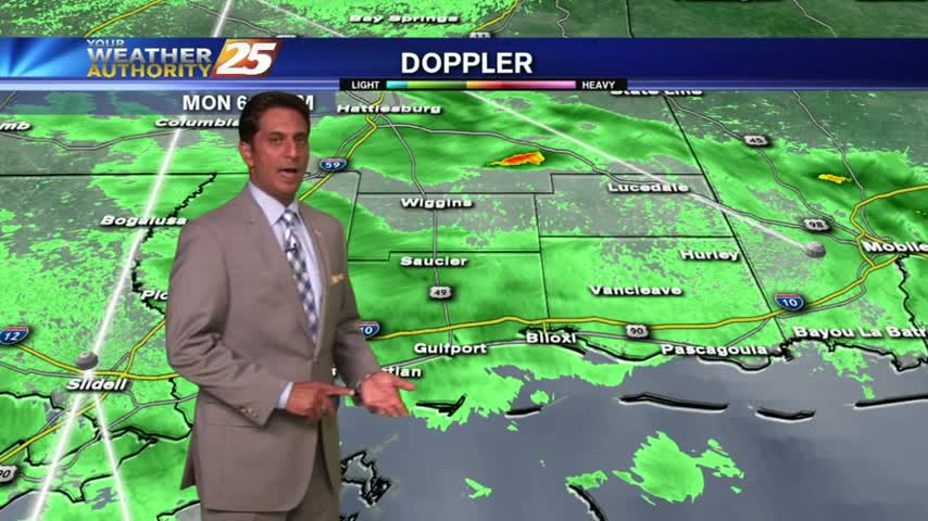
After a WARM/HUMID weekend with t-storms...you Monday morning is starting out with light rain.
Will afternoon and evening showers and thunderstorms be around in the coming week? Meteorologist Steve Taylor's forecast is here!
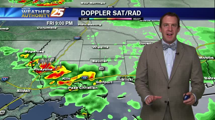
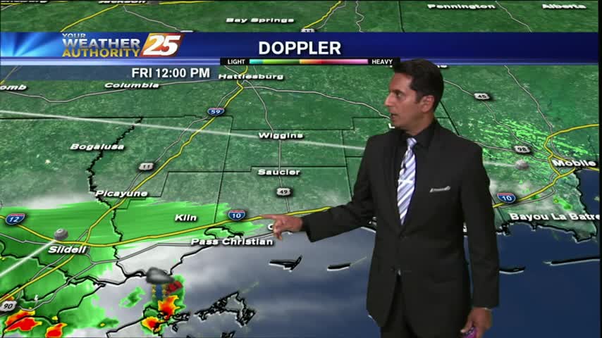
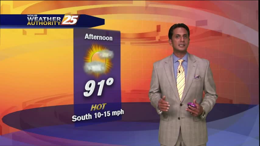
Today was nice for much of the day, but showers began to move around the area in the afternoon leading to a hot and humid Friday forecast. Expect the humidity and cloud cover to remain through the night, but it…
After isolated t-storms over the sound this morning, this afternoon will be HOT & HUMID...
A pretty sunrise with a few clouds in the area, along with warm temps in the 70s...

Upper level cloud cover kept much of the Sun's rays from doing too much damage to our temperatures today, leading to a slightly cooler/drier Thursday. The clouds moved in during the afternoon and will stick around through the evening, making…
The clouds have thinned considerably as temps continue to rise...
With a stationary front in the northern Gulf, mid/upper level clouds are moving across south Mississippi...
You can expect to have a slightly cooler evening tonight than we've seen in quite some time. Mostly clear skies will allow maximum cooling, leading to an evening temperature near 69. It will heat right back up as we head…
We had another hot day today and we aren't likely to get a break from that for quite some time. We'll see a little cooling and continued clearing into tonight, when we'll see our temperatures drop into the upper 60s,…