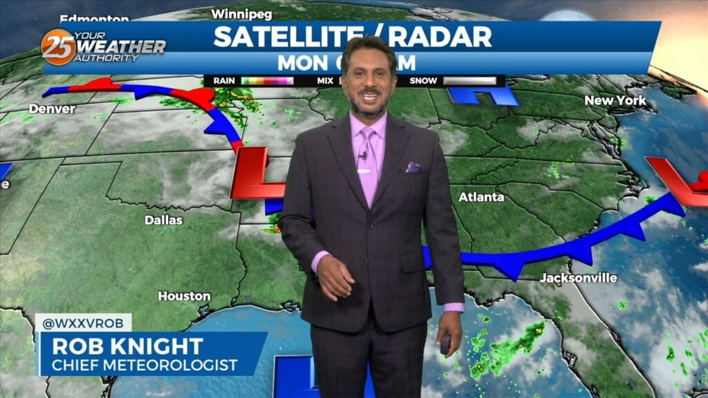
6/24 - The Chief's "Dangerous Heat" Monday Morning Forecast
The main story today will be the heat as high pressure continues to spread eastward along the Gulf Coast today. Low level moisture will be on the…
The main story today will be the heat as high pressure continues to spread eastward along the Gulf Coast today. Low level moisture will be on the…
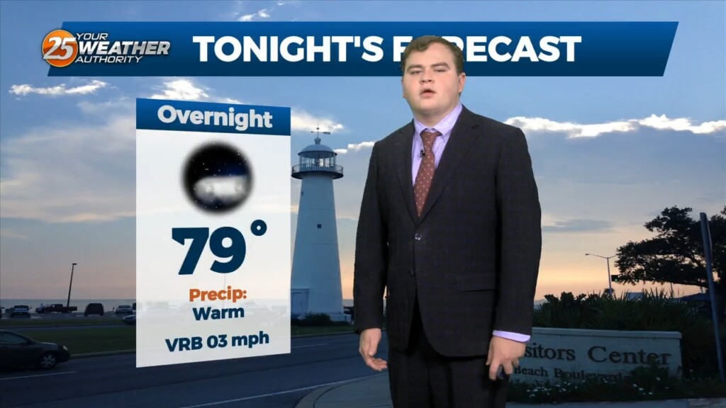
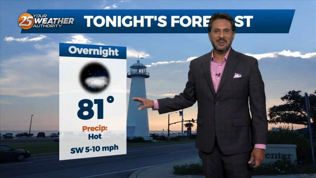
Tonight we will steadily drop into the upper 70s for overnight lows with mostly clear skies. Unfortunately little change in the overall pattern is expected through the end…
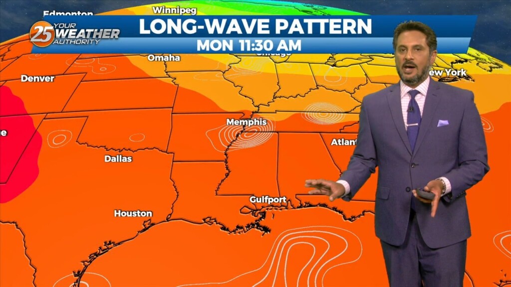
Unfortunately little change in the overall pattern is expected through the end of this week as high pressure remains dominant. However currently there is an overall weakness…
At the surface, a very subtle weakness resides across portions of the region, however, this feature hasn’t been as productive as I'd like in terms of…
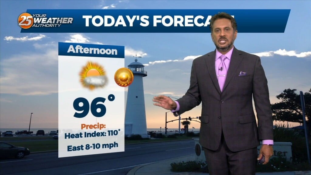
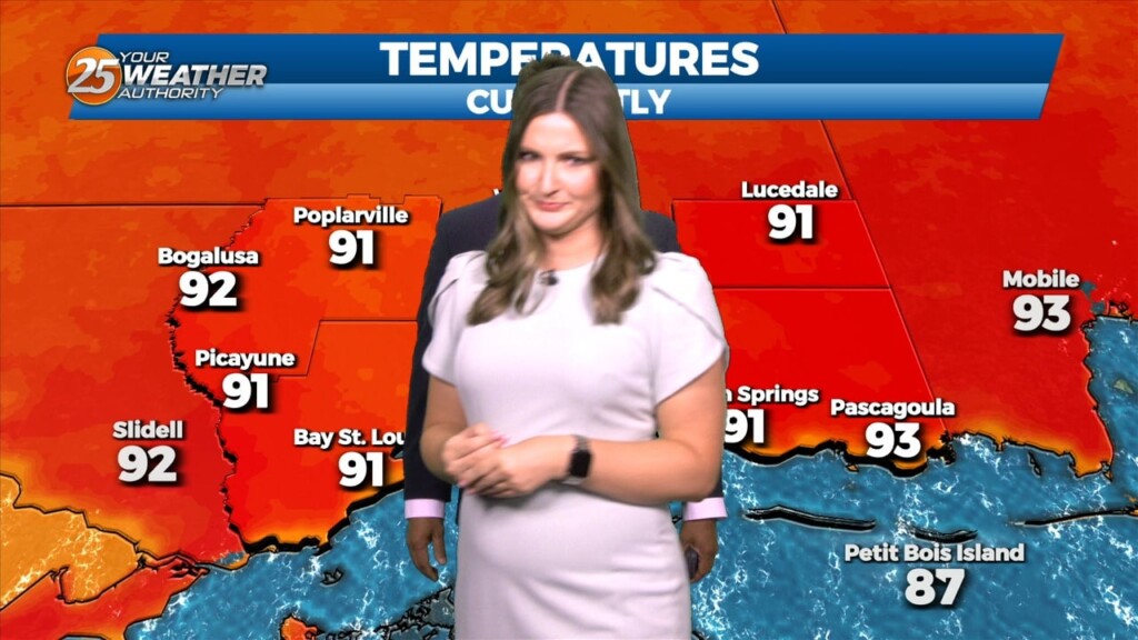
Yet another hot day is anticipated across the central Gulf region today as high pressure remains situated to our north with a general…
Winds remaining out of the south overnight will keep it very warm and extremely humid overnight. Some clouds will be present at times but expect the…
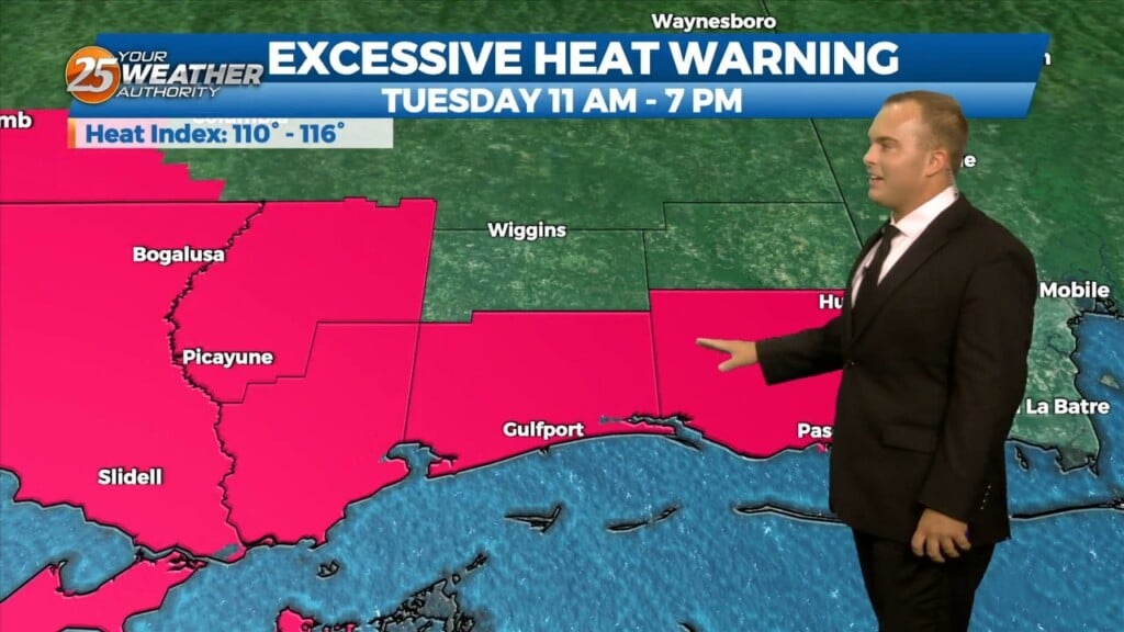
The heat wave we have been dealt continues through the much of this week. An Excessive Heat Warning is in effect until 7 PM for heat indices…
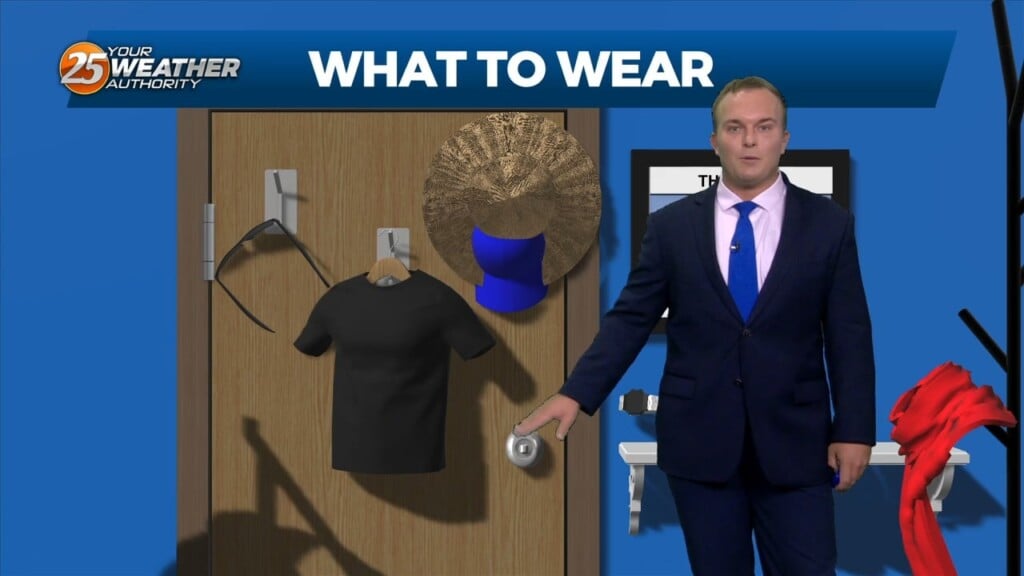
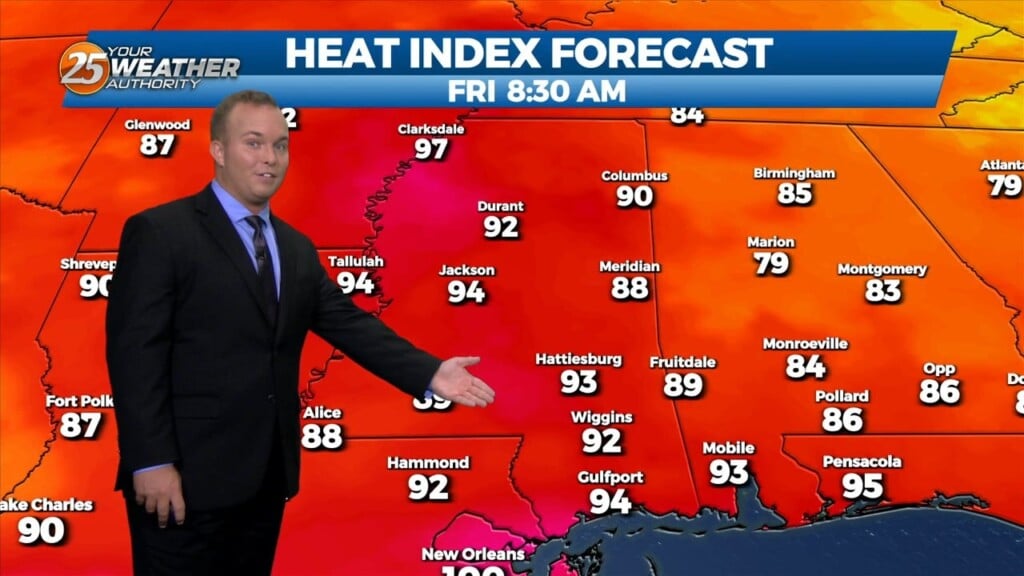
Welcome to the first Friday/Weekend of August. Temperatures will not be pleasant today or for the weekend. A EXCESSIVE HEAT WARNING IS IN EFFECT FROM Until 7pm for…
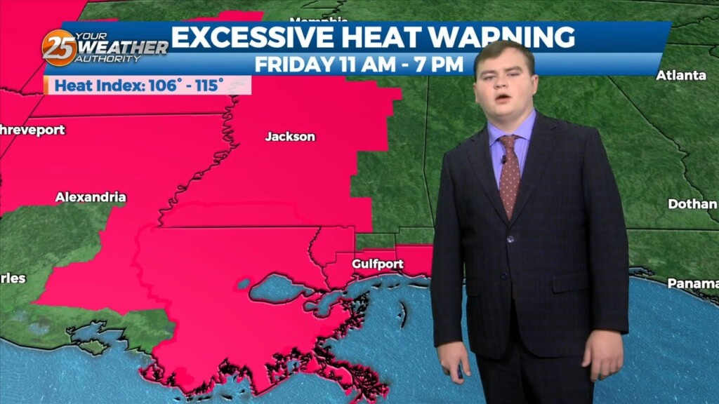
Welcome to the first Friday/Weekend of August. Temperatures will not be pleasant today or for the weekend. A EXCESSIVE HEAT WARNING IS IN EFFECT FROM 11am until 7pm for…
The humidity will remain in place overnight. Temperatures will not drop off too much more even under clear skies. Expect a very hot start tomorrow and the…
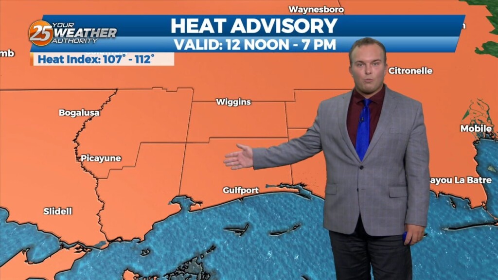
A Heat Advisory is in effect until 7 PM. The hot and humid pattern will continue into the first portion of the weekend. Overnight, it will be warm…
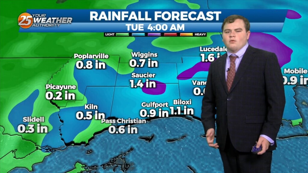
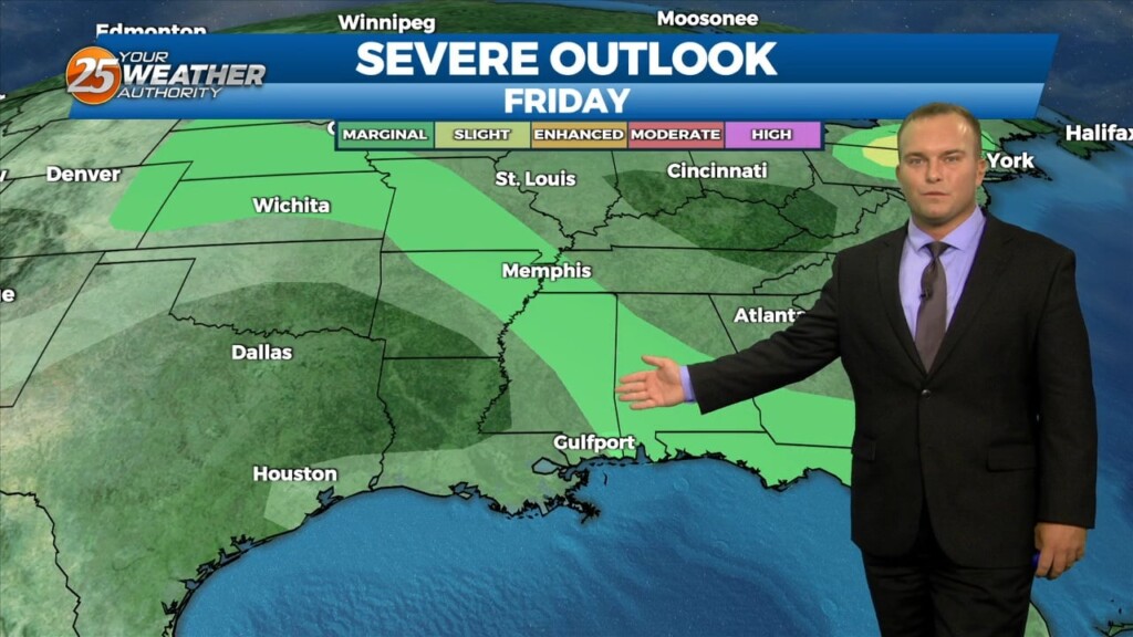
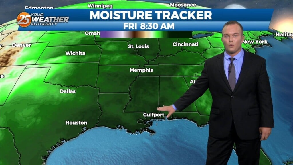
With little in the way of upper level support across the central Gulf States, expect only limited rain chances through mid-week…with another hot afternoon ahead. Models…
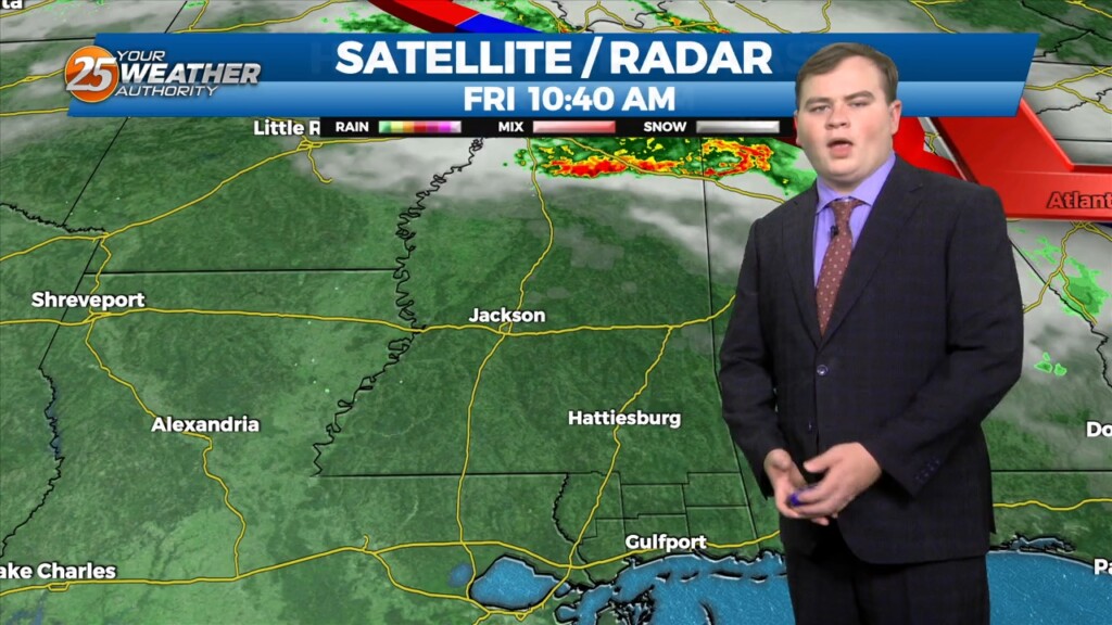
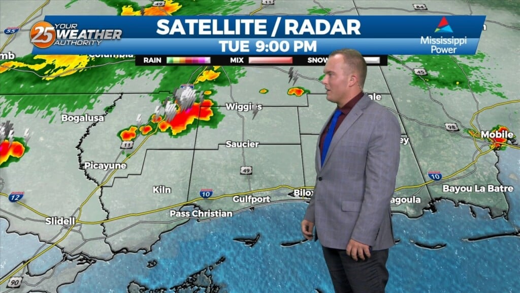
Earlier this morning, the MCS continues to decay as it moves south of our marine waters. Expect a few more isolated showers or storms…
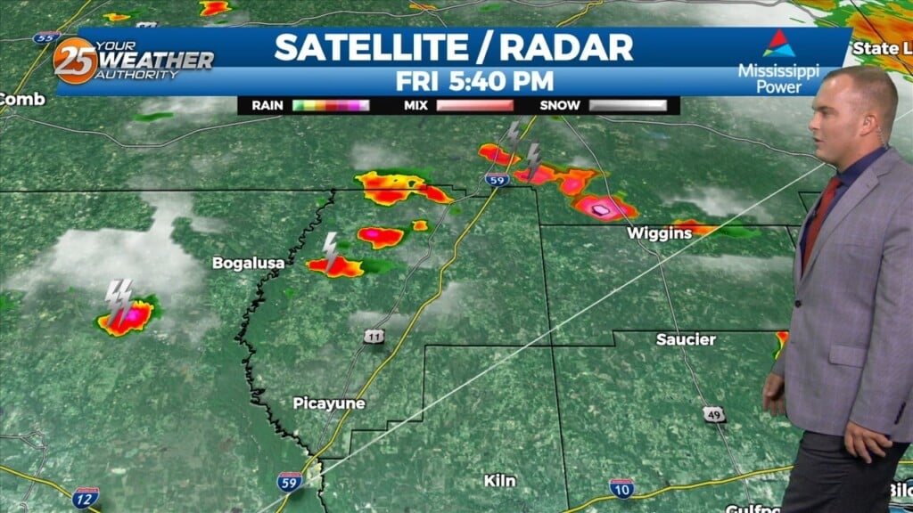
Any isolated thunderstorms this evening will be out of the picture by around sunset. Skies will clear out overnight leaving us with sunny skies to start…
Skies will be mainly clear the rest of tonight with warmer temperatures as compared to last night. Tomorrow will become hot and humid…
Spotty to isolated shower/thunderstorm chances will be around early this evening. Rain chances will drop off and skies will clear out tonight. Temperatures will be a…
Not much in the way of anything to help showers/t-storms get started today and relatively low chances will continue over the next several days. But some…
The short term is practically a rinse and repeat of the last day or two, with continued hot conditions expected. A HEAT ADVISORY is in effect…
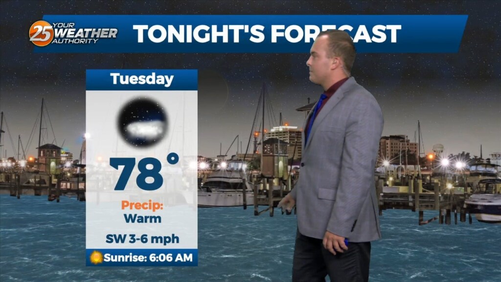
Warm and humid conditions will linger overnight as the flow gradually becomes southerly. Skies will be mostly clear if not totally clear. Tomorrow will be a repeat…
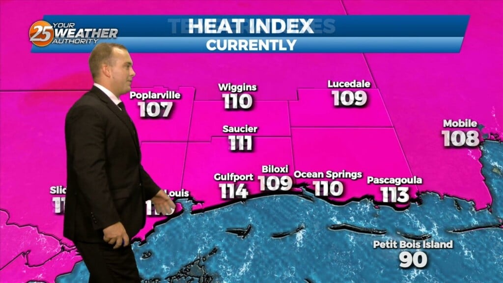
A Heat Advisory remains in effect until 7 PM. Heat indices of over 100 degrees will be around into portions of this evening. Skies will clear out…
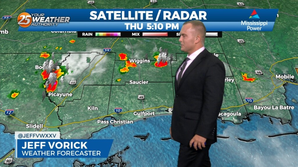
Any remaining thunderstorm activity this evening will come to an end by midnight or so. Clouds will gradually clear out towards daybreak. Some clouds will…
The very hot pattern will continue into the end of this week as we close out June. An Excessive Heat Warning will be in place…
The very hot and humid conditions will persist into the end of this week. Expect an uncomfortable evening and overnight as temperatures won’t cool too…
Thunderstorm chances will gradually clear out overnight as a piece of energy in the atmosphere moves past our area. It will remain warm and humid overnight as…