10/17 - Rob's "Cooler/Drier" Tuesday Morning Forecast
In the wake of yesterdays cold front, a cooler/drier air mass in now dominating the region with CHILLY morning temps...
In the wake of yesterdays cold front, a cooler/drier air mass in now dominating the region with CHILLY morning temps...
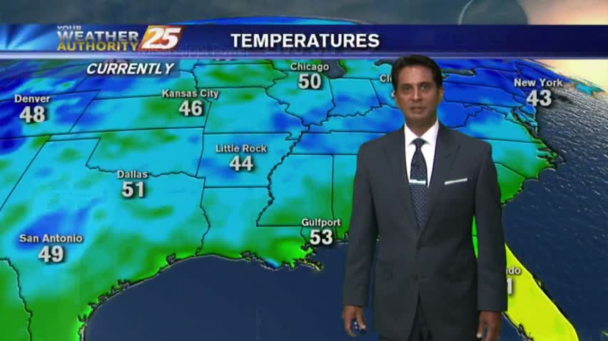
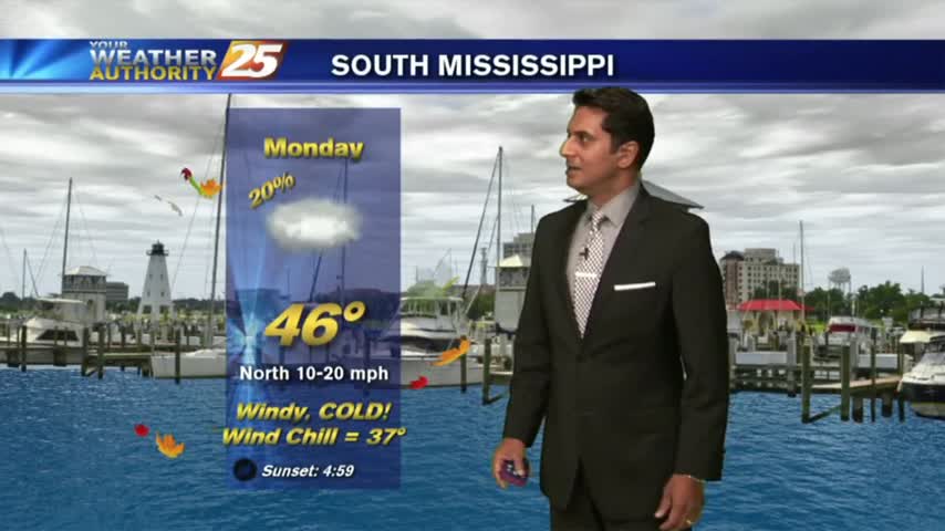
Clear skies and a north wind overnight has VERY COLD temps with morning lows in the upper 30s to low 40s...
In the wake of last night's cold front, it's a CHILLY start with partly cloudy skies through the area...
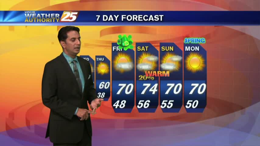
The morning brings chilly temperatures under clear skies through the region, as we head into the first weekend of March...

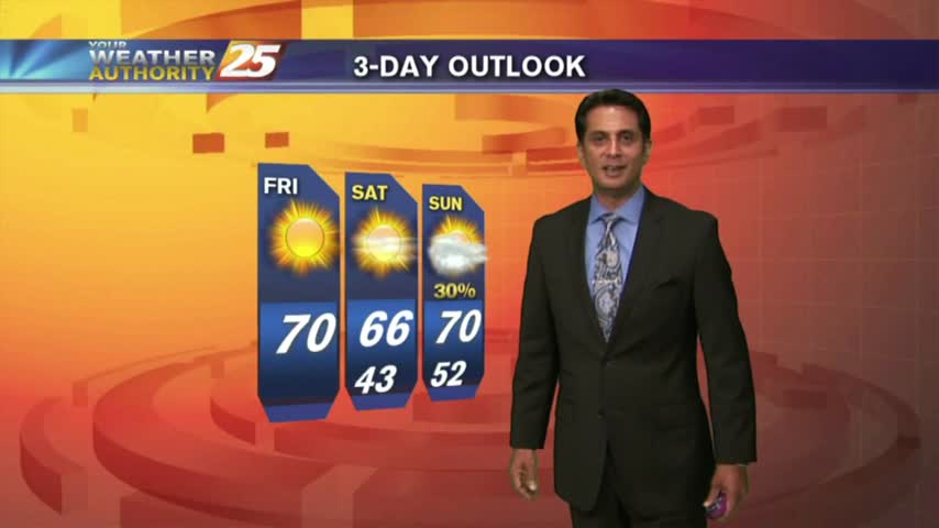
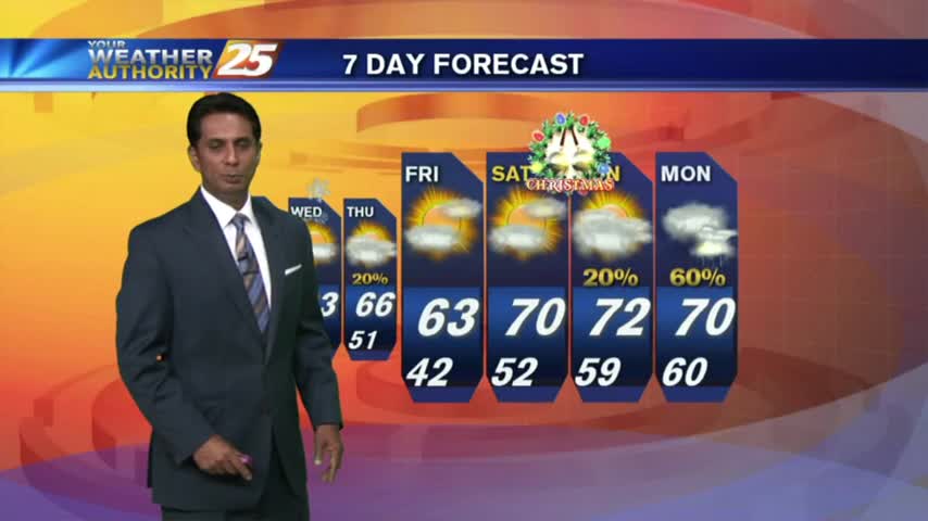
It's a COLD start to the weekend as a cold/dry air mass continues to move into the Gulf coast...
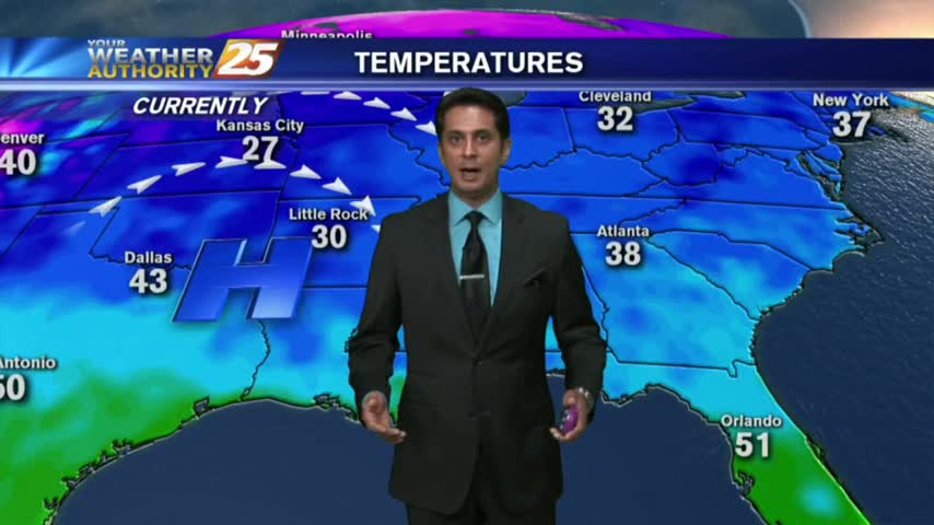
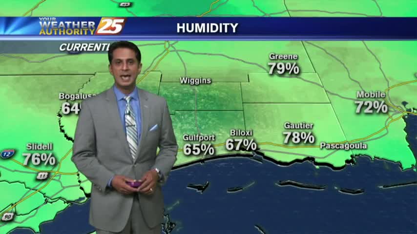
The humid air and foggy conditions are out of the area temporarily, with COLD and CLEAR start to the final Friday of the year...
After some clearing late yesterday afternoon...the low-level clouds rolled back in after sunset and continue this morning.
After a RAINY Sunday, the rain has moved east as very WINDY CONDITIONS continue to affect the local area...
After a bit of sunshine yesterday afternoon, the clouds rolled back in overnight with cool temps to start the morning...