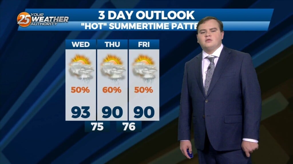
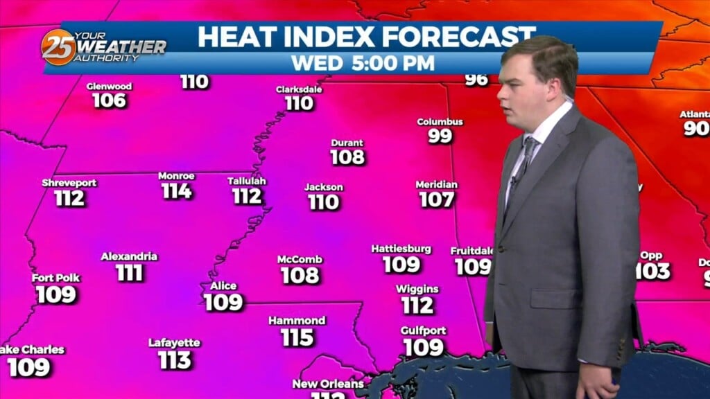
8/2 Chris's "The Heat Continues" Wednesday Afternoon Forecast
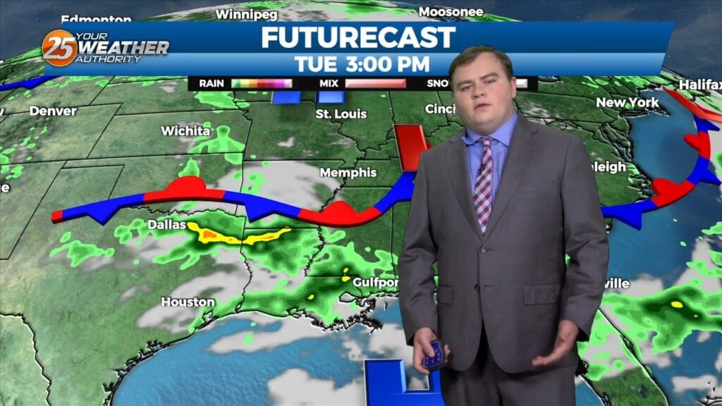
This afternoon there is a weak stationary front to the north of our area. This front will begin to move closer to the area later this afternoon, before…
This afternoon there is a weak stationary front to the north of our area. This front will begin to move closer to the area later this afternoon, before…
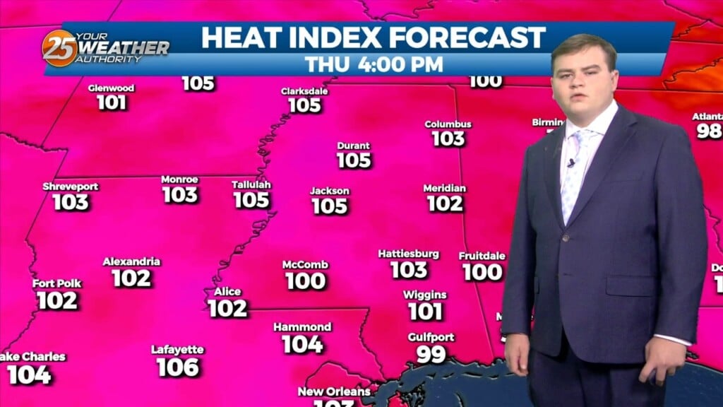
The main focus through the next couple of days will be the continuation of Excessive heat across the southern six counties. A Stationary boundary is near the area…
After a very loud evening a few showers and thunderstorms are still around the area this evening as rain chances decrease after the midnight hour. As we have…
We could just maybe have a possible shower this afternoon but very LIMITED activity through Friday. High pressure will continue to be the main factor shaping the forecast into the final weekend of July…more so into early August, as RECORD…
Manageable heat and more in the way of sunshine will continue this afternoon for the southern six counties. Currently a cold front is to the south of…
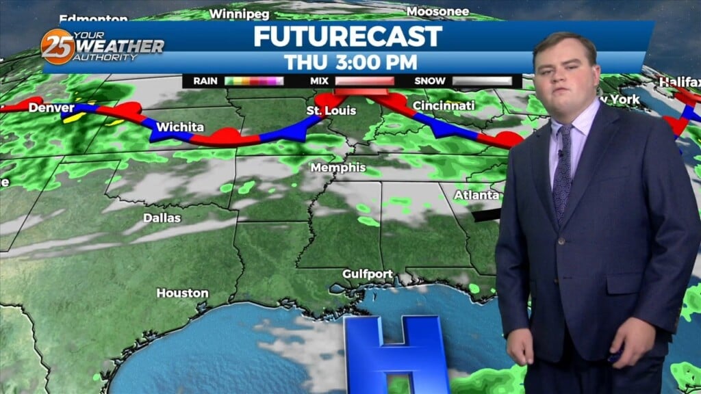
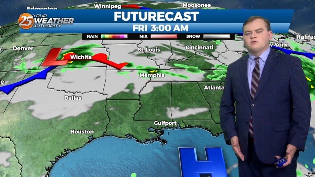
This afternoon a stalled stationary front just north will push to the south bringing subtle changes. This will also keep most of the shower and thunderstorm…
The dog days of summer are here to stay this week. A stationary boundary will begin to move out of the area tomorrow into the start of the…
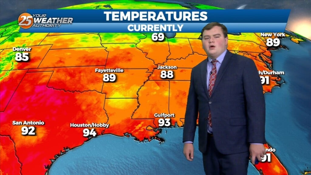
The pattern in the area is starting to feel like a broken recorded with oppressive temperatures daily. High pressure is the dominant feature and will continue to be…
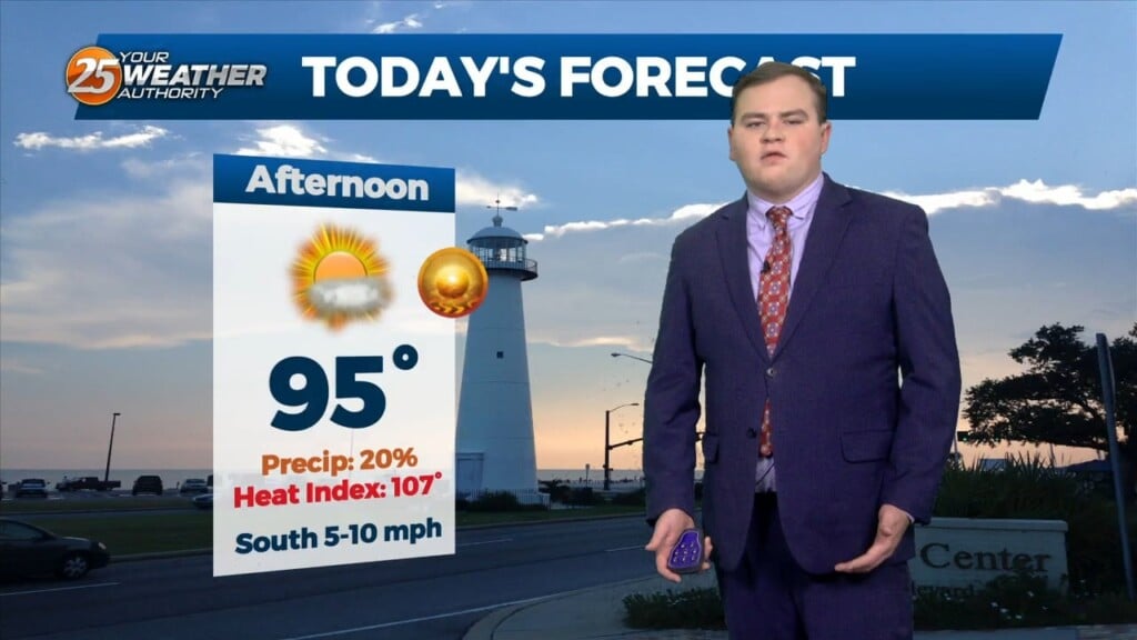
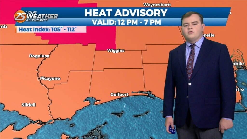
A HEAT ADVISORY is in effect until 7 pm as heat indices will max out between 107 to 111 degrees. High pressure is the dominant feature…
Already a hot and humid day across the Southern 6 counties. A HEAT ADVISORY is in effect until 7pm as heat indices will max…
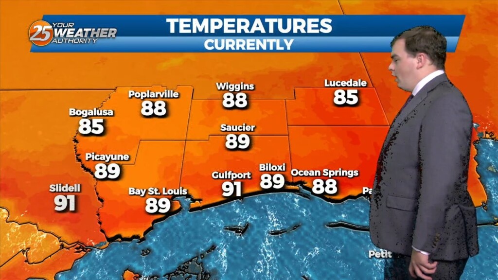
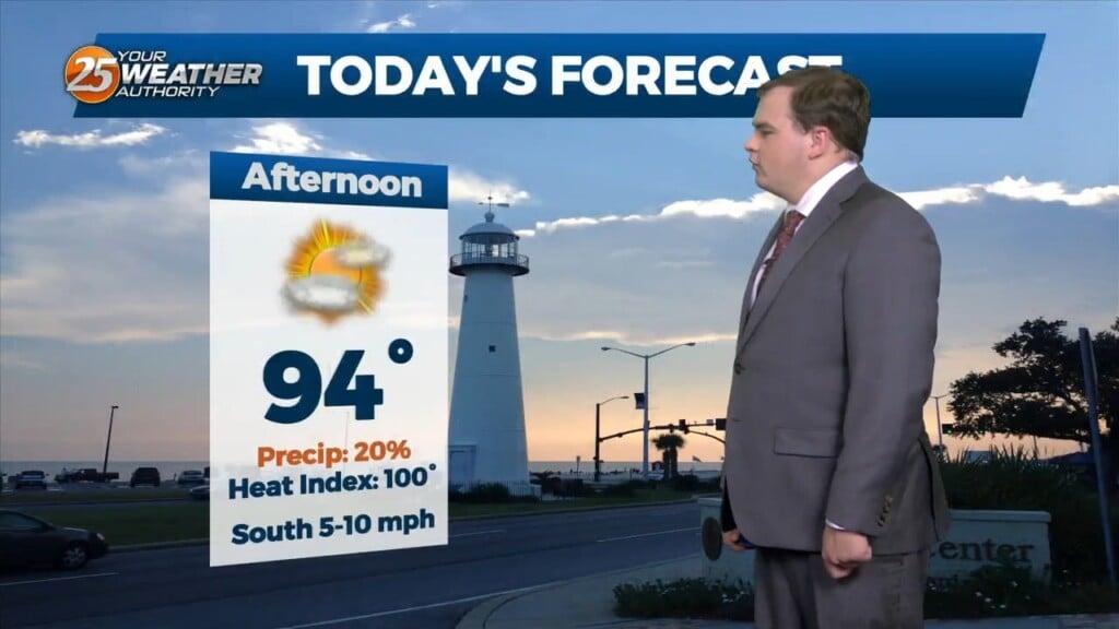
This afternoon temperatures will be in the low 90s, however heat indices will remain below advisory level. This is due to sea-breeze activity that will form coupled with daytime heating especially to the south of I-10 this afternoon. Activity will…
This afternoon a subtle SW’tly flow has taken over which helpes bring deeper Gulf moisture into the area. Daytime heating will be the main factor producing showers/t-storms,…
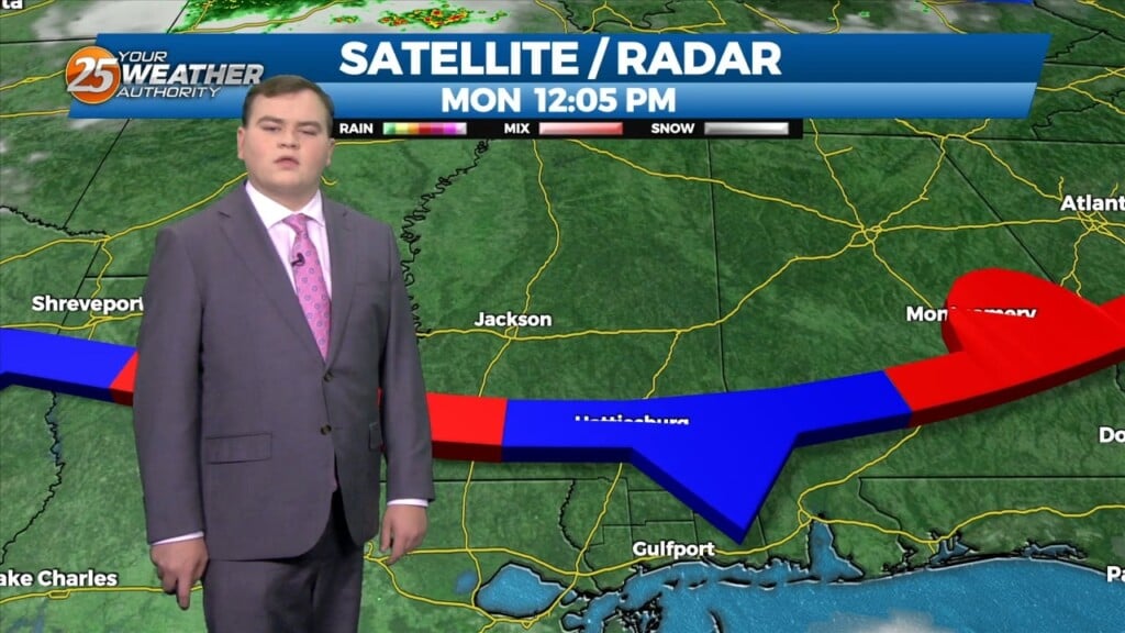
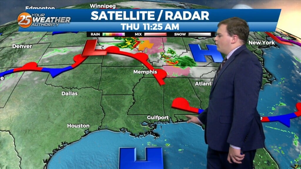
Currently there is a stationary front to the north of the I-20 corridor with showers and thunderstorms to the south of it. This afternoon will bring partly cloudy…
Another afternoon filled with the chance of showers and thunderstorms today. This afternoon high pressure will generally remain in place across the area, especially over the northern Gulf of Mexico. There is just enough of a weakness across the lower…

Happy Independence Day! Scattered showers and an occasional rumble of thunder have developed and moved across the area this morning moving to the NE. Isolated activity will continue…
This afternoon, the Bermuda high “High Pressure” extends westward across Florida into the northern Gulf of Mexico. A front is extended from Lake Erie into Oklahoma which…
An EXCESSIVE HEAT WARNING is in effect until 8pm. High pressure is still centered just south of the central Louisiana coast. High pressure isn’t going anywhere…
An EXCESSIVE HEAT WARNING is in place for today and Excessive Heat Watch for tomorrow, with the expectation that it will upgrade to a warning for tomorrow.…