2/15 - The Chief's "Changing Pattern" Thursday Morning Forecast
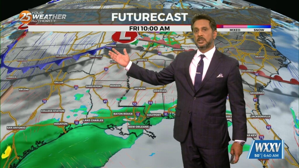
No significant changes in forecast though the weekend. An area of low-pressure along the W’tern Gulf will bring higher rain chances for the start of the weekend.…
No significant changes in forecast though the weekend. An area of low-pressure along the W’tern Gulf will bring higher rain chances for the start of the weekend.…
The forecast through the remainder of the workweek is pleasant with no major impacts. Rain should at least hold off till late Friday if not…
Low level moisture continues to increase with dew-points rising into the upper 40s or tower 50s. This warming/moistening trend will continue today. The…
High pressure will continue to move downstream over the Mid-Atlantic States through today. As the high moves east, onshore flow will be initiated at the surface.…
The system to the SE that brought thunder/hail to parts of the area yesterday evening will continue to meander south and east today. On the backside…
A reinforcing shot of dry air has started moving into the area. A back door cold front has moved into the N’tern GOM and…
A much drier air mass in the wake of an overnight cold front will remain in place through Thursday. The next reinforcing shot of dry air…
The next reinforcing shot of dry air will move down behind a new backdoor cold front overnight/Wednesday morning. There is not a lot of boundary…

A dry air mass will remain in place through Wednesday. The next reinforcing shot of dry air will move down behind a new backdoor cold front…
The overall pattern begins to shift with high pressure centered over eastern North Carolina, with a weakness/cold front along the lee side of the Rockies.…
At the surface, high pressure is centered near the Carolina coastline, producing light easterly to southerly surface flow across much of the Lower and Middle Mississippi…

A very deep longwave pattern still encompasses almost ¾ of the country with the apex now east of the Mississippi River Valley. This feature has…
With an approaching system to the west, showers and t-storms are expected through midday. It seems that the best instability and forcing will remain north.…

The main forecast issues will be the potential for severe weather late tonight and Friday morning, along with rather gusty winds on Friday. Temporarily fairly zonal…
The deep upper-level system that produced Monday night’s severe weather is now over the Mid-Atlantic states and moving into New England. The next disturbance in a…
The WIND ADVISORY will continue through this evening before the flow begins to weaken. Breezy conditions will continue overnight with winds around 15 mph…which means the…
I will try to keep things as simple and non-confusing as possible by keeping headlines to what is necessary and only ramping up to the highest…
Out with one, in with the next. All these systems will continue in rapid succession for the next several days. Very nice conditions will remain behind…
A lovely day ahead with sunshine and cool temperatures before the next system moves in. A new surface low-pressure system to the SW will develop and…
In the wake of an upper feature which moved through earlier this afternoon, clouds will rapidly clear this evening/tonight. A fairly potent upper level high…
A very progressive upper level wave pattern will keep things rather unsettled through the short term period as a series of disturbances pass…
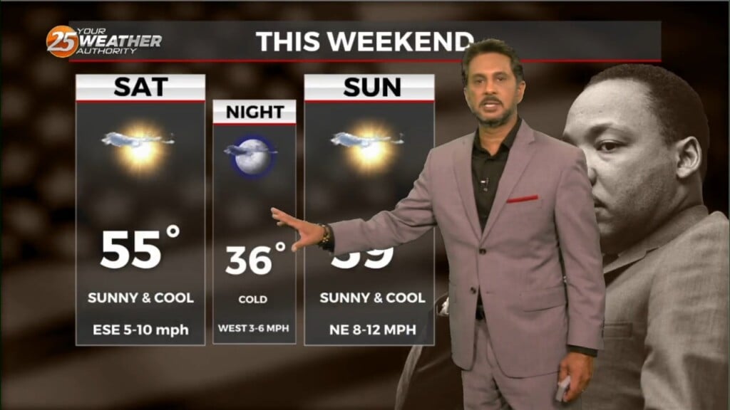
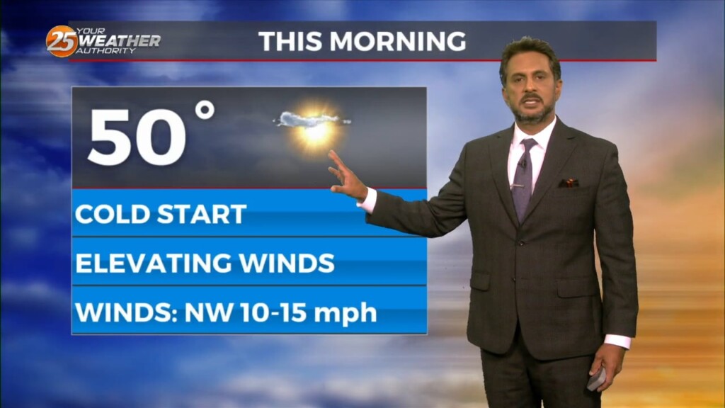
Today will be a cool day as highs will only get into the lower to mid-50s and this will provide a decent starting point for…
The main focus is once again on the possibility of a light freeze in areas that may not have experienced a freeze, then on the…
The biggest forecast challenge in the short term is the temperature forecast and the threat of a light freeze for many areas that may have not seen…