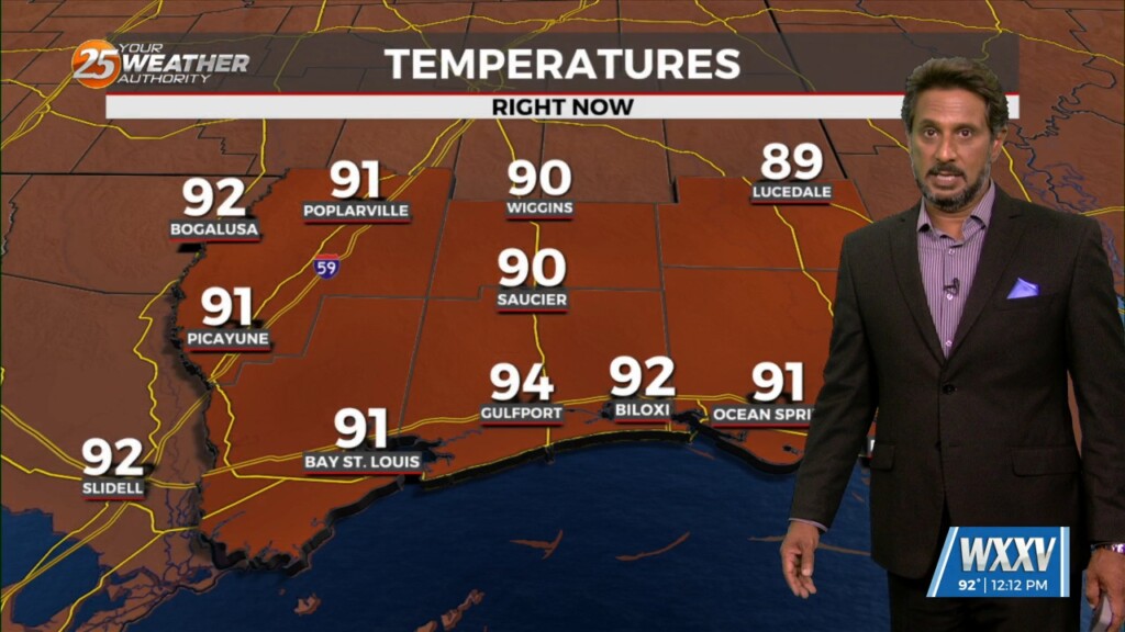
6/24 - The Chief's "Dangerous Heat" Monday Morning Forecast
The main story today will be the heat as high pressure continues to spread eastward along the Gulf Coast today. Low level moisture will be on the…
The main story today will be the heat as high pressure continues to spread eastward along the Gulf Coast today. Low level moisture will be on the…
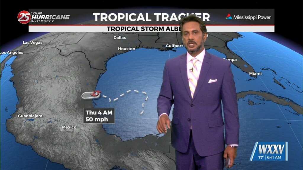
Tropical Storm Alberto has made landfall along the Mexico coastline and continues to move west and weaken. As the pressure gradient weakens, the wind field should…
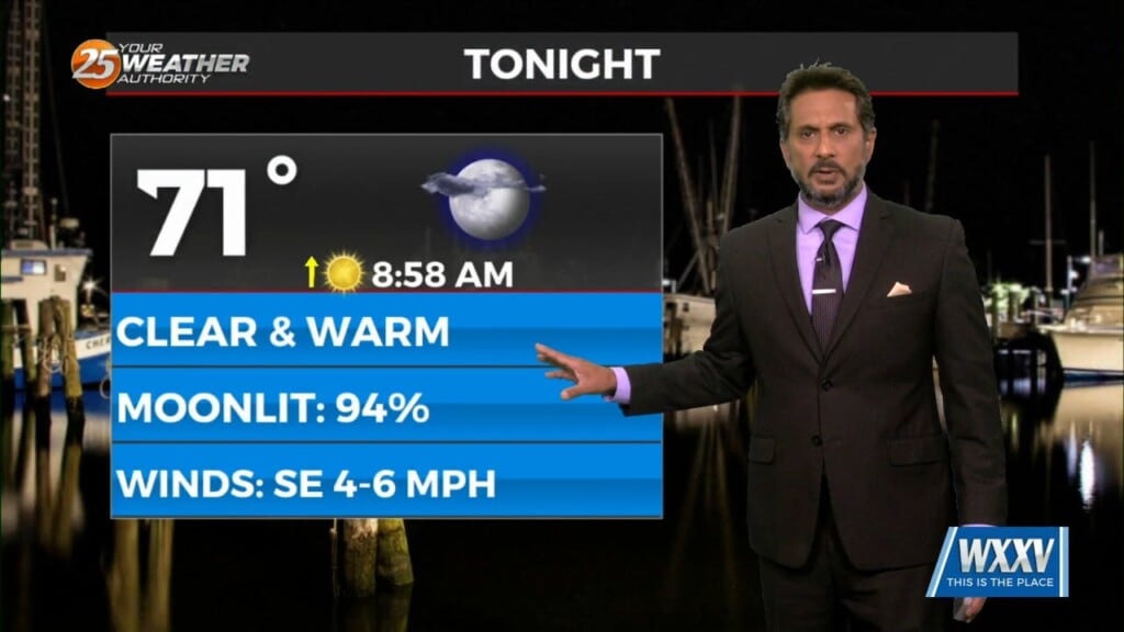
Overall the forecast as a whole is a tale of two scenarios with the first part being: high confidence, mostly dry, and HOT. The second part:…
As a stalled boundaries form last week move northward and leave the gulf coast, rain chances will drop off through the weekend. A…
A stationary front overhead will be the focal point for activity into the weekend. This boundary will help a very large complex of elevated storms develop later…
Strong high pressure will dominate the Gulf South through the entire short term period. The deep layer subsidence associated with this high pressure will result in…
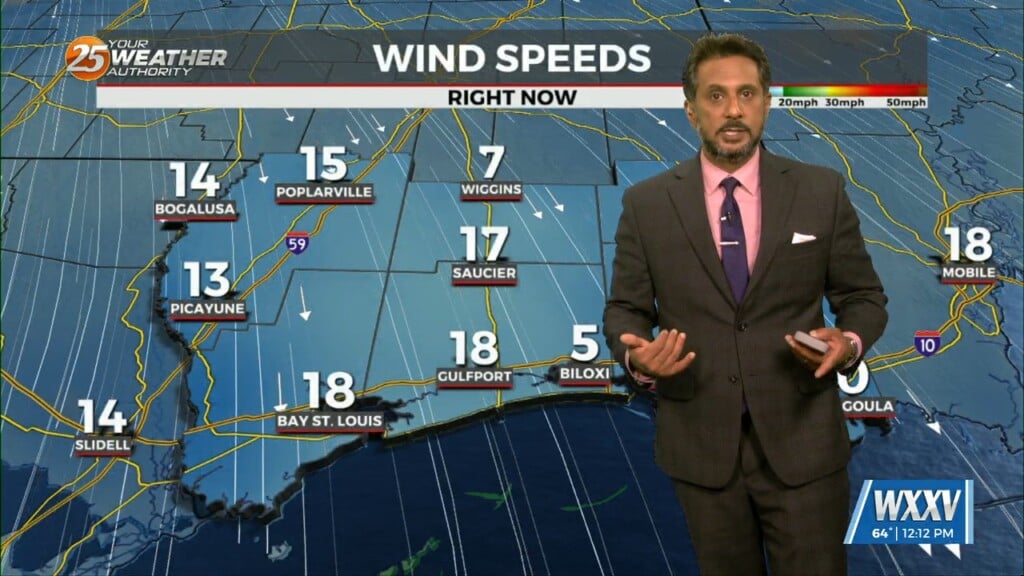
Winds will begin to weaken dropping below advisory thresholds this afternoon. But there will still be gusts to 25mph at times and even higher winds up…
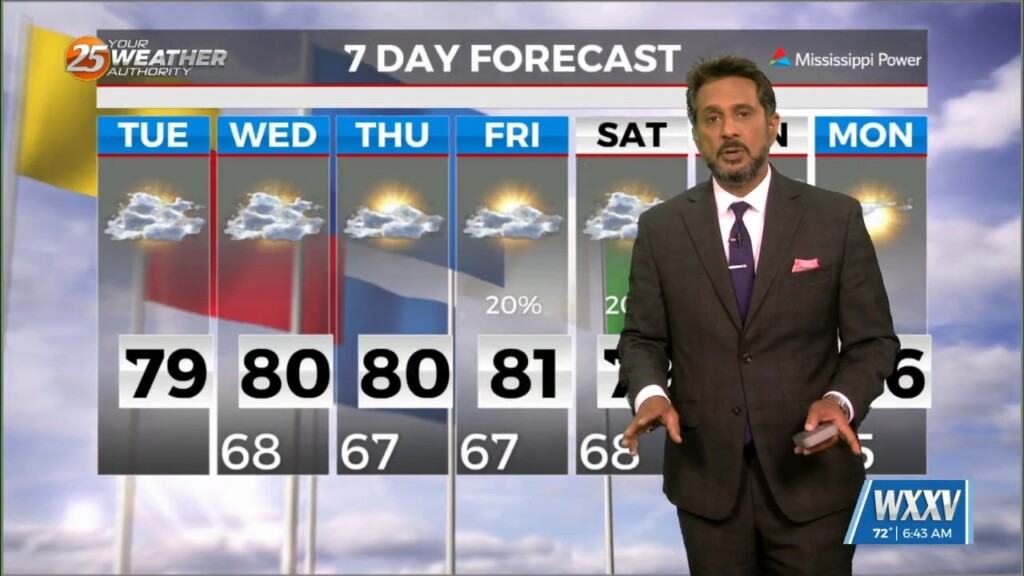
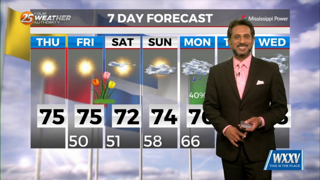
For the next few days and through the weekend the word is...WARM. So basically today, April 25th, is probably not the perfect date this year as…
With high pressure still in control along with a weak cold front to the NW, sunny skies and a zonal/progressive upper flow regime across the…

In the wake of yesterday’s cold front, strong dry air surge at the mid and upper levels is continues to move into the area.…
As temperatures warm into the 80s, low level instability will increase and some cumulus development is expected to take hold by late morning. However, a…
High pressure extended from the Gulf of Mexico to Wisconsin, with an upper-level low pressure near the Colorado-Kansas border. Low pressure was noted over Nebraska with a…
A vigorous storm system continues to move east though the region. Activity from this morning will begin to taper-off…with another batch of energy moving tough the…
Again today, we should see showers and a few t-storms around. But as we move forward in time, a few of these storms could become…

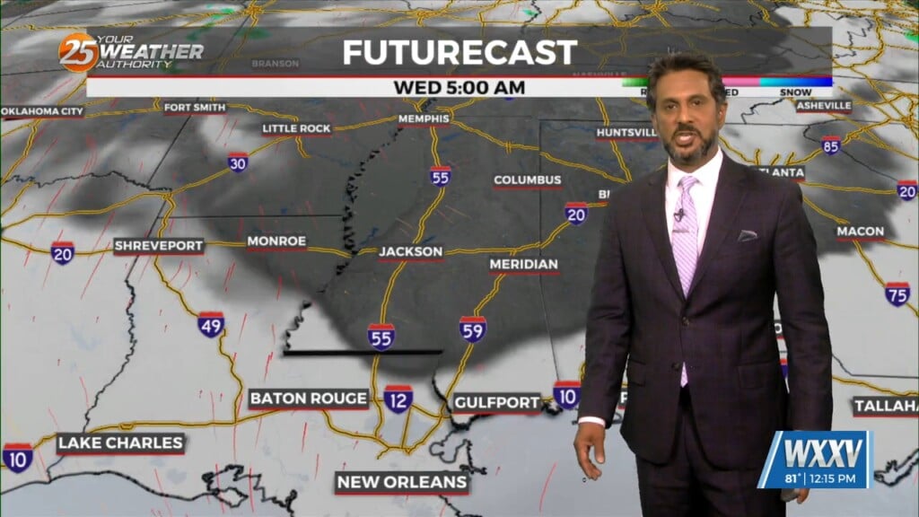
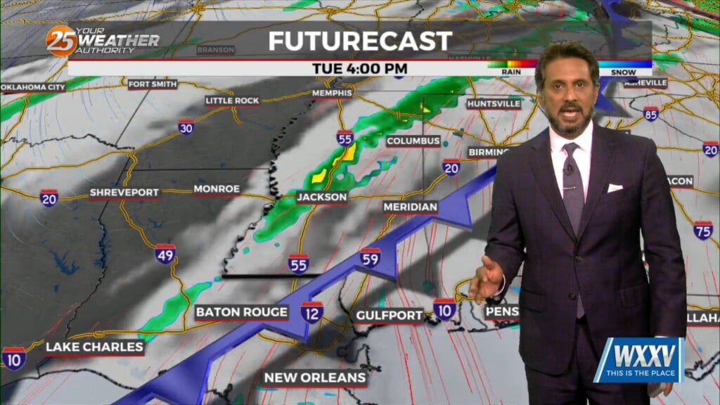
Early Wednesday we will see a cold front moving toward the area with very moisture content for this time of year. If this were stalled over the…
A highly amplified pattern in the mid and upper levels will remain in place through Saturday night across the CONUS. Today into tonight, the forecast area…
This afternoon will continue to bring breezy conditions from the south...increasing the moisture. Tuesday is still the main forecast issue but honestly it…
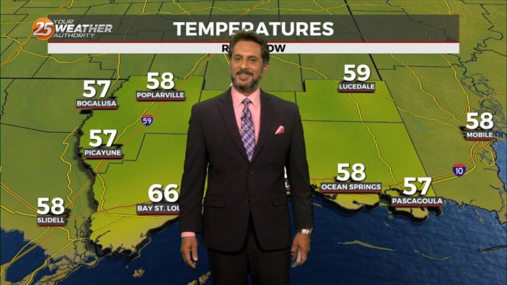
The cooler, drier air has been slow to arrive, with dew points only now starting to drop over southwest Mississippi. The local area will be under a…
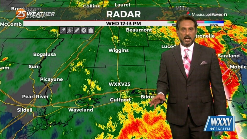
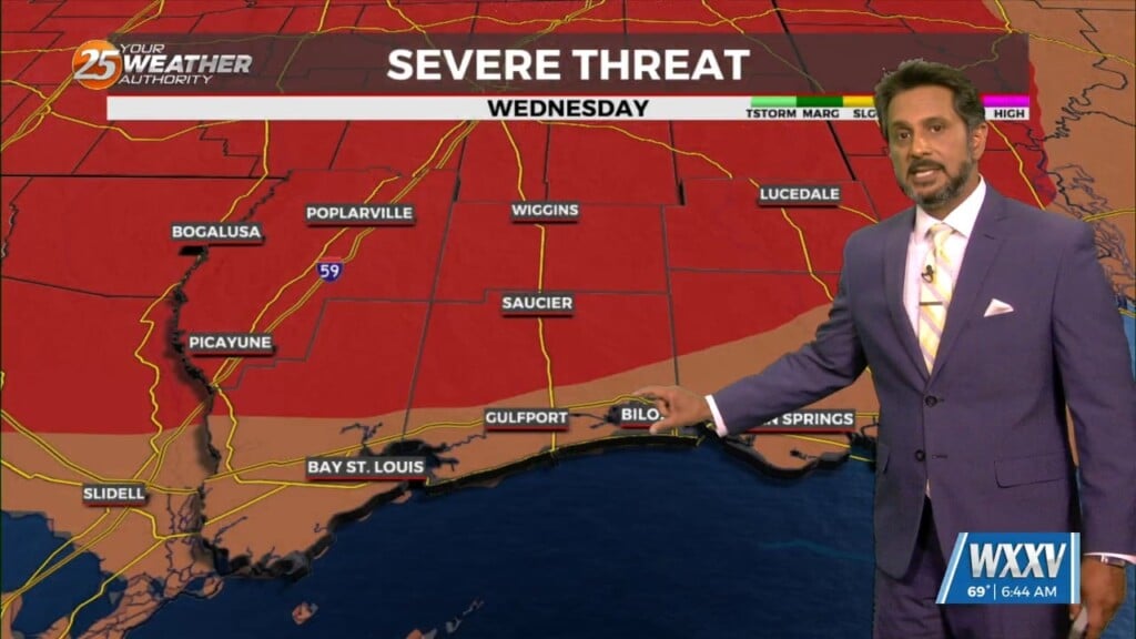
SEVERE & HEAVY RAIN THREAT THIS AFTERNOON/OVERNIGHT... Showers/t-storms will begin around midday with activity increasing this evening and overnight. The next thing would be…
Tonight, eyes begin to shift upstream as a cold front begins to move southeastward toward our region. Prior to the frontal passage, surface winds should begin…
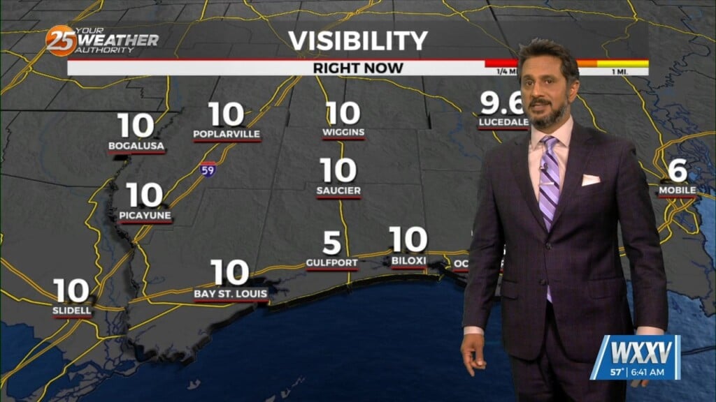
The only story this morning will be fog developing along the MS Gulf Coast. Aloft, a dry northwesterly flow should persist through the near term period.…
An area of upper-level high pressure remains over Mexico with weakness off both coasts. At the surface, low pressure was centered over Oklahoma with a…
High-pressure over the Rockies will shift eastward to the lower and middle Mississippi River Valley by Wednesday afternoon, with the surface high shifting to our…
An area of upper level high-pressure extends from western Mexico northward through the Rockies. At the surface, high pressure extended from New England to the Louisiana…