12/29 - The Chief's "Final Weekend of 2023" Friday Afternoon Forecast
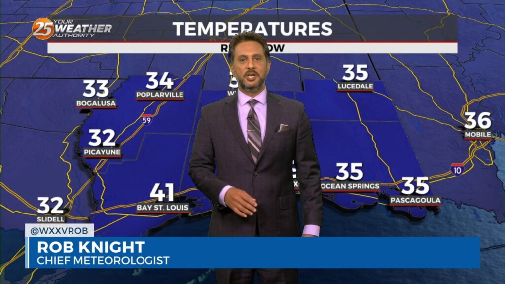
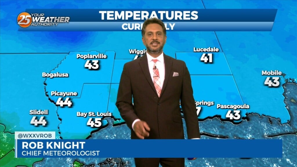
Today will be a cool day as highs will only get into the lower to mid-50s and this will provide a decent starting point for…
Today will be a cool day as highs will only get into the lower to mid-50s and this will provide a decent starting point for…
An upper-level disturbance moving into New England and the Pacific Northwest will provide for high pressure moving out of the Rockies into the Plains States. At…
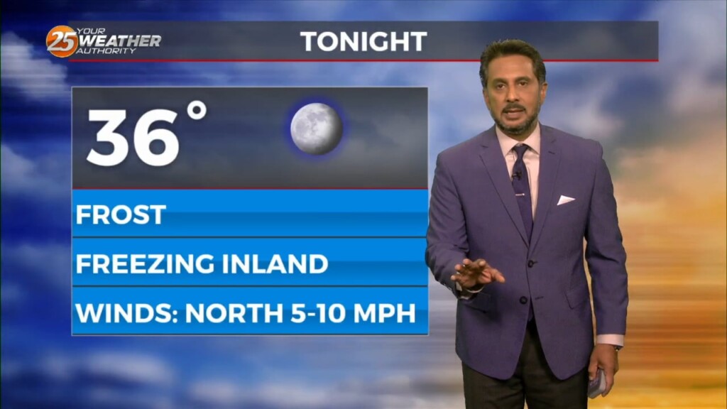
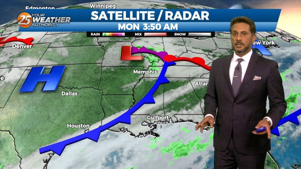
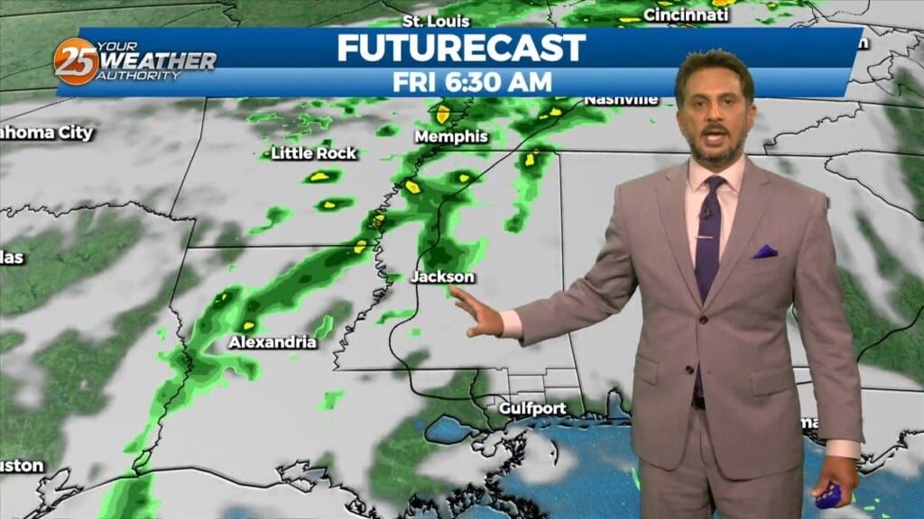
Eyes are now focused upstream as a dry cold front begins to march southward later this evening and overnight. Prior to the frontal passage, low…
The region will remain under a mostly dry northwesterly flow aloft today. Overall, temperatures will remain right around normal with most of the region climbing into…
There has been somewhat of a delay in surface winds responding to the system moving southward over the front range of the Rockies, but they will…
The current large scale pattern has an upper level closed low-pressure moving into the desert southwest and broad high pressure over the Caribbean, combining…
Weak high pressure in the upper levels will work in tandem with a surface to mid-level based high pressure system centered over the Deep South, will induce…
Although the surface high pressure will be centered east of the area, increasing upper-level subsidence aloft will continue. Winds at the surface will remain out of the…
Temperatures will warm up nicely today with ample sunshine and upper level clouds moving in this afternoon. Surface high pressure will build to our east allowing…
A large upper disturbance over the eastern states will continue to move off into the western Atlantic on later today. High pressure albeit fairly weak…will…
A relatively benign pattern will continue today before a weak cold front moves through the area. This frontal passage is expected to be dry due to…
A broad upper level disturbance over the eastern third of the CONUS will be the primary feature impacting the forecast area through Wednesday. Pacific based…

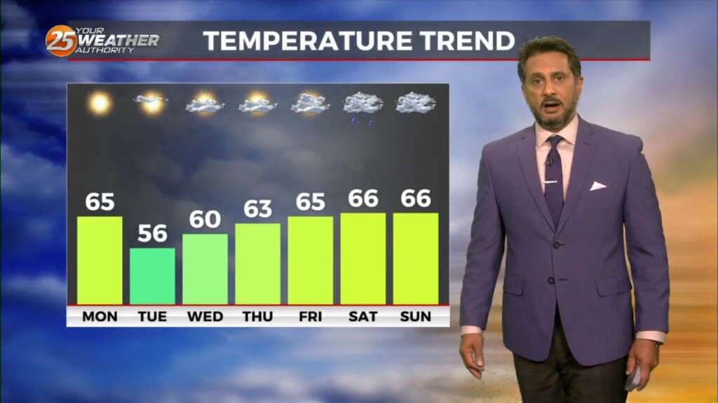
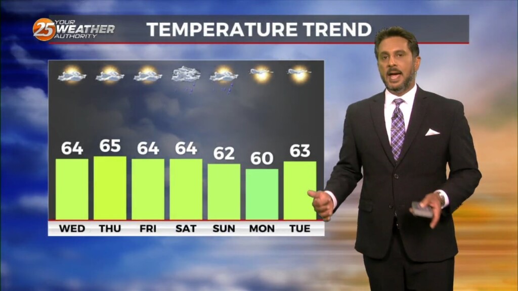
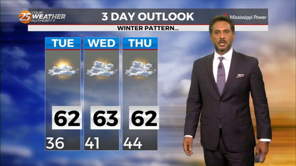
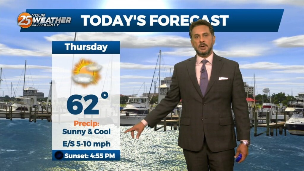
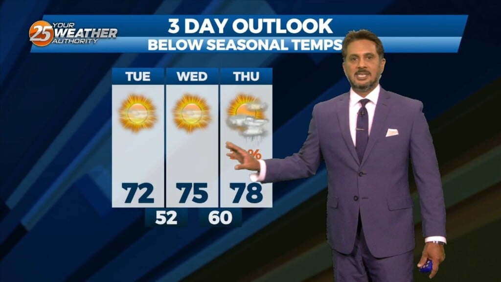
High temps will struggle each day through Friday to reach the 60s as colder/drier air continues to move in from the north. The area…
The cold front moved out over the gulf yesterday and cool air has been slowly filtering in behind it. This will continue today keeping high…
The upper level support for the system to the SW has now moved to the NE. The surface feature is to the south of the…
Lovely…but below seasonal temperatures will continue this afternoon as high pressure slides eastward to the Atlantic Coast by Wednesday afternoon, eventually turning low level flow onshore…
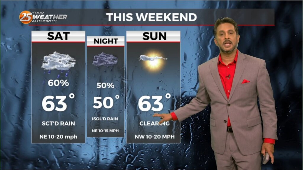
The stalled stationary front to the south is beginning to wash out quite a bit, but will linger into the final weekend of summer.…
The month of September will bring a changing pattern where dominant high-pressure in the SE begins to break down allowing cold fronts to move through the…
As we head toward the equinox, the upper pattern is becoming more active across the northern half of the US. Upper level high pressure was noted…
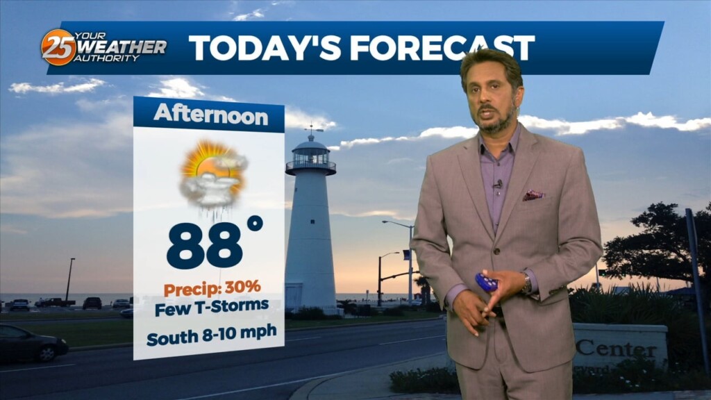
Another hot and muggy day is in store today with highs in the mid to upper 80s, some areas reaching 90F as morning clouds clear out…
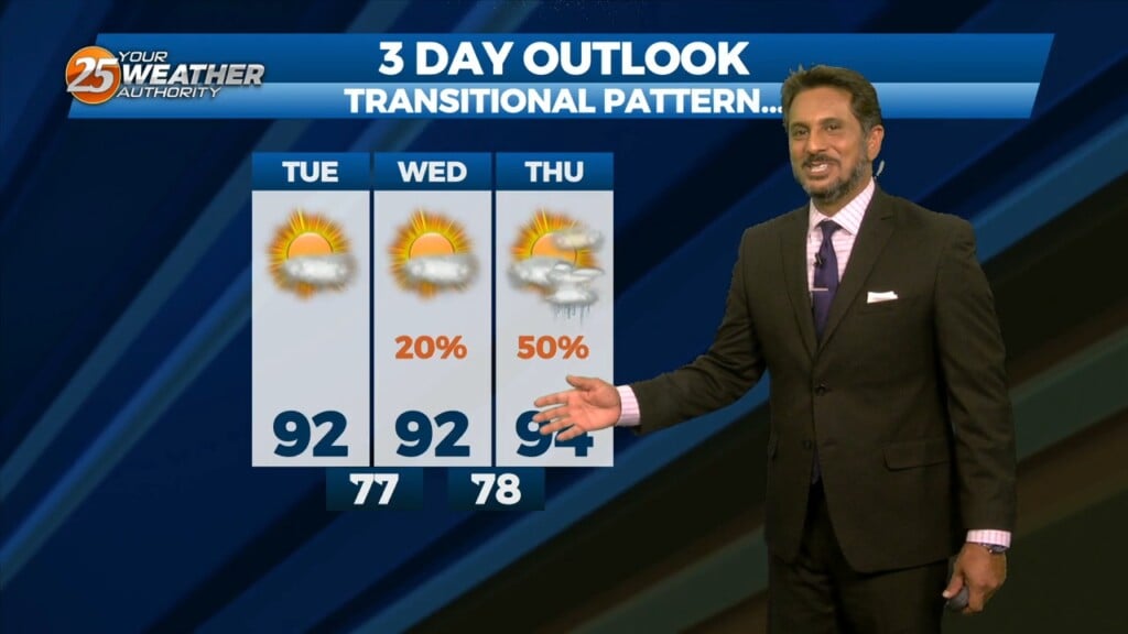
An upper level weakness continues to reside over Texas this afternoon keeping our region under an active southwesterly flow aloft with impulses circulating around this upper level…
This afternoon will bring drier conditions from the spotty rain moving across the area earlier. The lack of convection will lead to warmer afternoon temps but…
The upper troughs are located north of the Great Lakes and off the British Columbia coast this morning with high pressure over the center of the…
Today, eyes will be focused upstream as a mid-level impulse begins to move near and over the region. This feature along with the surface convergence along…