8/22 - Chris's "Excessive Heat" Tuesday Afternoon Forecast
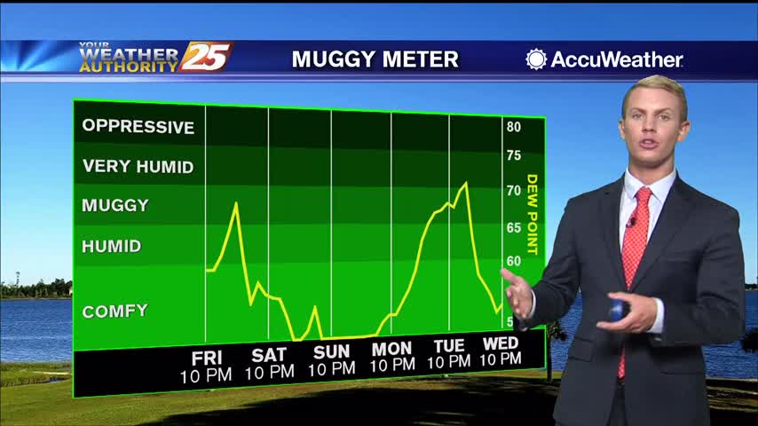
The heat continues to be oppressive across South Mississippi as a heat dome is overhead and over most of the country. This afternoon more areas than not reached…
The heat continues to be oppressive across South Mississippi as a heat dome is overhead and over most of the country. This afternoon more areas than not reached…
Man oh man was it a hot day for the the southern six counties some areas had high temperatures above the century mark . Currently there is stationary front…

This afternoon the main feature across the area continues to be the very dry air overhead. A stationary front is to the north of the area…
This morning the main feature across the area continues to be the very dry air overhead. A stationary front is to the north of the area…
This afternoon there is a stationary front to the south of the area; it is keeping moisture well to the south as very, very strong dry air…
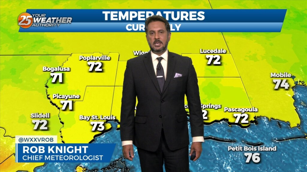
Temperatures are mild across the area this morning below average for some. There is a stationary front to the south of the area; it is keeping…
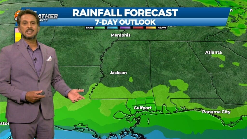
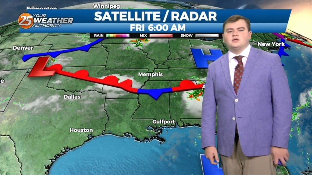
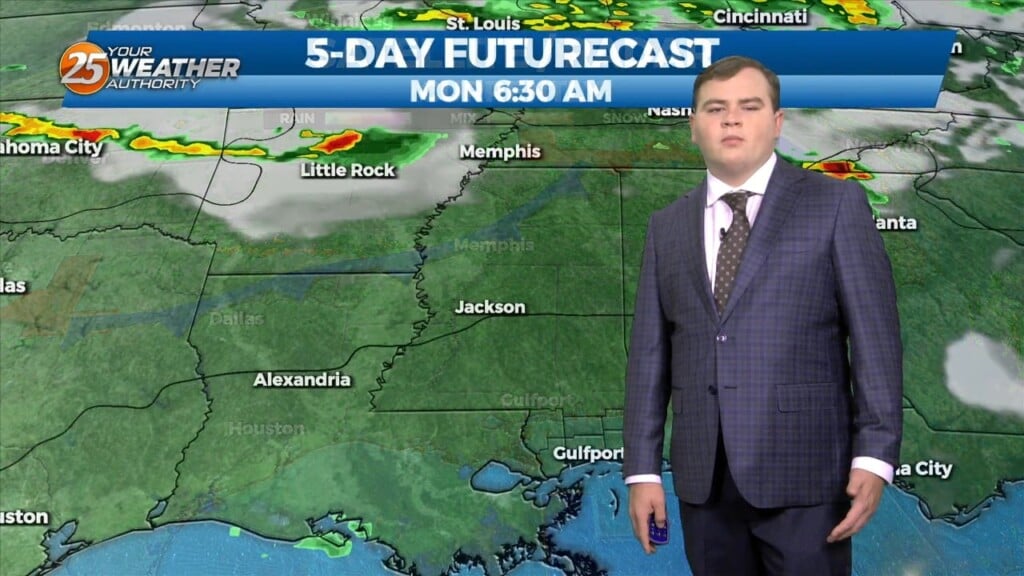
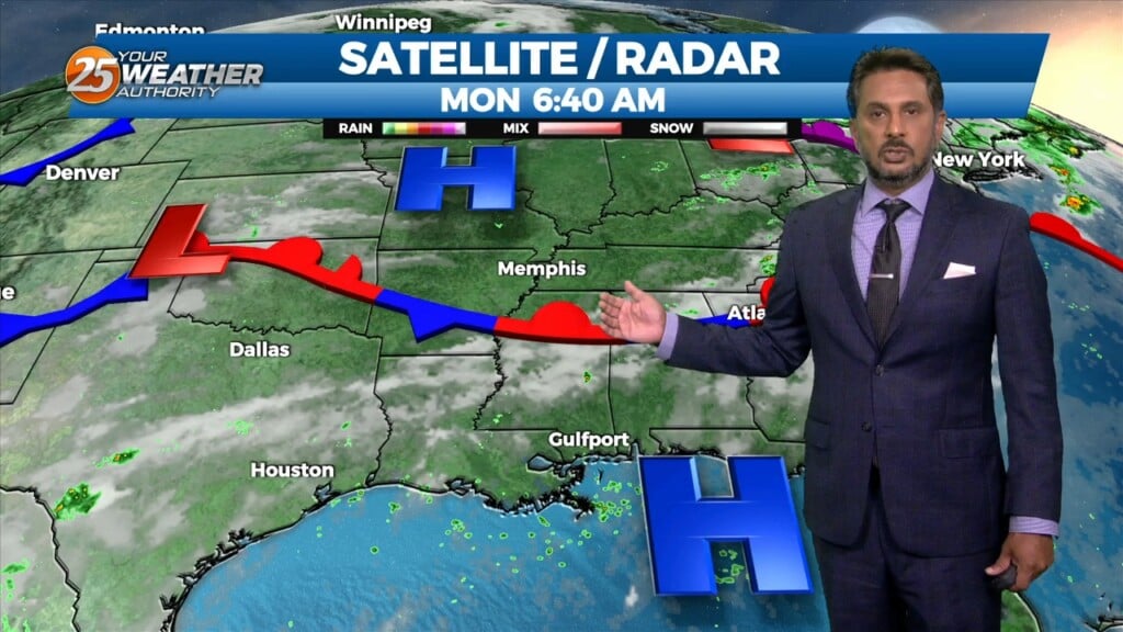
Early this morning, a disturbance extended from Lake Ontario to near Memphis, southwestward into east Texas. Showers and thunderstorms yesterday afternoon brought much needed rain to…
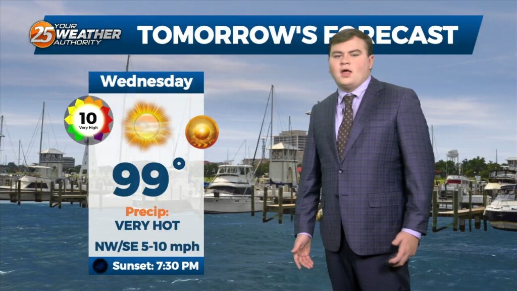
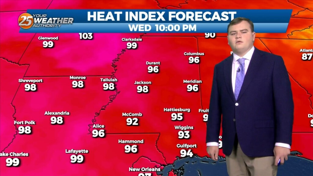
Yes you guessed it another day of oppressive heat is in store for our area. This means that there is an EXCESSIVE HEAT WARNING from Until 7PM today for heat indices from 110-116. This will come under mostly sunny skies…
Yes you guessed it another day of oppressive heat is in store for our area. This means that there is an EXCESSIVE HEAT WARNING from 11am-7PM today for…
I know folks we sound like a broken record, however another day of oppressive heat is in store for our area. This means that there is an…
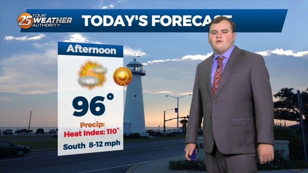
We will experience another day of high temperatures in the upper 90s. This means that there is an EXCESSIVE HEAT WARNING from until 7PM today for heat…
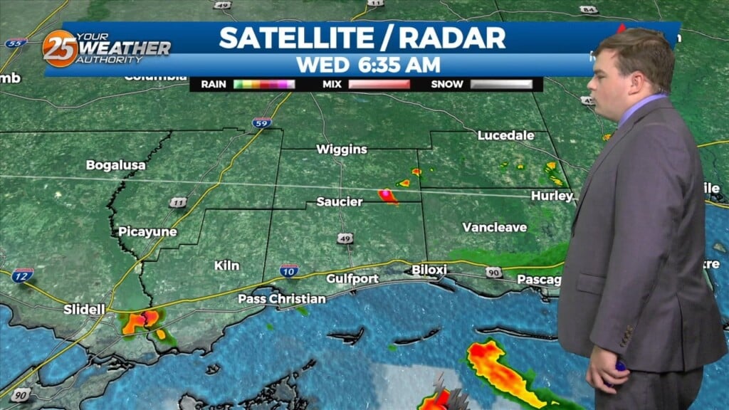
A few of you saw showers and thunderstorms overnight especially in southern Harrison county. The showers will diminish as we head towards midday leaving us with hot conditions again…
Another day of oppressive heat is in store for our area. We will experience another day of high temperatures in the upper 90s. This means that there…
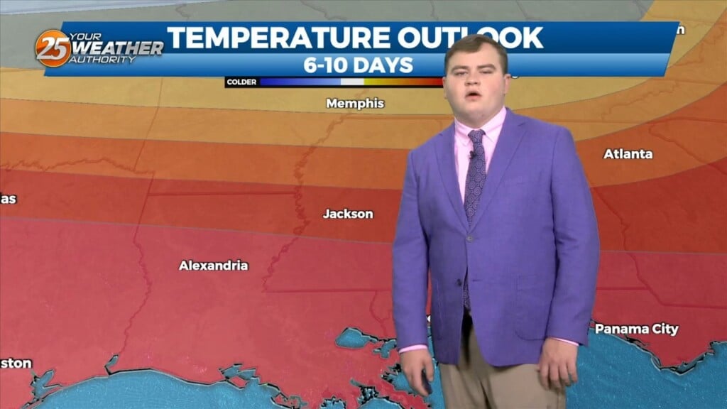
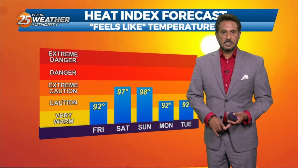
Folks the heat wave will continue into the first full week of August. This means that there is an EXCESSIVE HEAT WARNING until 7PM today for heat indices…
Folks the heat wave will continue into the first full week of August. This means that there is an EXCESSIVE HEAT WARNING FROM 11AM - 7PM today…
The main focus through this afternoon and the next couple of days will be the continuation of Excessive heat across the southern six counties. AN EXCESSIVE…
The dog days of summer are here to stay this week. A stationary boundary will begin to move out of the area tomorrow into the start of the…
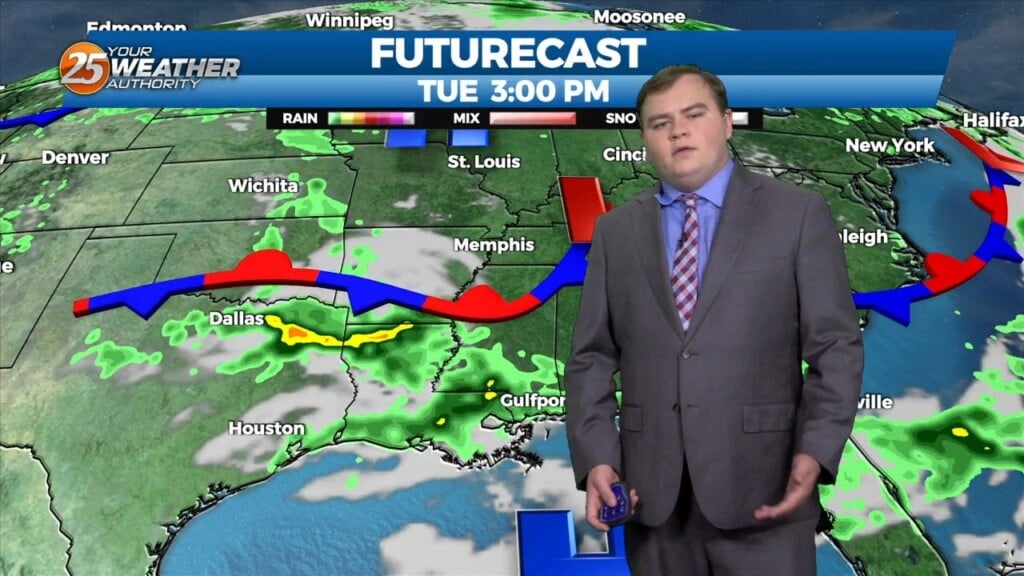
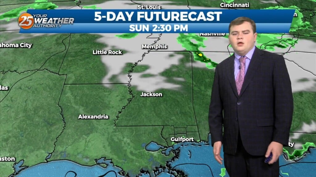
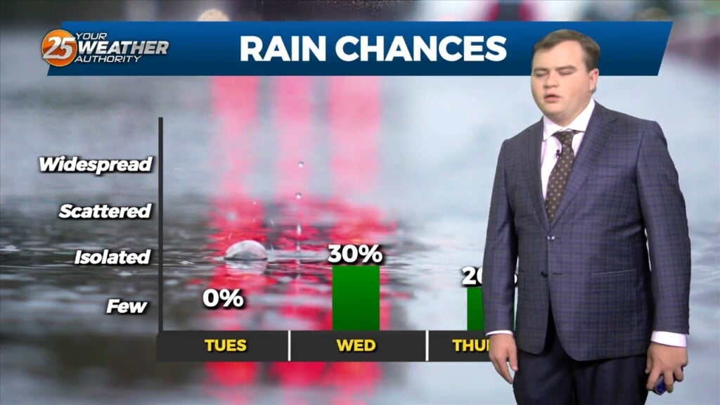
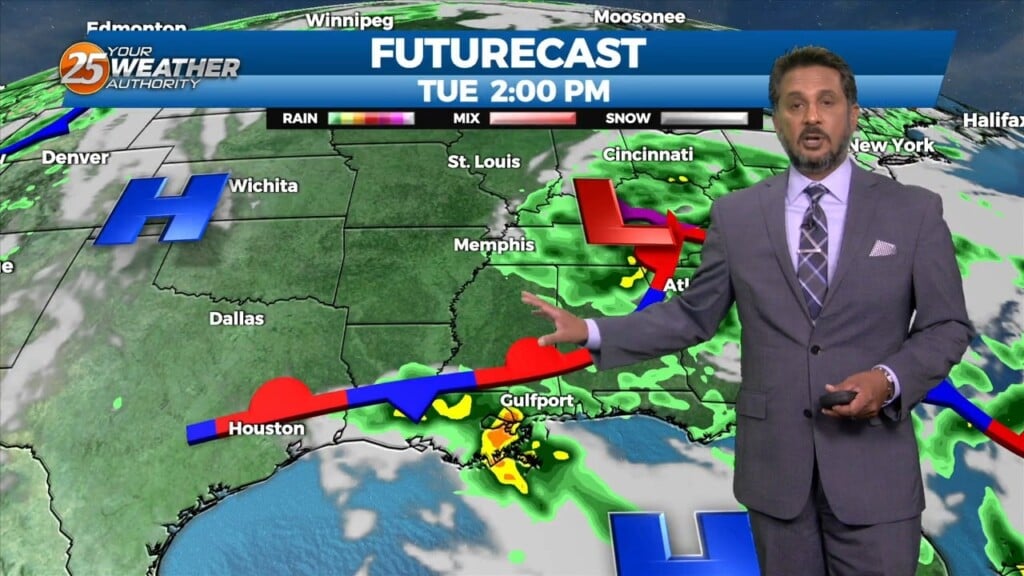
Currently there is a stationary front to the north of the I-20 corridor with showers and thunderstorms to the south of it. This afternoon will bring partly cloudy…
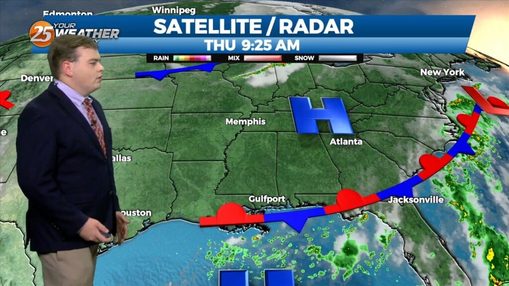
At the surface, the Bermuda high “High Pressure” extends westward across Florida into the northern Gulf of Mexico. A front is extended from Lake Erie into…
There is a disturbance in the pattern located in our area this morning. This disturbance will move SW just a bit and should be located…
A Heat Advisory will be in effect from 11am to 7pm. How long can our NW to westerly upper flow continue to dominate our…
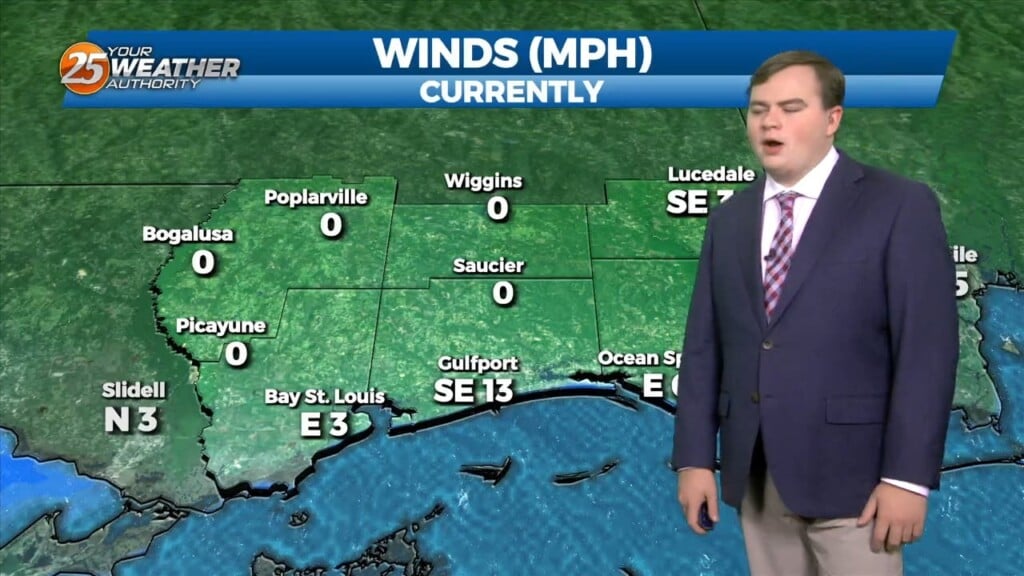
High pressure to the NW coupled with TD #2 to our SE will continue to provide for e NE/E wind this afternoon...dropping relative humidity into the 40% range.…
Moist, southerly flow in addition to increasing cloud cover will keep overnight lows slightly warmer than last night. Lows tonight will only fall into the mid to upper 60s at the beaches and low 60s to upper 50s further inland.…