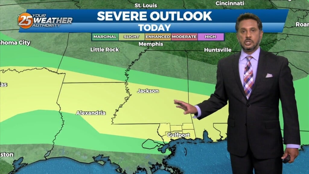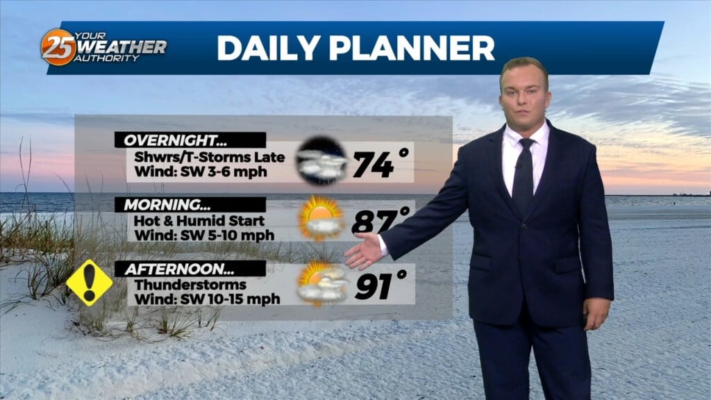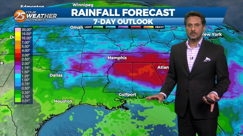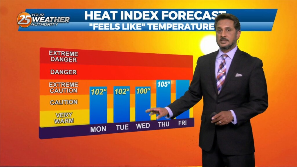
6/12 – The Chief’s “Low-End Severe Potential” Monday Afternoon Forecast
Very HOT temperatures ahead this afternoon as the HEAT INDEX will top the 100 degree mark. A stationary front coupled with daytime heating will pop afternoon showers/t-storm. Meanwhile high pressure was centered from the Florida Straits to the northern Gulf of Mexico just south of our area. There’s not a lot of agreement between short term models and global models…