6/19 - Chris Denmark's "Severe Thunderstorms Possible" Monday Afternoon Forecast
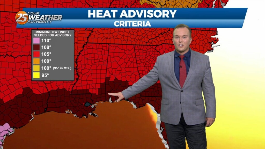
A Heat Advisory is in effect untill 7pm, showers and thunderstorms will bring relief to a lucky few. How long can our NW to westerly upper…
A Heat Advisory is in effect untill 7pm, showers and thunderstorms will bring relief to a lucky few. How long can our NW to westerly upper…
A Heat Advisory will be in effect from 11am to 7pm. How long can our NW to westerly upper flow continue to dominate our…
Isolated shower and thunderstorm chances will be around tonight. Expect warm and humid conditions to continue overnight. Cloud coverage will be dominant. Tomorrow will be another…
Isolated strong thunderstorms are possible tonight bringing the potential for hail and strong winds. A Severe Thunderstorm Watch is in effect until Midnight. The very persistent…
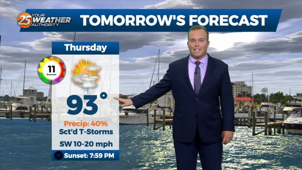
Hot and humid conditions will continue for the area into this weekend. There is about a 40% or so chance of showers and thunderstorms overnight. A…
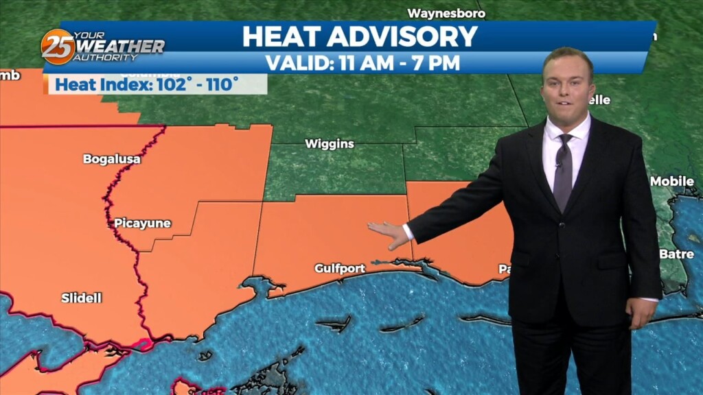
A Heat advisory is in affect for area from 11 am to 7 pm, be sure to practice summertime safety. The boundary has generally been north of our…
It will remain warm and humid overnight with southerly winds continuing. A 20% or so chance of a shower or thunderstorm cannot be ruled out. A thunderstorm…
Isolated thunderstorms are possible this evening due to the favorable environment. There is the potential for a strong thunderstorm or two as well. Other than rain…
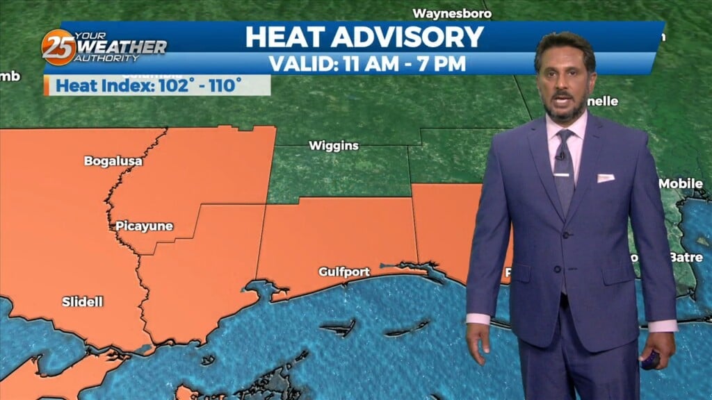
A Heat Advisory is in effect for our area from 11am to 7pm. This afternoon looks to be somewhat similar to the last day or…
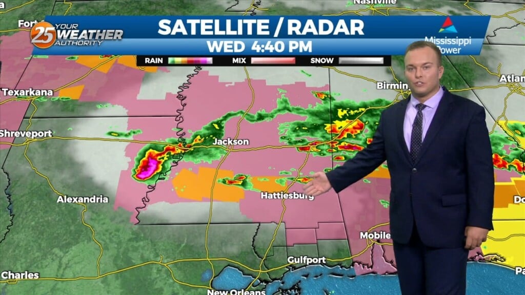
A few scattered showers have developed across the region early this morning, which will continue to develop into t-storms as we progresses towards midday. Today looks…
It will remain warm and humid overnight. Winds out of the southwest will continue to keep the hot pattern in place for South Mississippi. Any threat of…
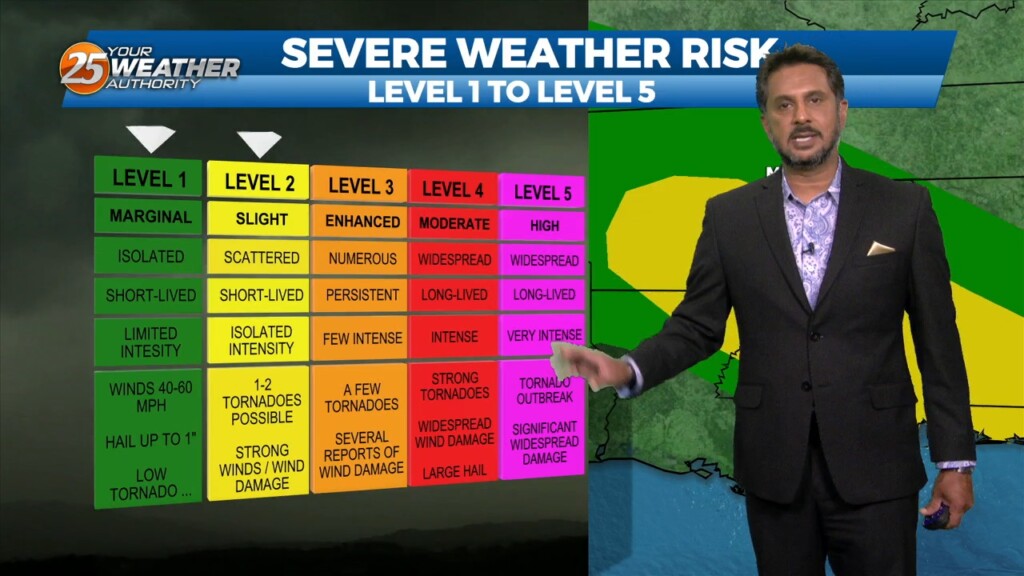
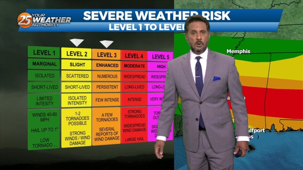
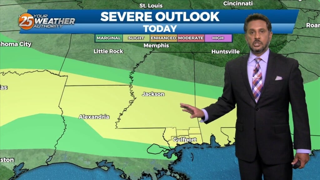
There is the potential for severe weather in South Mississippi tonight. Our area is under an Enhanced, or Level 3 of 5 threat for severe thunderstorms.…
A disturbance in the overall pattern riding SE into the area will continue to bring a SLIGHT/MODERATE threat to the area into early afternoon. All forms…
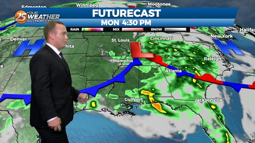
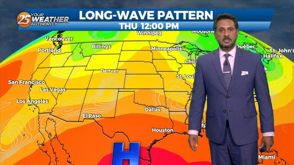
There is plenty to talk about in the first 24-48 hours with a challenging forecast ahead. An impulse riding SE along a stationary front to the…
It will remain warm overnight as temperatures will not drop significantly. The humidity will remain in place as we are in meteorological summer. There is the low-end potential…
Clouds took a very slight edge off of the heat today. Some spotty rain has popped up here and there. It will remain very warm overnight…
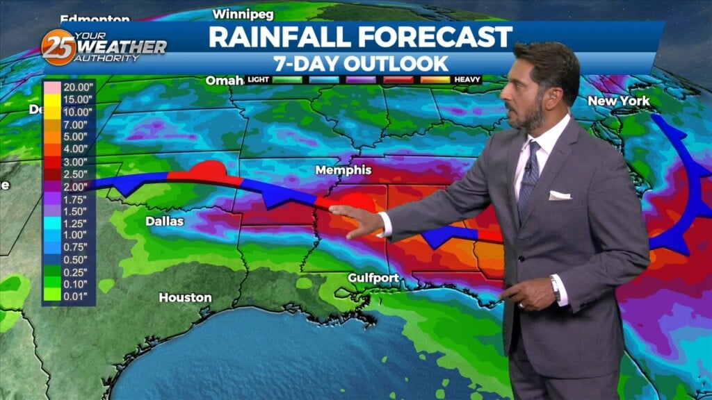
A secondary disturbance has settled into SE LA coastal areas. This is bringing a highly unstable marine airmass to the There will be a brief, disorganized…
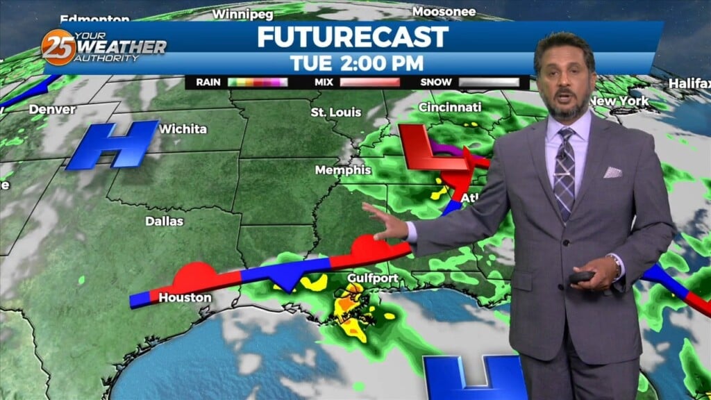
Starting out this Tuesday morning on the calm side after a rather active late afternoon/evening yesterday. Upper-level clouds are spreading east across the area from earlier thunderstorm…
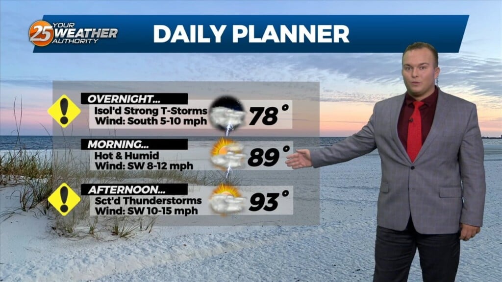
Other than very isolated shower/thunderstorm chances, the threat for severe weather has ended. Temperatures will remain warm overnight as humidity won’t allow for much cooling off.…
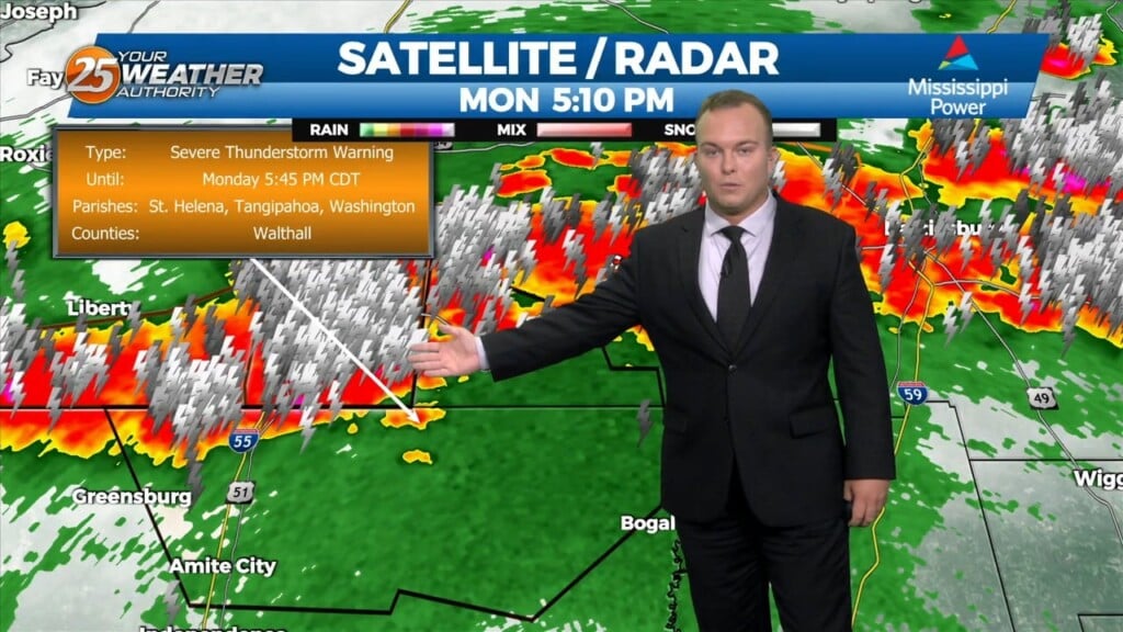
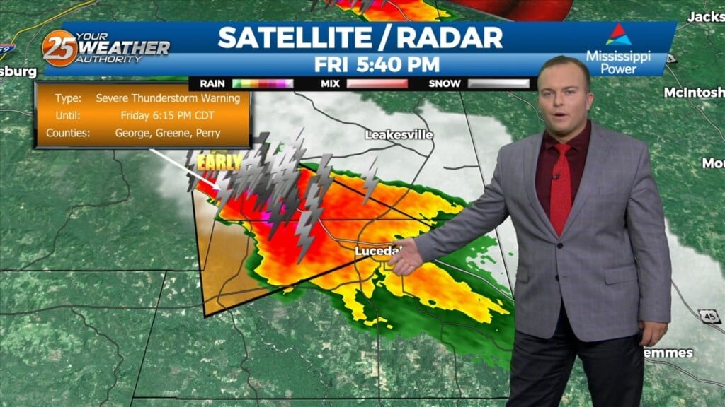
There is the potential for strong thunderstorms this evening. Our Southern Six Counties are under a Severe Thunderstorm WATCH until 8 PM CDT. Thunderstorms could have…
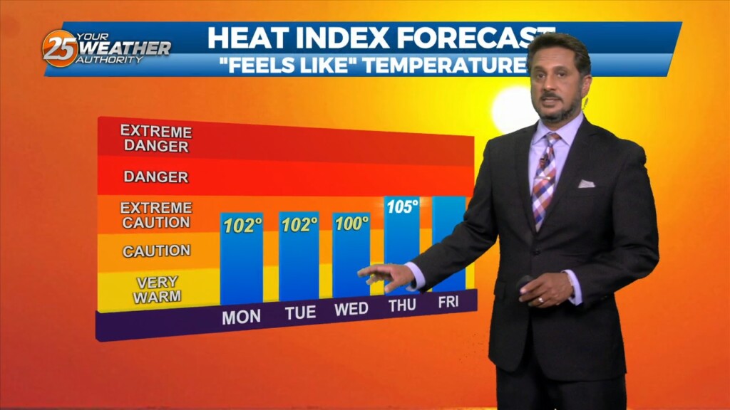
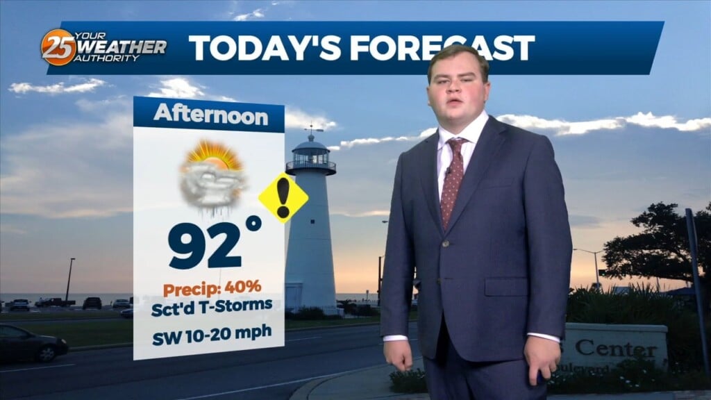
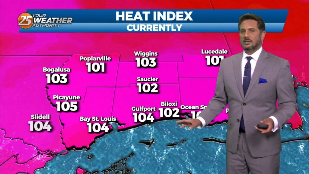
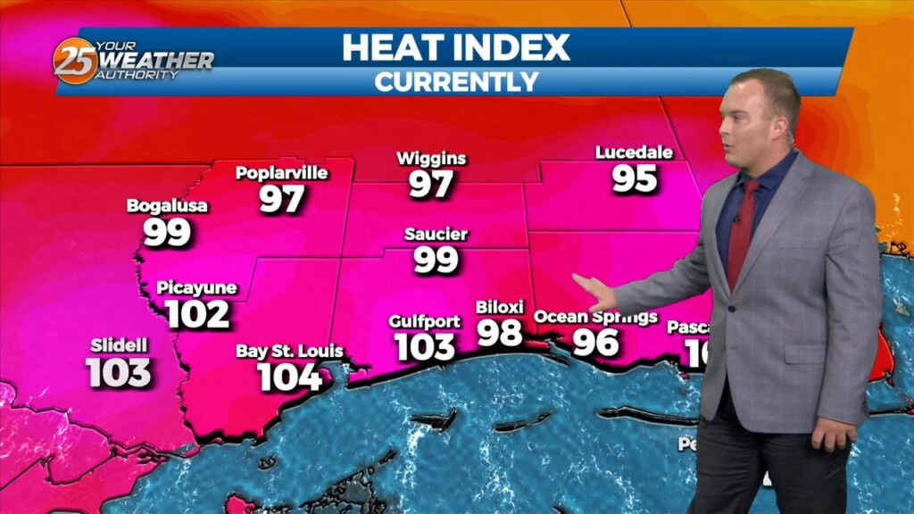
Very HOT temperatures ahead this afternoon as the HEAT INDEX will top the 100 degree mark. A stationary front coupled with daytime heating will pop afternoon showers/t-storm.…
There is a low pressure system is in the Great Lakes region with a cold front draped just north of the area that has become stationary. This…
Winds have primarily become a southerly flow which is taking the humidity up another notch. Overnight, there is the possibility for showers and thunderstorms after midnight.…
Any isolated thunderstorms this evening will come to an end after sunset. This weekend will be on the unsettled side, especially Saturday. In addition to our standard…