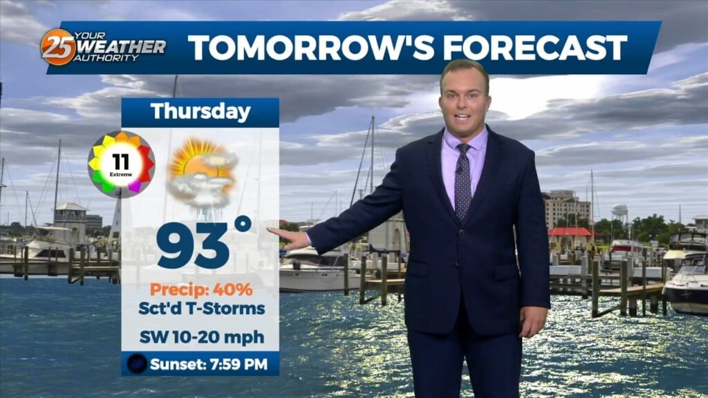
6/22 - Jeff Vorick's "Scattered Thunderstorms" Thursday Night Forecast
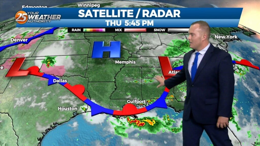
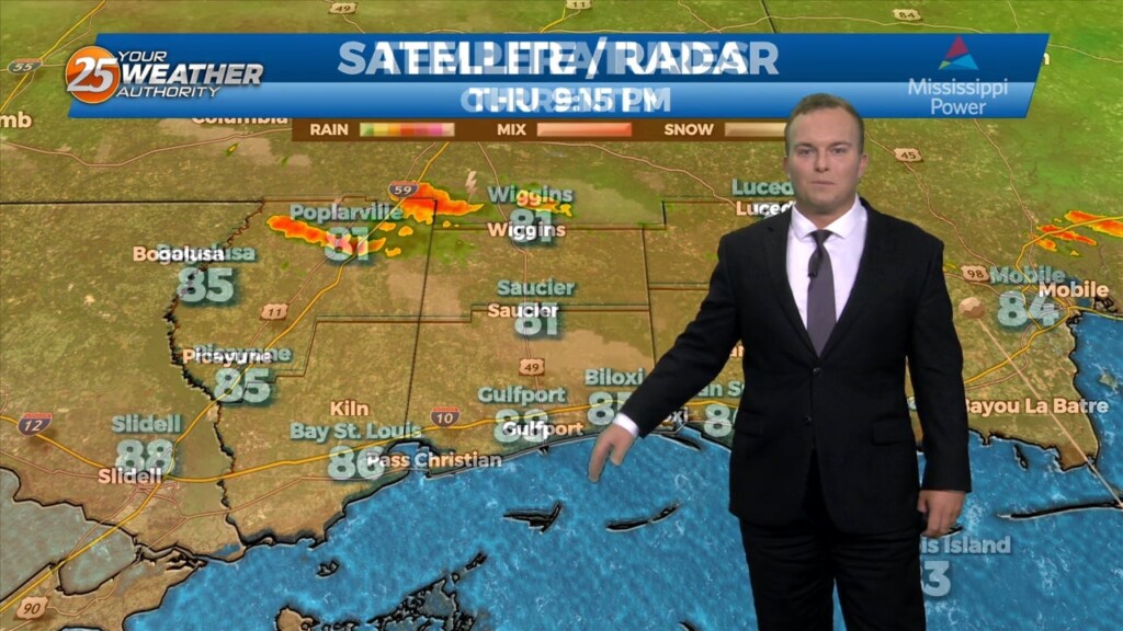
Isolated-to-scattered thunderstorm chances are in the picture this evening. Other than that, the pattern is gradually changing back to the usual hot and humid regime. Any rain…
Isolated-to-scattered thunderstorm chances are in the picture this evening. Other than that, the pattern is gradually changing back to the usual hot and humid regime. Any rain…
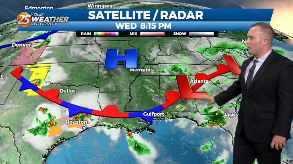
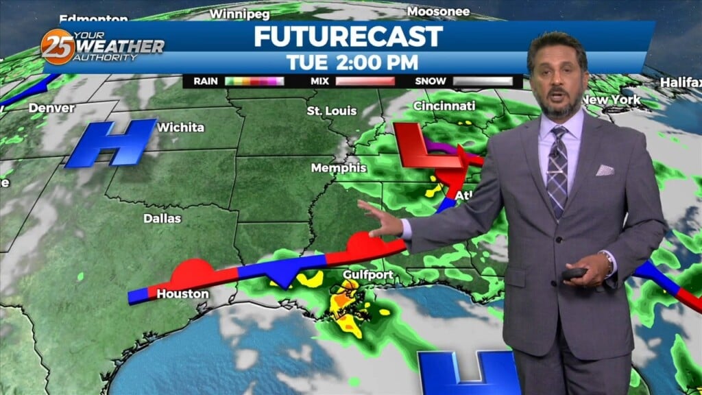
A stationary front is overhead or just to the south of our area. With that being said activity may be ignited along the stationary…
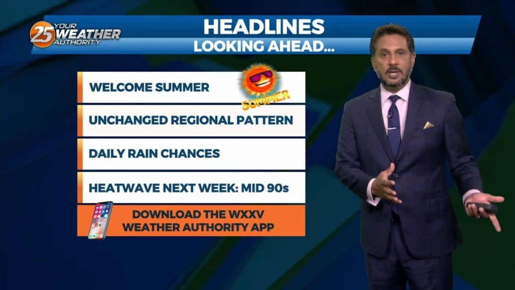
A more typical summertime pattern is on the way for South Mississippi. For tonight, expect rain chances to quickly dwindle for the majority of the area.…

Isolated thunderstorm chances can be expected for some this evening. Today brought a lot of sunshine and hotter temperatures than earlier on this week. Heat index…
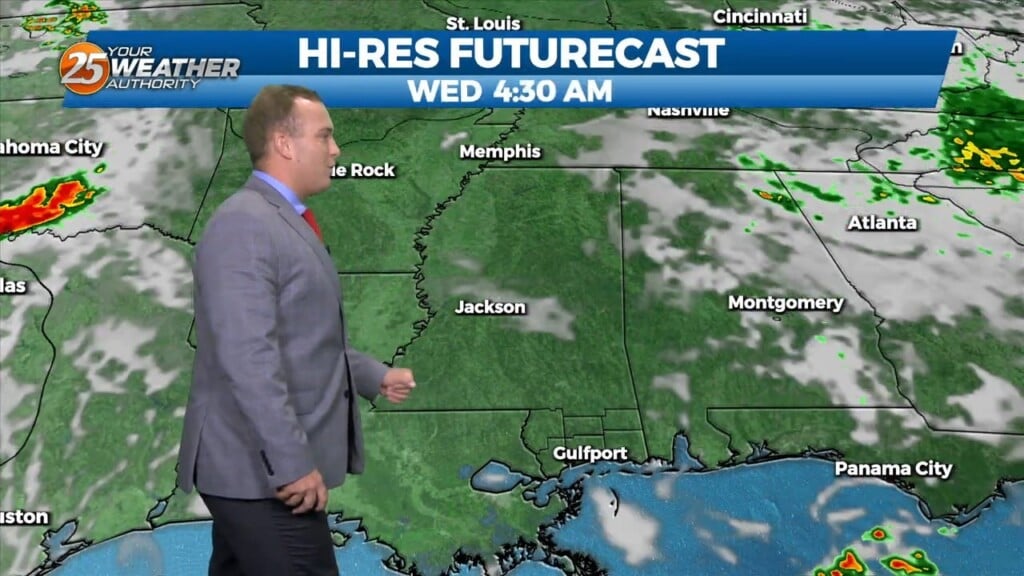
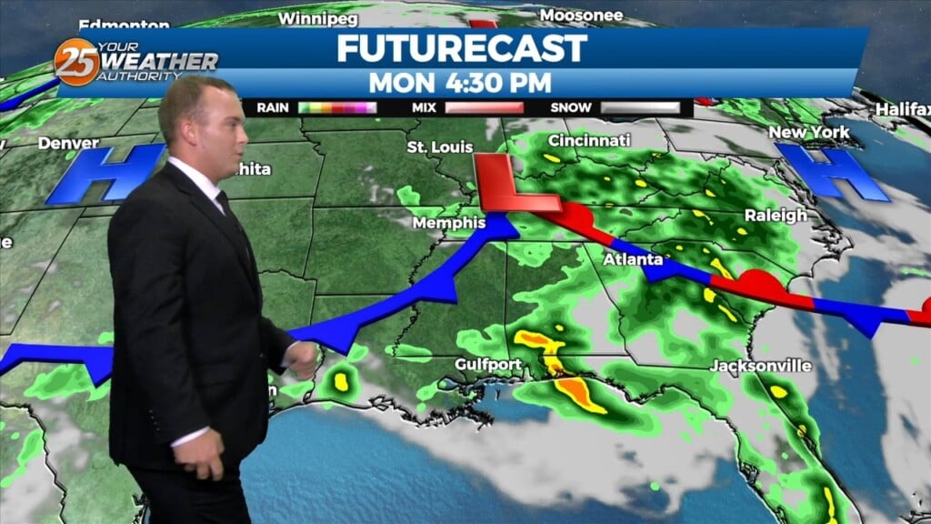
There is a disturbance in the pattern located in our area this morning. This disturbance will move SW just a bit and should be located…

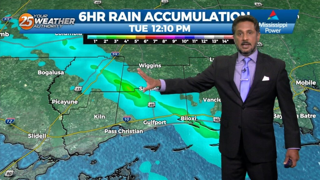
The Flash Flood Watch for our area will be allowed to expire at 10 PM. South Mississippi will be drying out gradually from the heavy rainfall earlier.…
Coverage of showers and thunderstorms will gradually lessen over the next few hours. A Flash Flood Watch for our area will expire at 10 PM. Gradual…
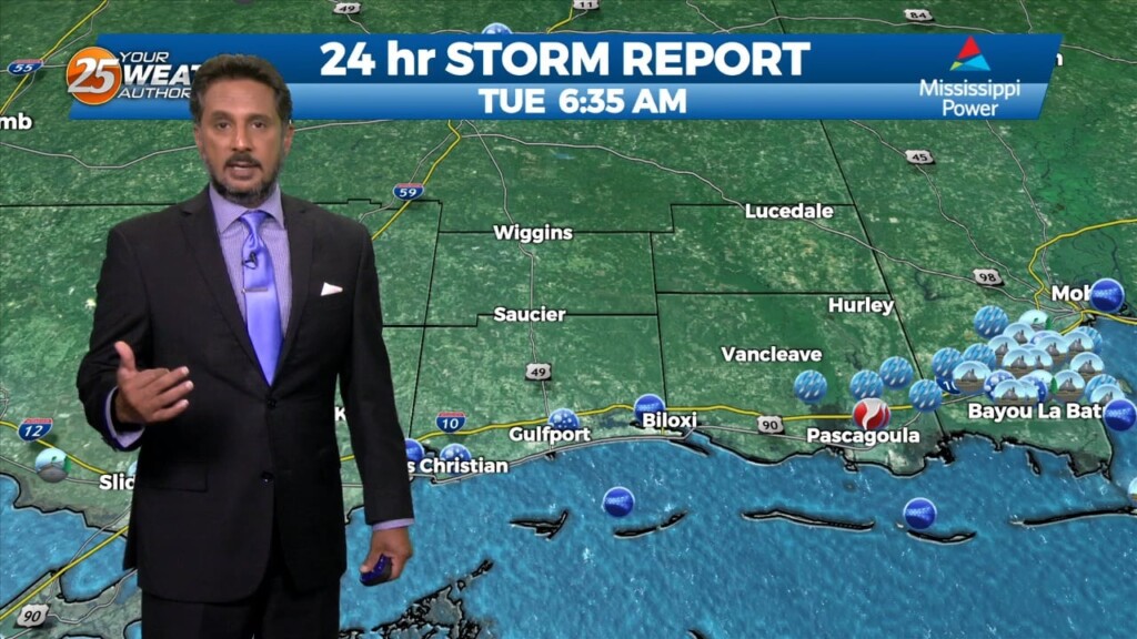
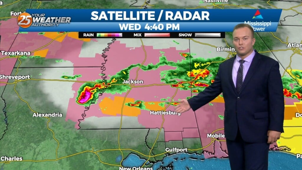
The National Weather Service has issued a flash flood warning for areas in South Mississippi. The advisory, which is until 5 p.m., includes east central Harrison County and southwestern Jackson County. Doppler radar indicated thunderstorms producing heavy rain across the…
With a weak cold front overhead and drier airmass, showers and thunderstorms will pop a little later this afternoon. The activity will get started farther NW and…
Outflow boundary is firing new cells this morning where it meets the surface front just to the N/NW of our area. Stability should begin to increase over…

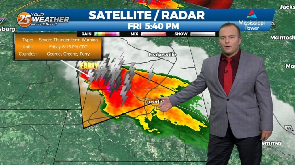
A Severe Thunderstorm Watch is in effect for our area until 1 AM. Thunderstorms bring the potential of strong winds and small hail with the…

A tornado touched down in downtown Moss Point this afternoon. The WXXV Weather Center reports the funnel cloud touched down about 2:50 p.m. Reports are coming in of damage in the city and Jackson County Sheriff's Office has sent deputies…
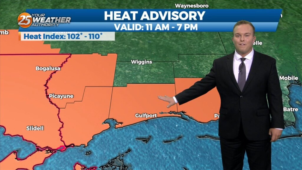
A Heat Advisory is in effect untill 7pm, showers and thunderstorms will bring relief to a lucky few. How long can our NW to westerly upper…
A Heat Advisory will be in effect from 11am to 7pm. How long can our NW to westerly upper flow continue to dominate our…
Isolated shower and thunderstorm chances will be around tonight. Expect warm and humid conditions to continue overnight. Cloud coverage will be dominant. Tomorrow will be another…
Isolated strong thunderstorms are possible tonight bringing the potential for hail and strong winds. A Severe Thunderstorm Watch is in effect until Midnight. The very persistent…
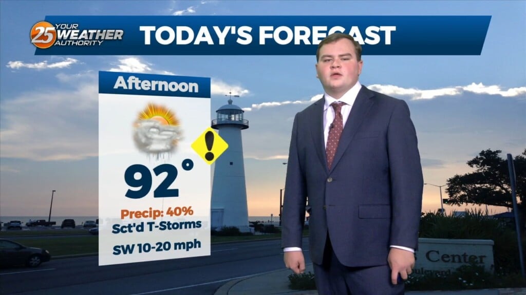
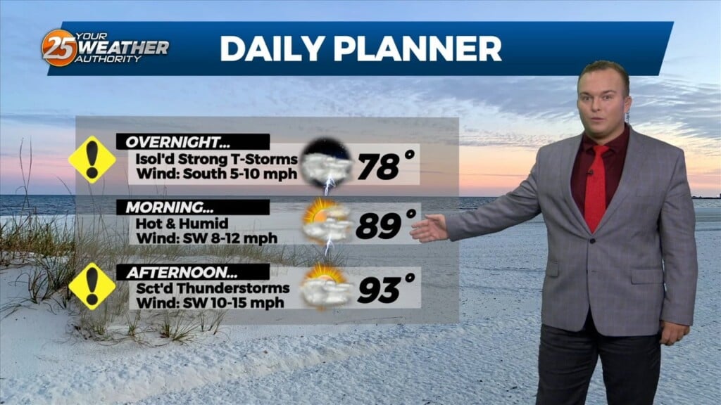
Hot and humid conditions will continue for the area into this weekend. There is about a 40% or so chance of showers and thunderstorms overnight. A…
A Heat advisory is in affect for area from 11 am to 7 pm, be sure to practice summertime safety. The boundary has generally been north of our…
It will remain warm and humid overnight with southerly winds continuing. A 20% or so chance of a shower or thunderstorm cannot be ruled out. A thunderstorm…
Isolated thunderstorms are possible this evening due to the favorable environment. There is the potential for a strong thunderstorm or two as well. Other than rain…
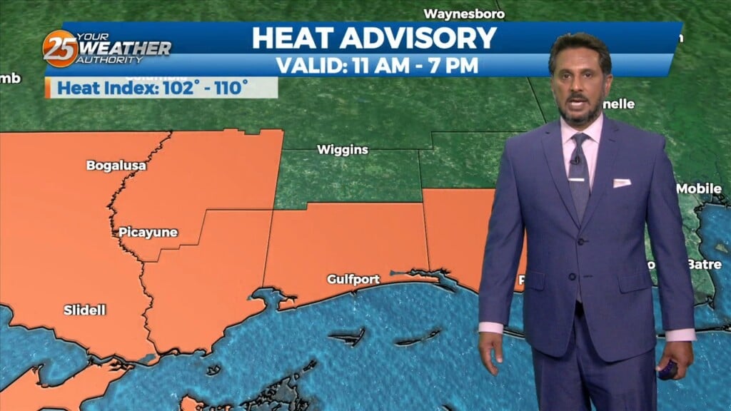
A Heat Advisory is in effect for our area from 11am to 7pm. This afternoon looks to be somewhat similar to the last day or…
A few scattered showers have developed across the region early this morning, which will continue to develop into t-storms as we progresses towards midday. Today looks…
It will remain warm and humid overnight. Winds out of the southwest will continue to keep the hot pattern in place for South Mississippi. Any threat of…
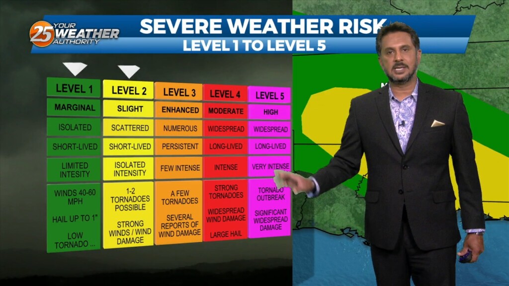
There is the potential for severe weather in South Mississippi tonight. Our area is under an Enhanced, or Level 3 of 5 threat for severe thunderstorms.…