8/16 - Jeff Vorick's "Clearing/Pleasant" Wednesday Evening Forecast
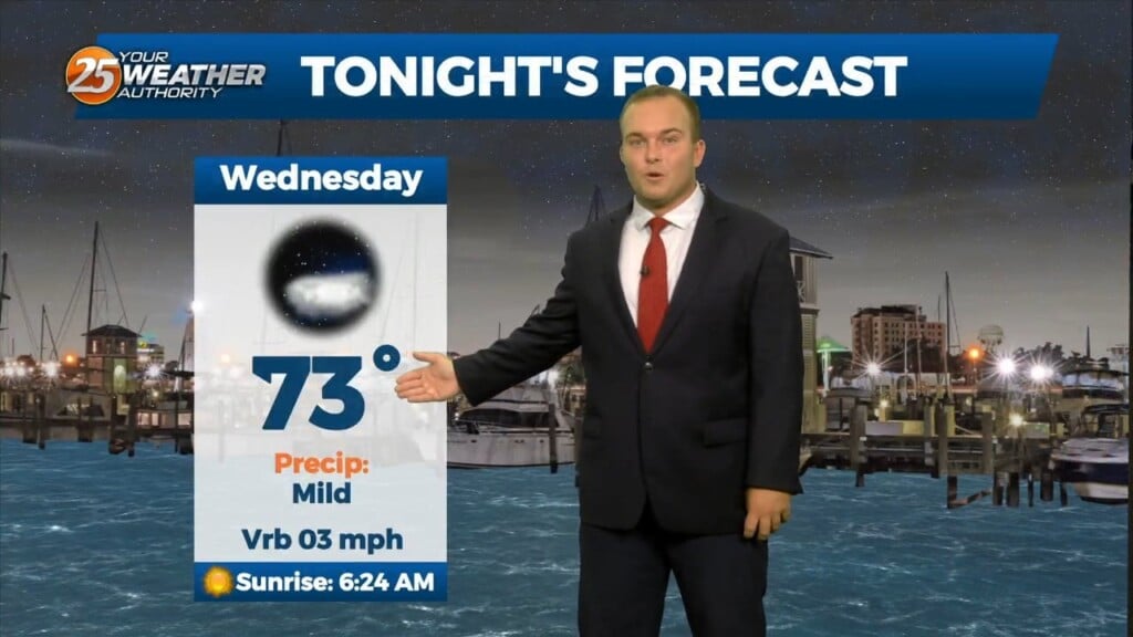
Clouds will clear out this evening and it will remain relatively mild. Hot temperatures early will cool off to manageable levels for any plans around sunset. Humidity will…
Clouds will clear out this evening and it will remain relatively mild. Hot temperatures early will cool off to manageable levels for any plans around sunset. Humidity will…
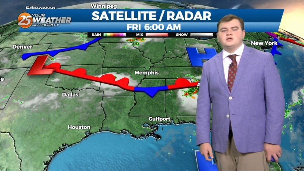
This afternoon a disturbance extended from Lake Ontario to near Memphis, southwestward into east Texas. Showers and thunderstorms yesterday afternoon brought much needed rain to the area as…
Early this morning, a disturbance extended from Lake Ontario to near Memphis, southwestward into east Texas. Showers and thunderstorms yesterday afternoon brought much needed rain to…
Other than spotty showers, rain chances have exited the area for the most part and skies will clear out overnight. A front is moving through the area…
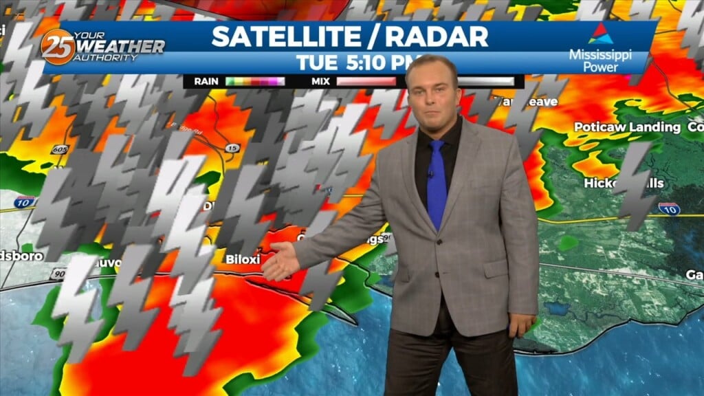
Scattered showers and thunderstorms are in the area ahead of an approaching cold front. Some heavy rainfall, frequent lightning, and non-severe wind gusts of 30-40 MPH. Rain…
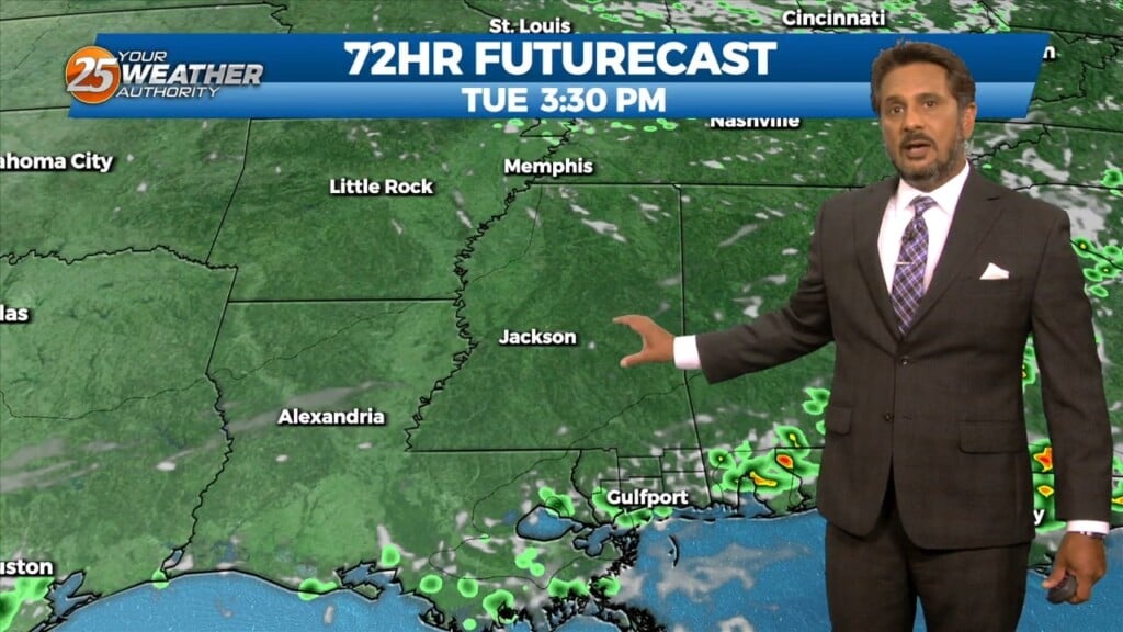
A strong upper disturbance is near Chicago early this afternoon, extending southwest to near Oklahoma City. At the surface, a cool (NOT COLD) front extended from…
A strong upper disturbance is near Chicago early this morning, extending southwest to near Oklahoma City. At the surface, a cool (NOT COLD) front…
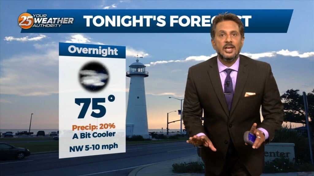
Temperatures will struggle to cool off overnight as the warm and very humid pattern remains in place. Skies will be clear for the start of your…
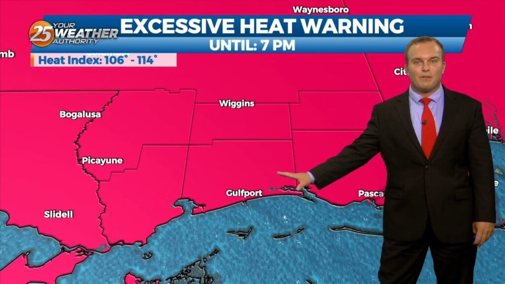
We have ushered in a new week and it still remains very hot. An Excessive Heat Warning is in effect until 7 PM for all 6…
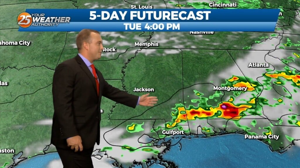
An area of low pressure over-southern Minnesota will move to the Mid-Atlantic states by Tuesday night, dragging the trailing frontal boundary into the local area during…
High pressure continues to be centered near the Texas-Louisiana border, with a cold front moving into the lower Tennessee valley this morning. The front is expected…
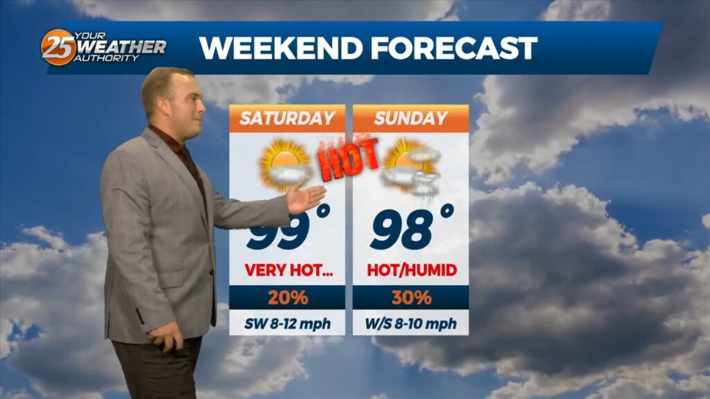
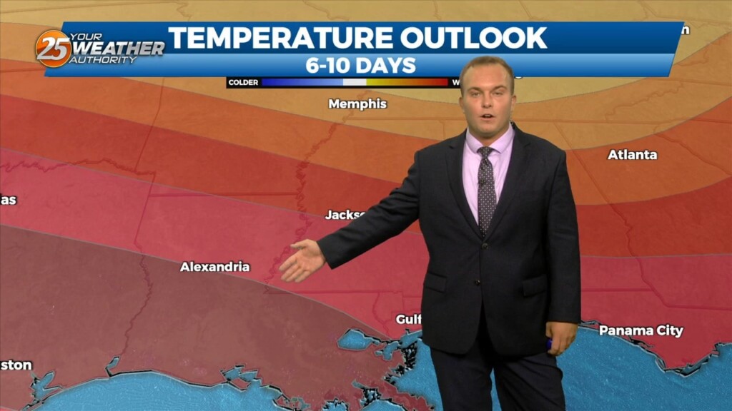
No need to sugar coat it this weekend has been very hot. This trend will continue into the start of the new work week. On Monday there…
It will not cool off to any comfortable level overnight. The humidity remains in place while skies will be mainly clear. Southerly winds will continue to be…
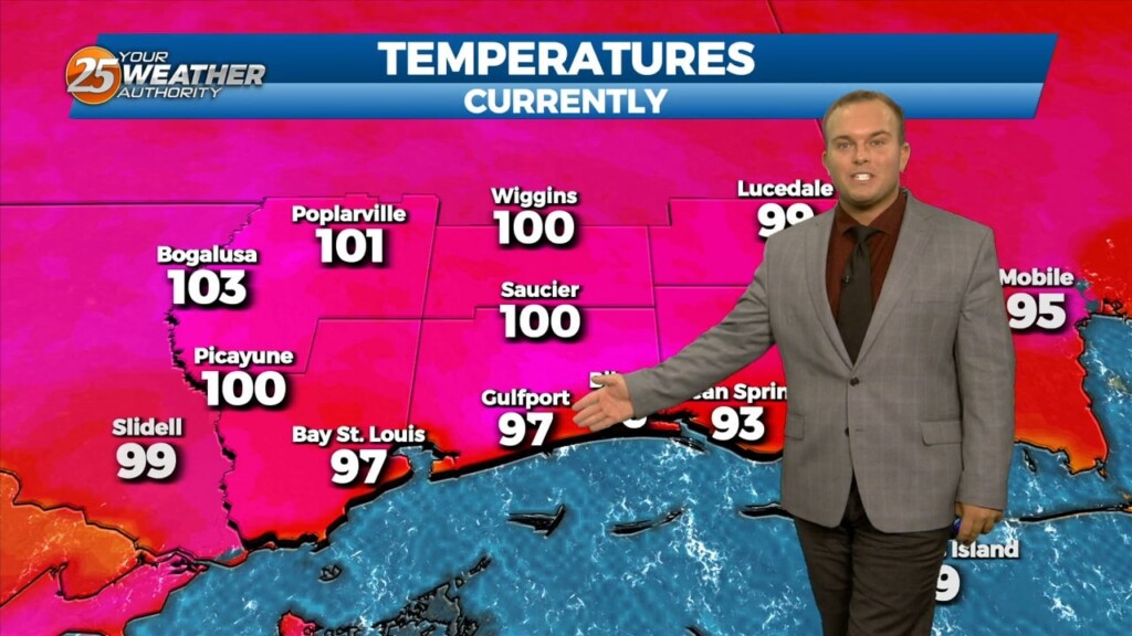
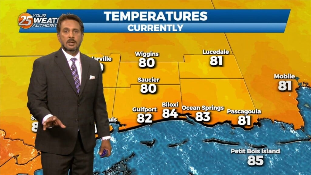
More heat continues in the area. The mercury reached 100 degrees at Gulfport earlier, breaking the daily record of 99 degrees. Many spots have been feeling…
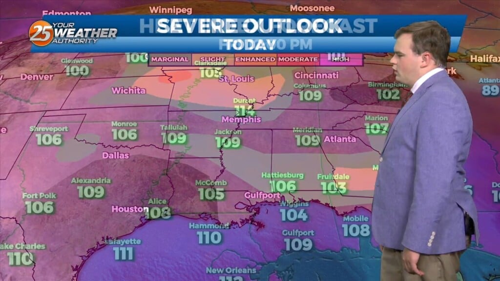
Yes you guessed it another day of oppressive heat is in store for our area. This means that there is an EXCESSIVE HEAT WARNING from Until 7PM today for heat indices from 110-116. This will come under mostly sunny skies…
Yes you guessed it another day of oppressive heat is in store for our area. This means that there is an EXCESSIVE HEAT WARNING from 11am-7PM today for…

It will remain hot and humid overnight as southerly winds continue. The warm nights and long duration of this heat wave can and do account for…
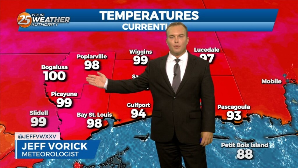
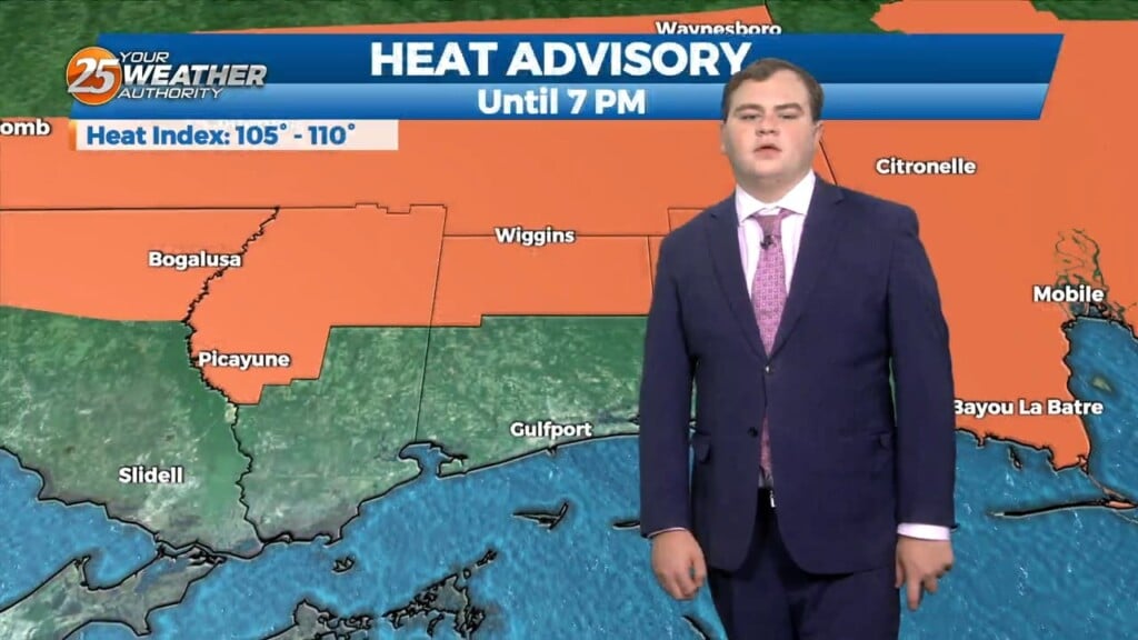
Extremely hot conditions continue for South Mississippi. Heat alerts remain in effect until 7 PM as heat indices are over 110 degrees. Clouds will clear overnight but…
I know folks we sound like a broken record, however another day of oppressive heat is in store for our area this afternoon. This means that there is…
I know folks we sound like a broken record, however another day of oppressive heat is in store for our area. This means that there is an…
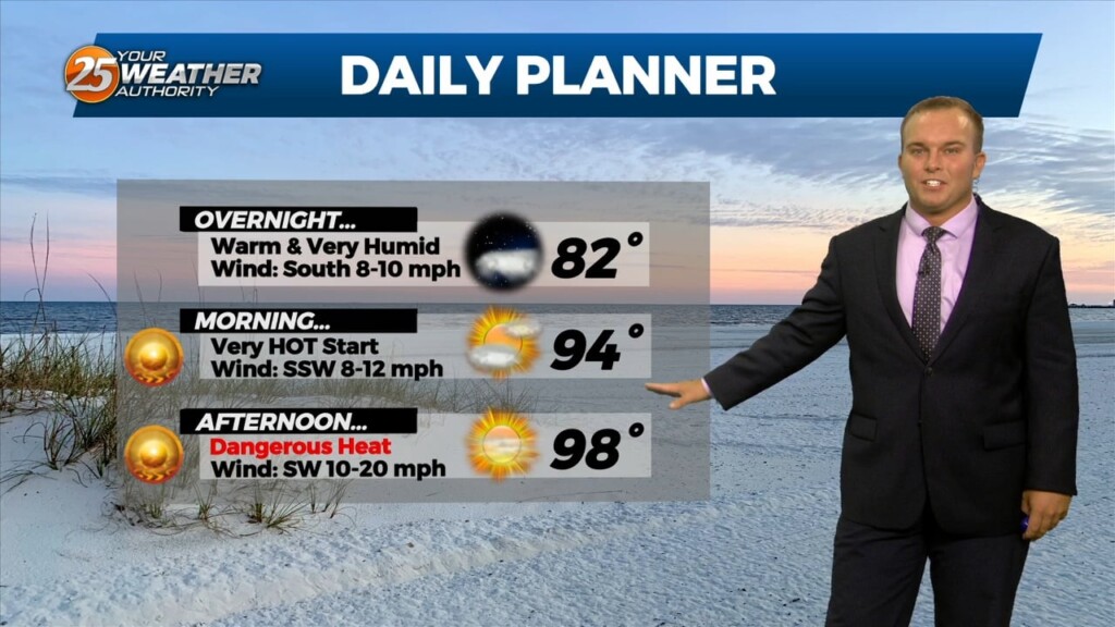
It will remain very warm overnight with southerly winds ushering in extremely high levels of humidity. Some clouds will be around at times but the…
As has been the case for a while, dangerous heat continues into this evening. Heat alerts expire at 7 PM but it will still be VERY…
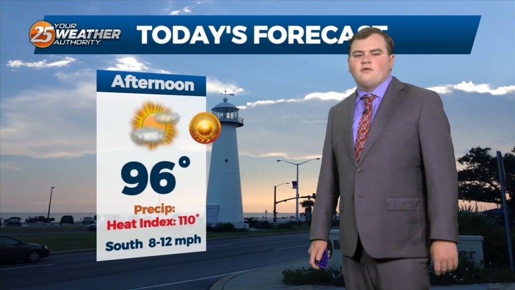
We will experience another day of high temperatures in the upper 90s. This means that there is an EXCESSIVE HEAT WARNING from until 7PM today for heat…
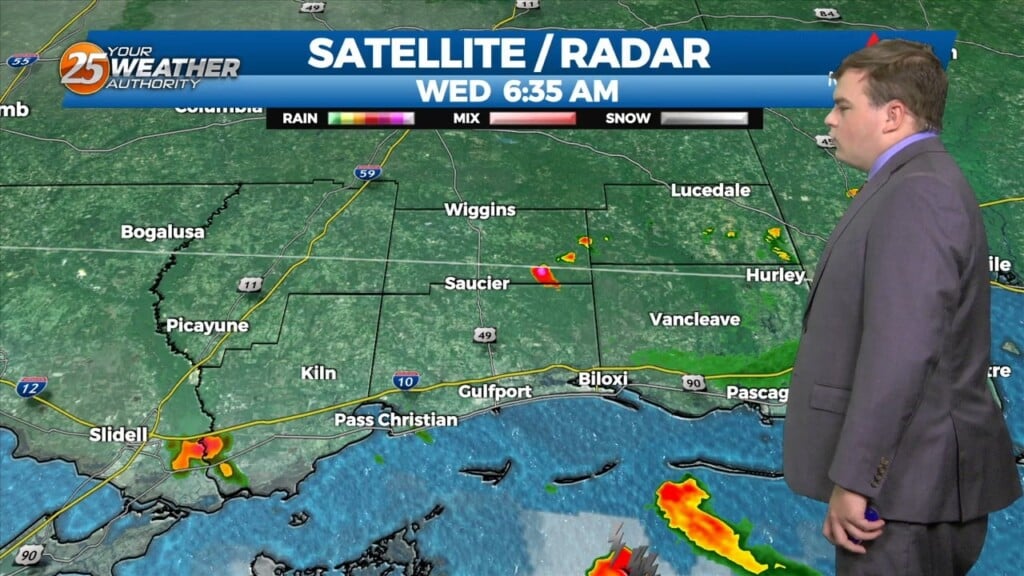
A few of you saw showers and thunderstorms overnight especially in southern Harrison county. The showers will diminish as we head towards midday leaving us with hot conditions again…