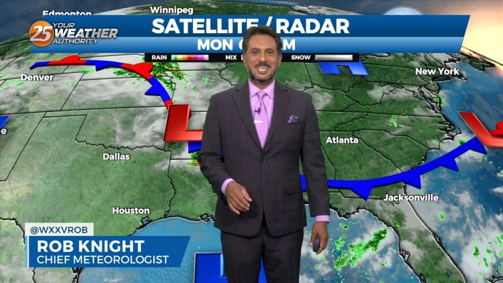
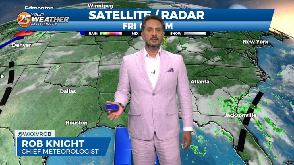
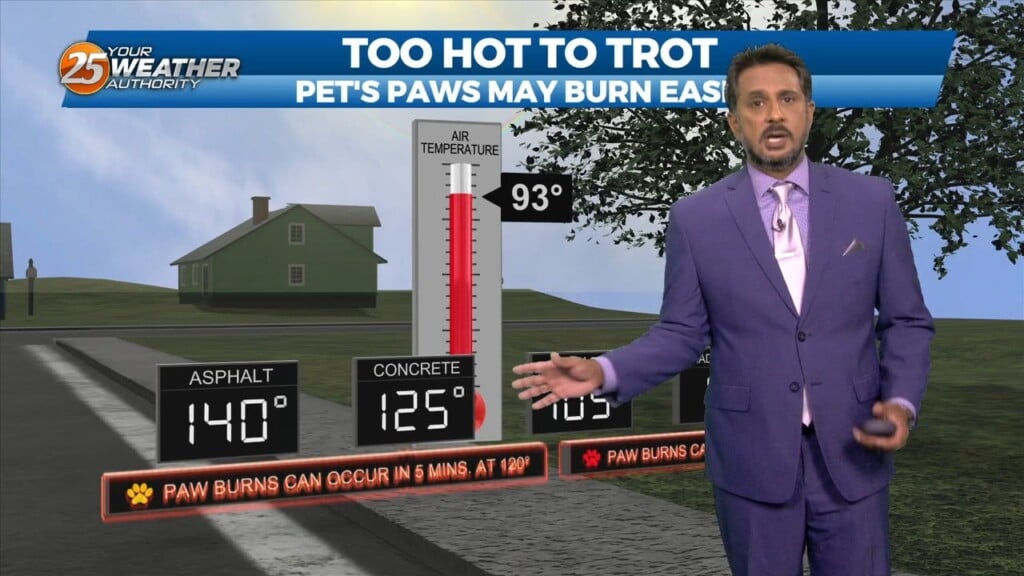
8/4 Chris's "Heat Warning" Friday Morning Forecast
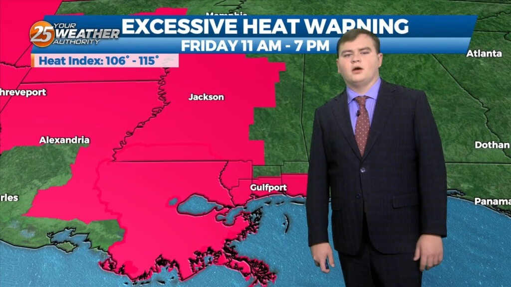
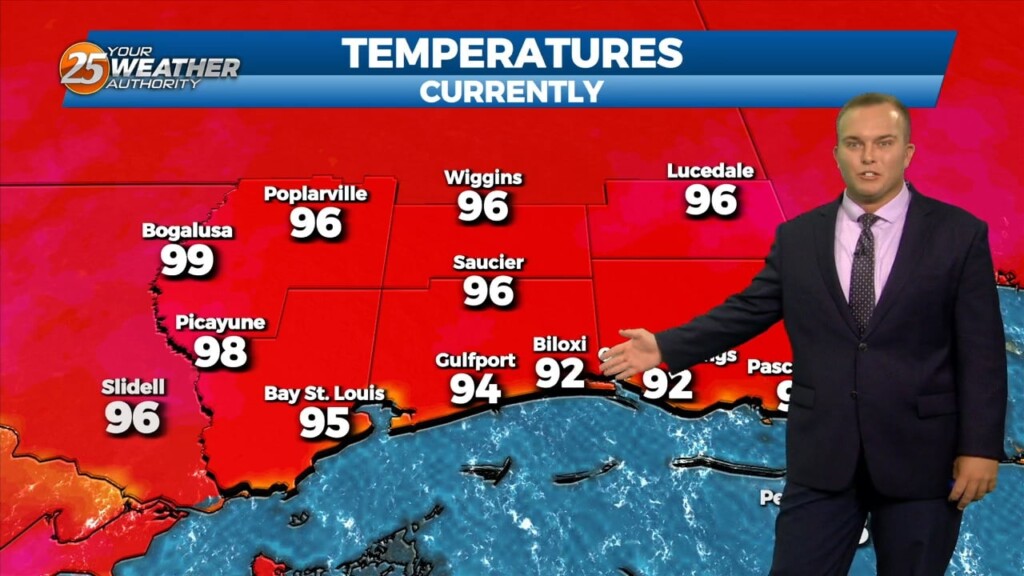
Welcome to the first Friday/Weekend of August. Temperatures will not be pleasant today or for the weekend. A EXCESSIVE HEAT WARNING IS IN EFFECT FROM 11am until 7pm for…
Welcome to the first Friday/Weekend of August. Temperatures will not be pleasant today or for the weekend. A EXCESSIVE HEAT WARNING IS IN EFFECT FROM 11am until 7pm for…
The humidity will remain in place overnight. Temperatures will not drop off too much more even under clear skies. Expect a very hot start tomorrow and the…
A Heat Advisory is in effect until 7 PM. The hot and humid pattern will continue into the first portion of the weekend. Overnight, it will be warm…
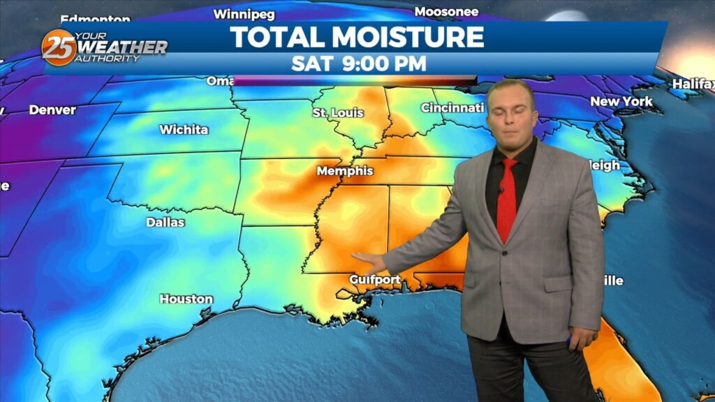
The stationary front in central Mississippi yesterday has retreated well to the north this afternoon with high pressure in the Gulf. A HEAT ADVISORY is in effect until 7 pm for heat indices of 106-114. Any showers or thunderstorms that…
The stationary front in central Mississippi yesterday has retreated well to the north this morning with high pressure in the Gulf. A HEAT…
Warm and humid conditions will remain overnight. Expect a few clouds from time to time and light southwesterly winds to usher in humidity. High pressure shifting to its…
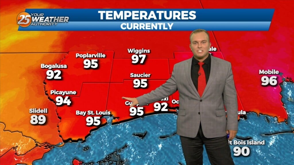
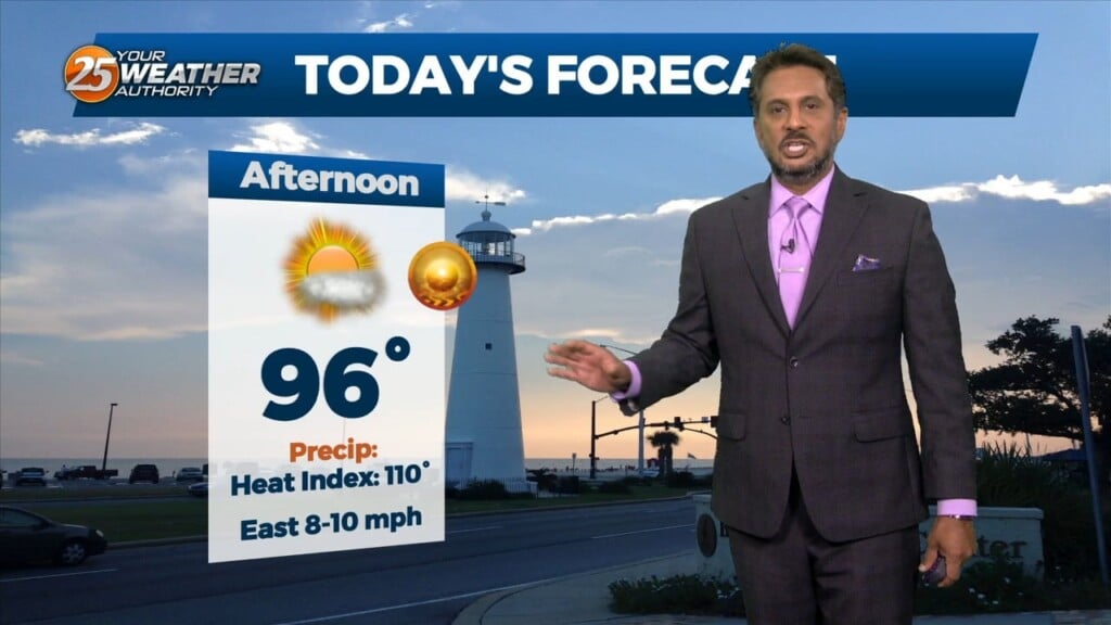
A Heat Advisory remains in place until 7 PM this evening. Temperatures well into the 90s will feel like 110 degrees at times. There is a chance…
This afternoon there is a weak stationary front to the north of our area. This front will begin to move closer to the area later this afternoon, before…

This morning there is a weak stationary front to the north of our area. This front will begin to move closer to the area this afternoon, before…
It will be warm and humid out the door tomorrow morning. Your Wednesday is going to start off with sunny skies and that will allow for hot…
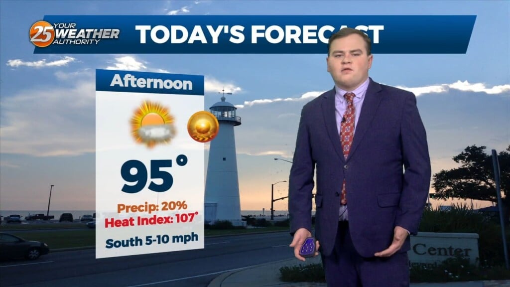
An Excessive Heat Warning remains in place for Hancock, Harrison, Jackson, and Pearl River County until 7 PM. Skies will clear from partly cloudy to mainly clear skies…
The main focus through this afternoon and the next couple of days will be the continuation of Excessive heat across the southern six counties. AN EXCESSIVE…
The main focus through the next couple of days will be the continuation of Excessive heat across the southern six counties. A Stationary boundary is near the area…
With little in the way of upper level support across the central Gulf States, expect only limited rain chances through mid-week…with another hot afternoon ahead. Models…
Earlier this morning, the MCS continues to decay as it moves south of our marine waters. Expect a few more isolated showers or storms…
After a very loud evening a few showers and thunderstorms are still around the area this evening as rain chances decrease after the midnight hour. As we have…
Any isolated thunderstorms this evening will be out of the picture by around sunset. Skies will clear out overnight leaving us with sunny skies to start…
High Pressure is to our south in the gulf and is the most dominate feature today into the weekend. Today and Saturday will be hot with the chance of an…
Starting the last Friday morning of July with cloud coverage in the area, due to a disturbance over the eastern portions of Florida off the coast.…
Skies will be mainly clear the rest of tonight with warmer temperatures as compared to last night. Tomorrow will become hot and humid…
Spotty to isolated shower/thunderstorm chances will be around early this evening. Rain chances will drop off and skies will clear out tonight. Temperatures will be a…
We could just maybe have a possible shower this afternoon but very LIMITED activity through Friday. High pressure will continue to be the main factor shaping the forecast into the final weekend of July…more so into early August, as RECORD…
Not much difference this morning than the past couple of days with another warm and humid start. A possible shower can be expect this afternoon…
Skies will remain mostly clear overnight as temperatures will once again cool to milder readings. Humidity is very gradually on the uptick but it is still…