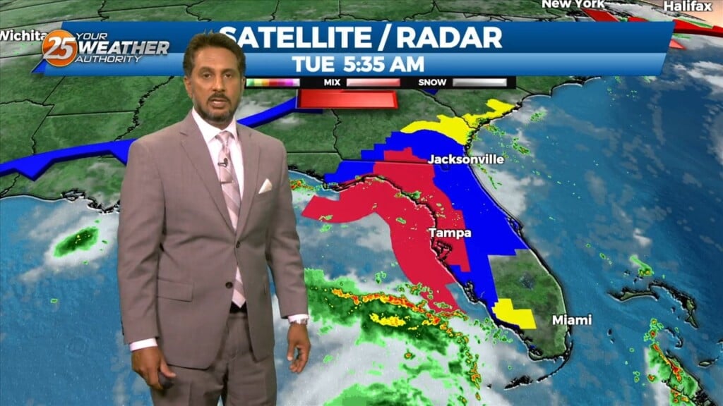
8/29 - The Chief's "Tracking Hurricane Idalia" Tuesday Morning Forecast
This morning a weak cold front to the north is causing an abundance of cloud coverage and a few showers across the area…mainly in the N’tern…
This morning a weak cold front to the north is causing an abundance of cloud coverage and a few showers across the area…mainly in the N’tern…
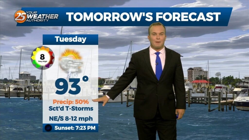
Skies will clear somewhat overnight and rain chances will gradually exit the picture for the night. It will remain mild, and humid. Tomorrow will start…
Thunderstorms will remain around early on this evening for a lot of you. Very heavy rain and isolated pockets of gusty winds and small hail are possible…
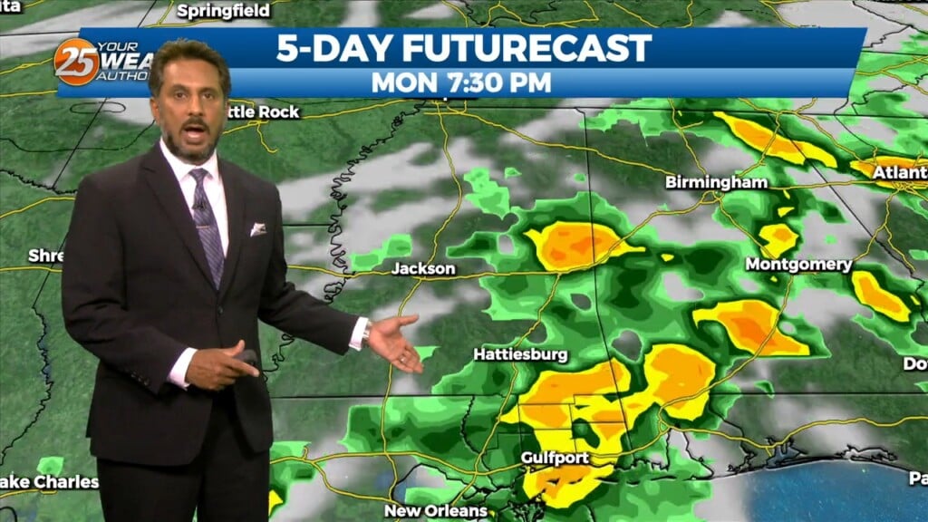
Multiple weaknesses in the overall pattern including an area of low pressure to the west has brought rain chances back to the region. Strong cored…
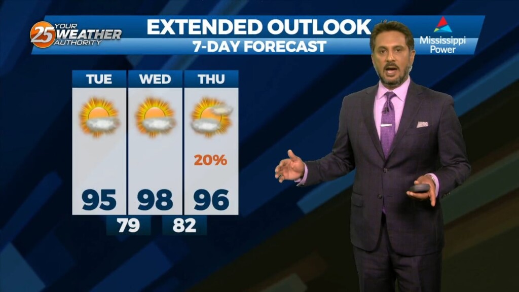
For today and Tue, models are trying to lower temps since there will be more cloud cover around and more showers/t-storms. Multiple weaknesses in the overall…
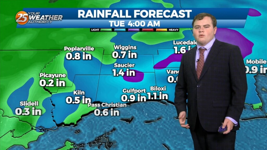
Folks it actually rained today some even saw 1-2 inches in the severe thunderstorm. This trend will continue this week to hopefully combat the severe drought across…
If you're like me and very tired of this ongoing never ending oppressive heat tuned to the end of this article you will love what I have to…
If you're like me and very tired of this ongoing never ending oppressive heat tuned to the end of this article you will love what I have to…
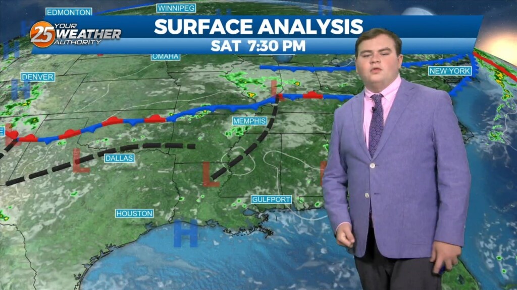
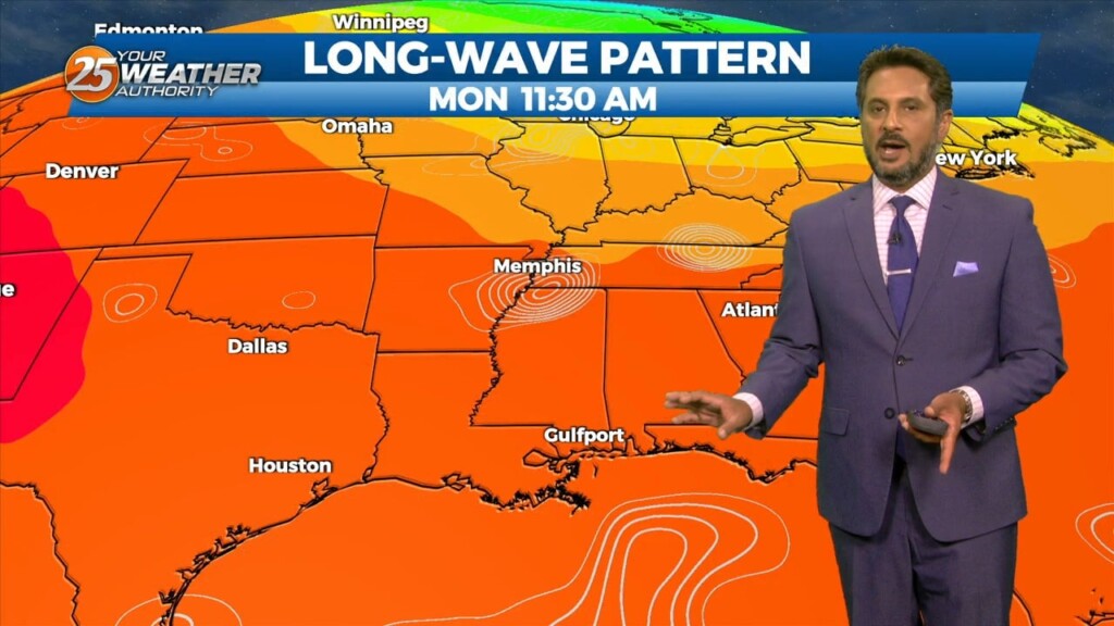
Upper level high pressure continues to spread eastward through the central MS River Valley and into the southern Appalachians. Basically, in a nutshell, same old same old…
The stubborn high pressure continues to remain centered over the I-35 corridor from Kansas through much of north and central Texas this morning.…
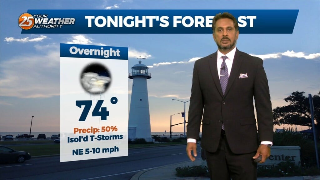
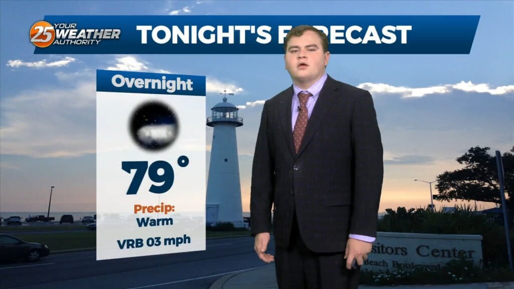
Tonight we will steadily drop into the upper 70s for overnight lows with mostly clear skies. Unfortunately little change in the overall pattern is expected through the end…
Unfortunately little change in the overall pattern is expected through the end of this week as high pressure remains dominant. However currently there is an overall weakness…

At the surface, a very subtle weakness resides across portions of the region, however, this feature hasn’t been as productive as I'd like in terms of…
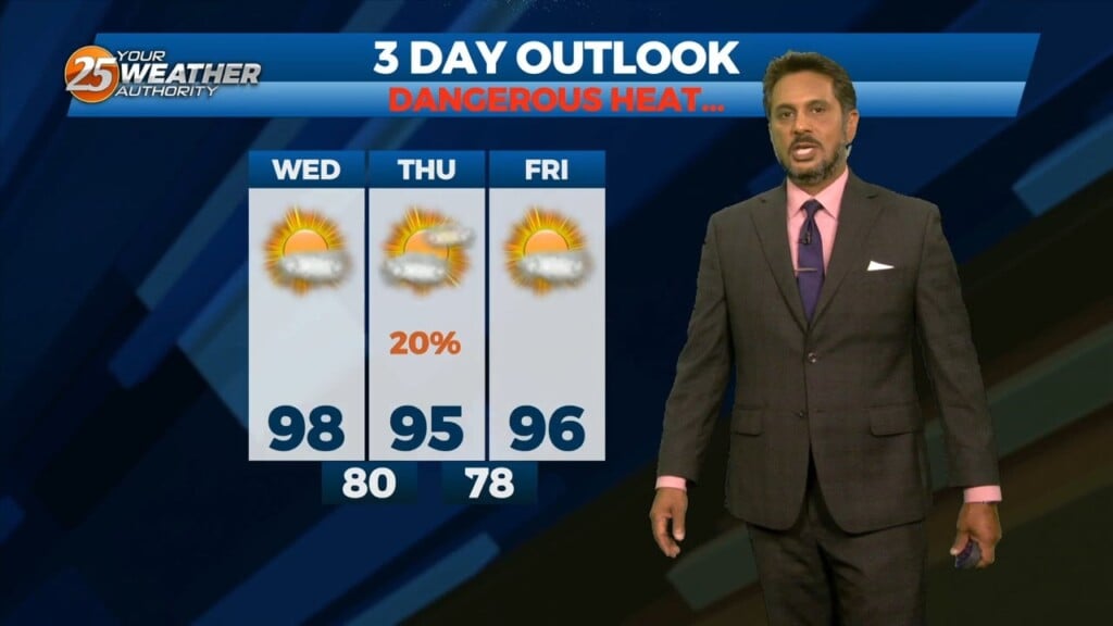
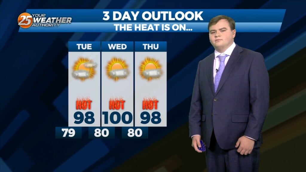
Yet another hot day is anticipated across the central Gulf region today as high pressure remains situated to our north with a general…
Tonight we will see clear skies and warm low temperatures in the low 80s. High pressure continues to be the most dominate feature across the there…
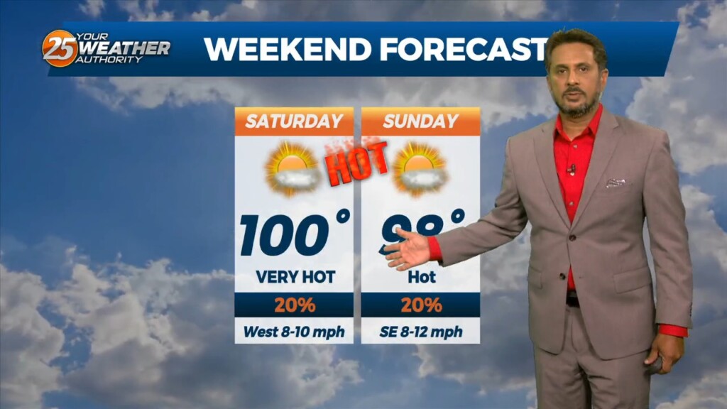
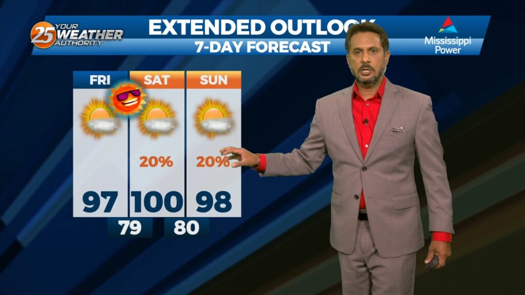
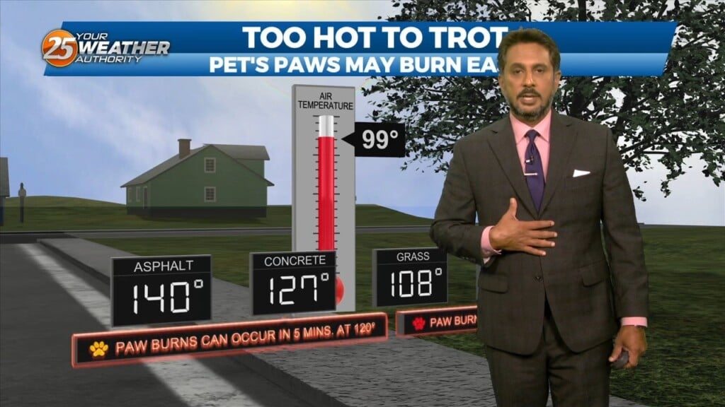
Today has been miserably hot across the area most of our reporting sites are well into triple digit values with heat indices well above 110. Temperatures will…
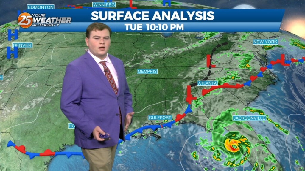
An easterly wave is currently located from Appalachia Bay FL down to the NE’tern Gulf of Mexico. This wave will also get flattened down on its…
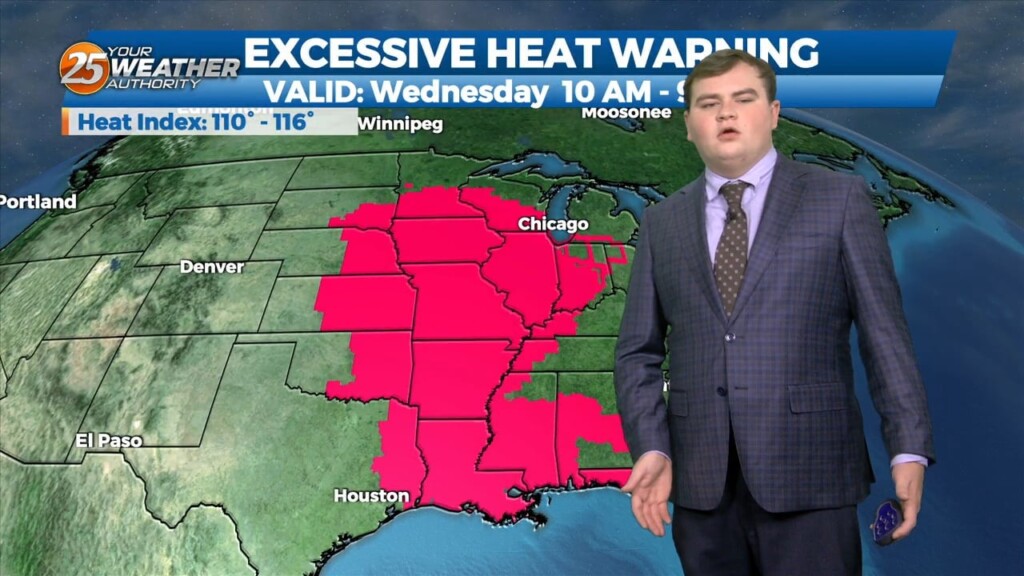
An EXCESSIVE HEAT warning is in effect as this OPPRESSIVE summertime pattern continues. An easterly wave is currently located from Appalachia Bay FL down…
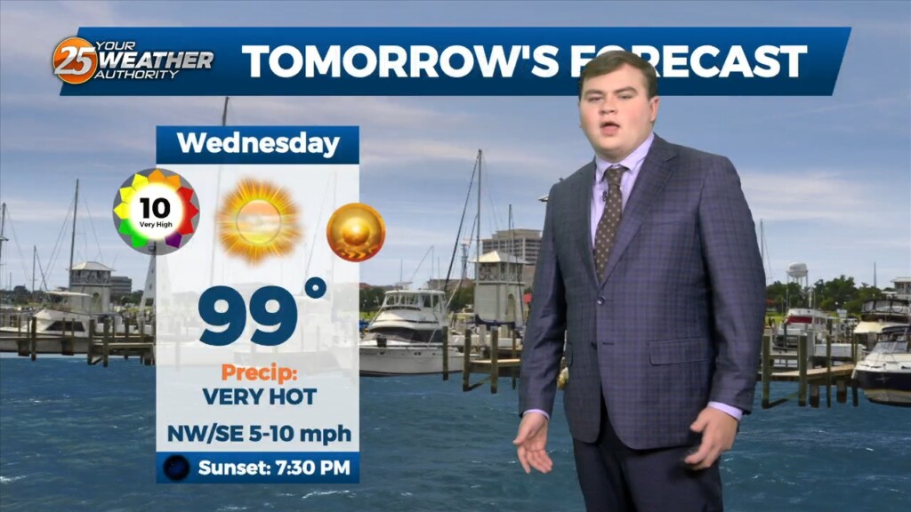
Temperatures will continue to be hot this evening in the upper 80s before dropping off to a overnight low in the upper 70s. The heat continues to be…
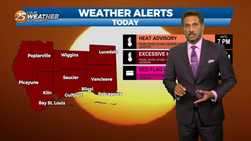
The heat continues to be oppressive across South Mississippi as a heat dome is overhead and over most of the country. This afternoon more areas than not reached…
Temps will climb a bit today as dry air will begin to take the place of the departing tropical environment but won’t be too fast…
The nice "cooler" temps yesterday were courtesy of the tropical wave that became TS Harold. The back end of this is exiting stage left for us…
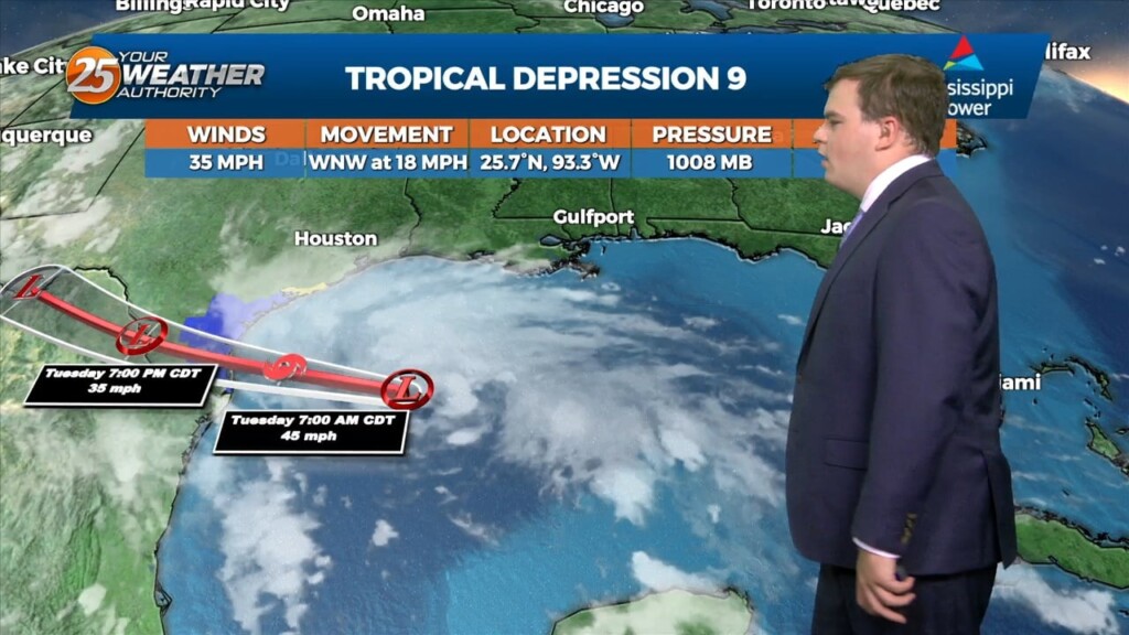
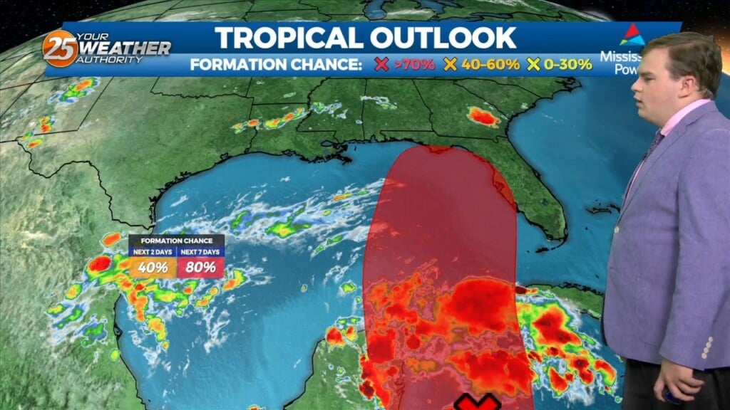
Really breezy out there this evening with winds up to 20 mph. Today was another day with oppressive heat across the southern six. Newly-formed Tropical…
Another day with oppressive heat across the southern six. Newly-formed Tropical Depression 9 is currently making its way through the central Gulf this afternoon. It has brought…