9/6 - The Chief's "T-Storms Late" Wednesday Morning Forecast
An area of high pressure is currently centered near El Paso extending through the Mid-Atlantic States. A weakness in the overall pattern in the upper levels currently…
An area of high pressure is currently centered near El Paso extending through the Mid-Atlantic States. A weakness in the overall pattern in the upper levels currently…
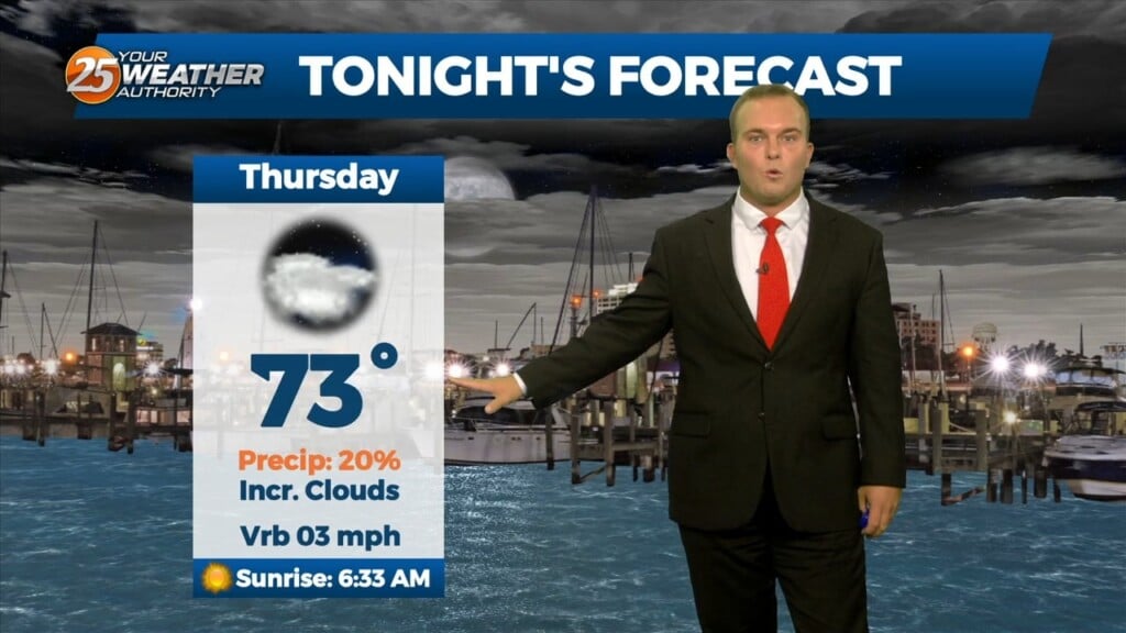
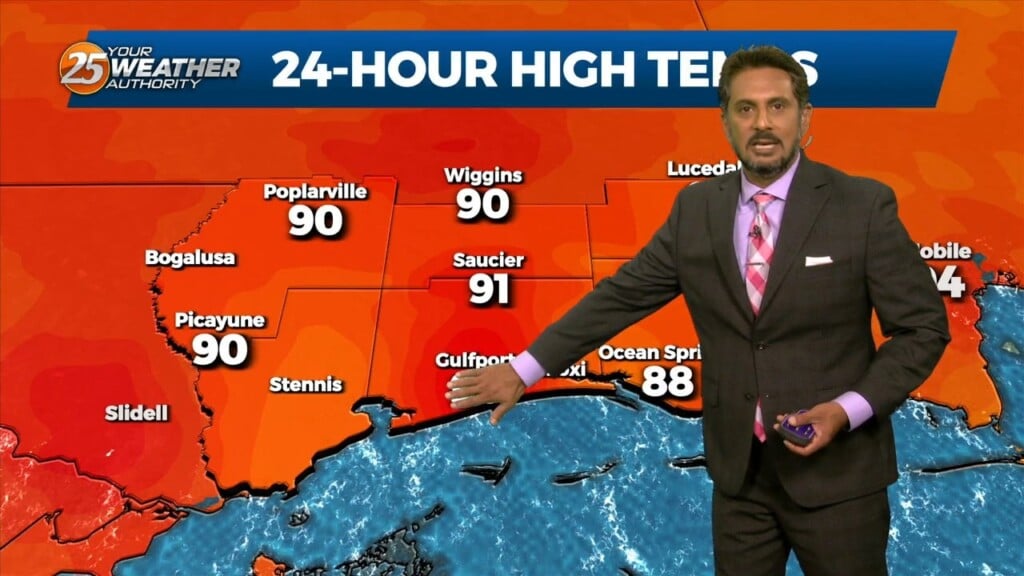
Temperatures will drop to tolerable levels out the door tomorrow. Some clouds will be around at times and humidity will be on the upswing. The start of your…
Some clouds will be around this evening as temperatures will cool from hot to more tolerable by sundown. Humidity will be tolerable overnight but it will…
The month of September will bring a changing pattern where dominant high-pressure in the SE begins to break down allowing cold fronts to move through the…
As we head toward the equinox, the upper pattern is becoming more active across the northern half of the US. Upper level high pressure was noted…
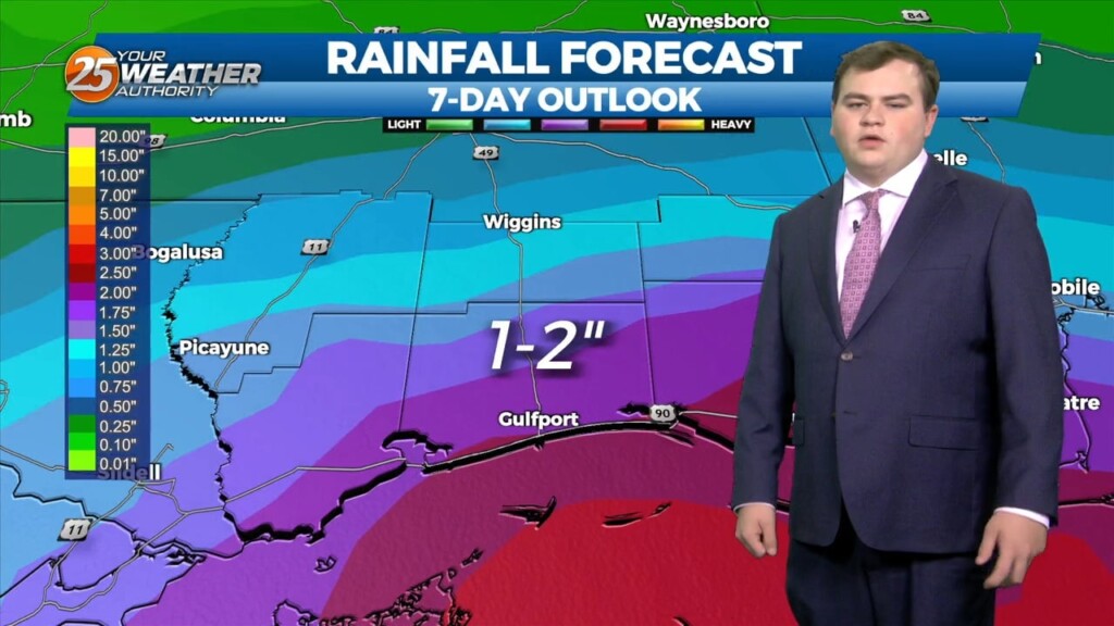
This afternoon brought very beneficial rainfall across Hancock and Pearl River counties. Well over 5 inches of rainfall has fallen is some spots close to the the…
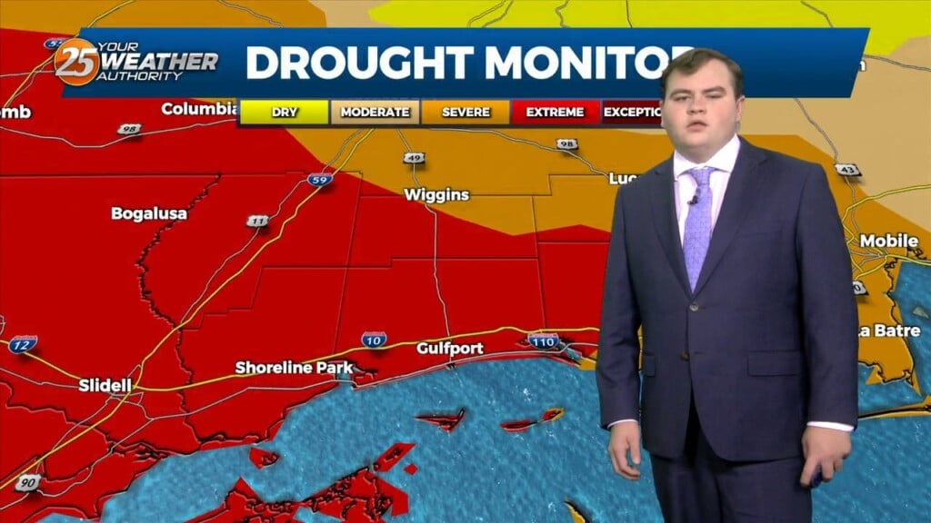
This afternoon we have seen very beneficial rain fall across Hancock and Pearl River counties. Well over 5 inches of rainfall has fallen is some…
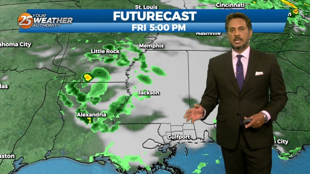
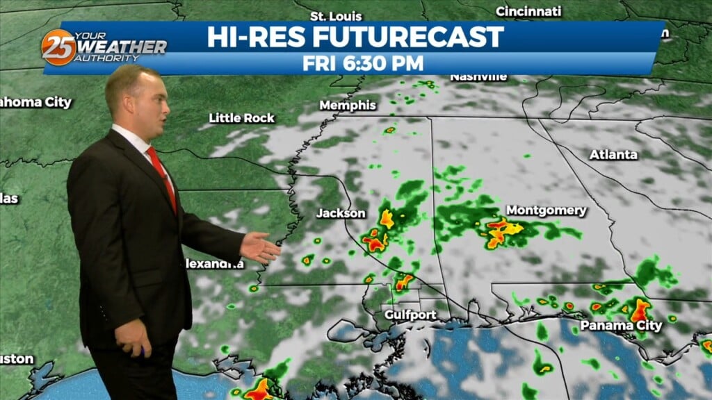
Today most things point to a favorable day for scattered to numerous storms but again obviously current events are highly impacting the thought process. This…
Confidence in the forecast/conditions continues to take hits as convection is just not developing like initially anticipated. Even with the arrival of rich low-level moisture and…
Isolated to scattered thunderstorm activity will be around at some points overnight. There will also be the possibility for thunderstorms tomorrow morning until about 12 Noon.…
Isolated showers and thunderstorms will be around at times this weekend. Generally speaking, activity will come in waves/rounds for the next several days. Cloud cover and a…
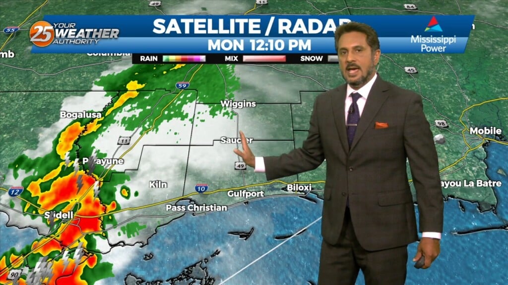
An area of low pressure has formed along a stalled frontal boundary west of the area. We can expect much needed showers and thunderstorms, as activity will…
An area of low pressure has formed along a stalled frontal boundary west of the area. We can expect much needed showers and thunderstorms this morning,…
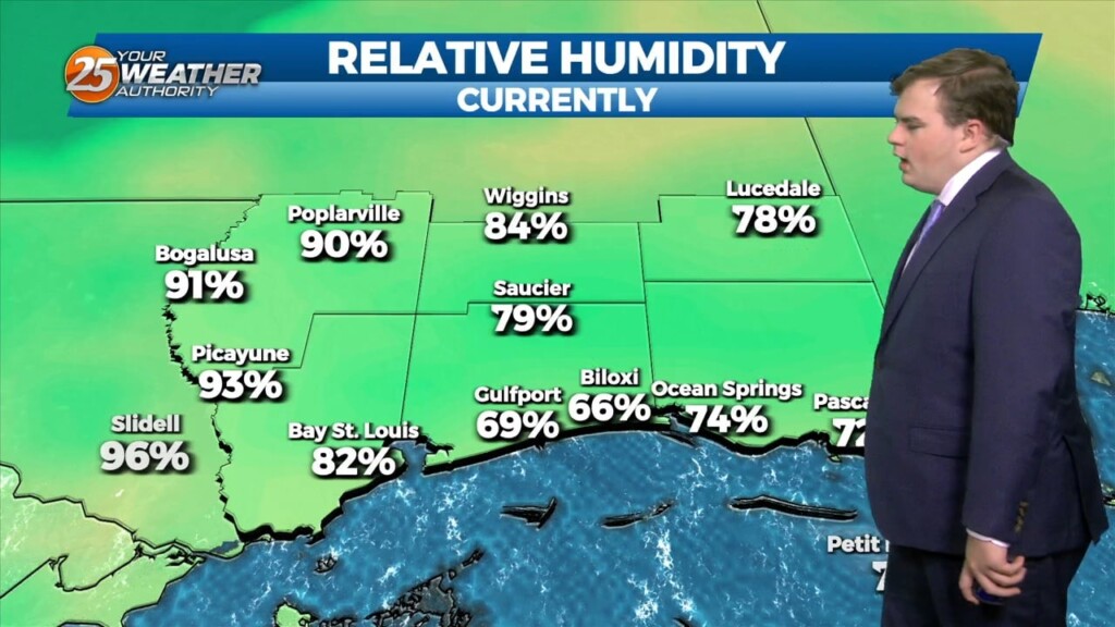
Cloud cover, humidity, and rain chances will increase overnight. Isolated rain chances, more favored along and south of the interstate, are in play after midnight up until daybreak.…
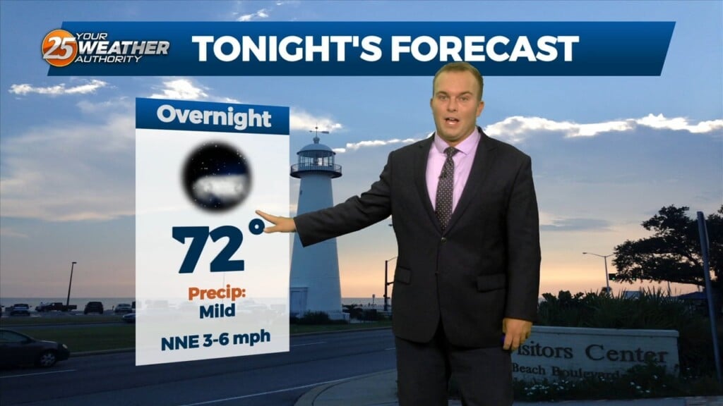
It will be warm this evening with humidity gradually on the upswing. Cloud cover will increase overnight but most of us will still find mild temperatures.…
This afternoon there is a stationary cold front to the south of our area. A drier air mass is still in the area causing dew-points to be…
This morning there is a stationary cold front to the south of our area. A drier airmass is still in the area causing dew-points to…
Skies will clear out overnight and temperatures will cool off to pleasant readings out the door tomorrow. Humidity won’t be a major factor so the heat will…
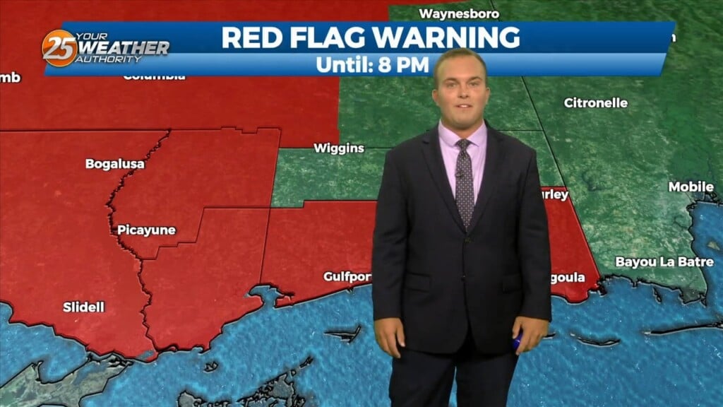
Dry conditions, low humidity, and breezy winds have provided for a Red Flag Warning being in effect until 8 PM. Do not burn, and continue that…
This afternoon a stalled cold front overhead or just to the north of the area will continue to usher in a drier air mass…a welcome change from…
This morning a stalled cold front overhead or just to the north of the area will usher in a drier air mass…a welcome change from what…
Rain chances will fade and skies will clear out overnight. Your Wednesday will start off on a mild note with humidity lowering. Skies will only feature a…
Showers and thunderstorms are in our area. Expect for them to continue to be scattered in nature this evening. Overnight, activity will gradually come to…
A weak cold front to the north will aid in showers and thunderstorms. Temperatures will stay lower this afternoon due to rain cooled air and the…