12/4 - The Chief's "Recap Of Heavy Rain" Monday Morning Forecast
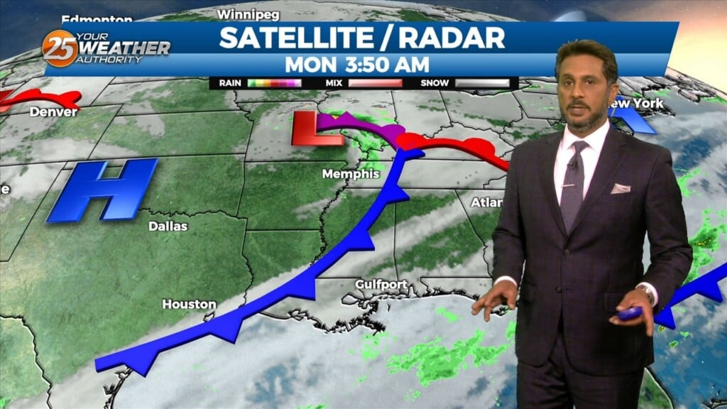
A broad upper level disturbance over the eastern third of the CONUS will be the primary feature impacting the forecast area through Wednesday. Pacific based…
A broad upper level disturbance over the eastern third of the CONUS will be the primary feature impacting the forecast area through Wednesday. Pacific based…
Some dry time will be around this afternoon and you may even find a few breaks in the cloud cover. Rain chances begin to come back…
The first of 3 disturbances moving through this morning and should be out of the area by 10am today. This does not mean that the rain…

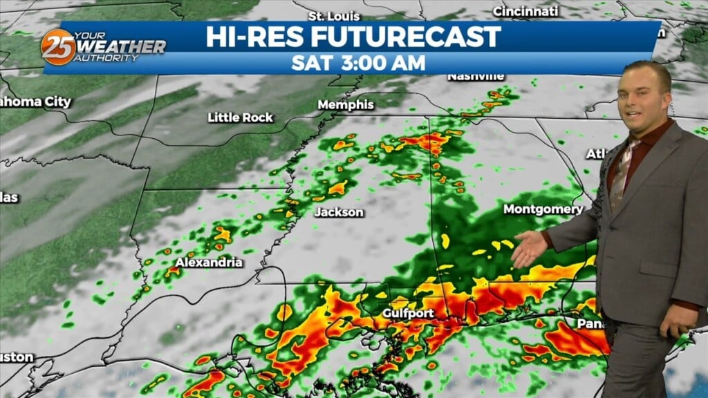
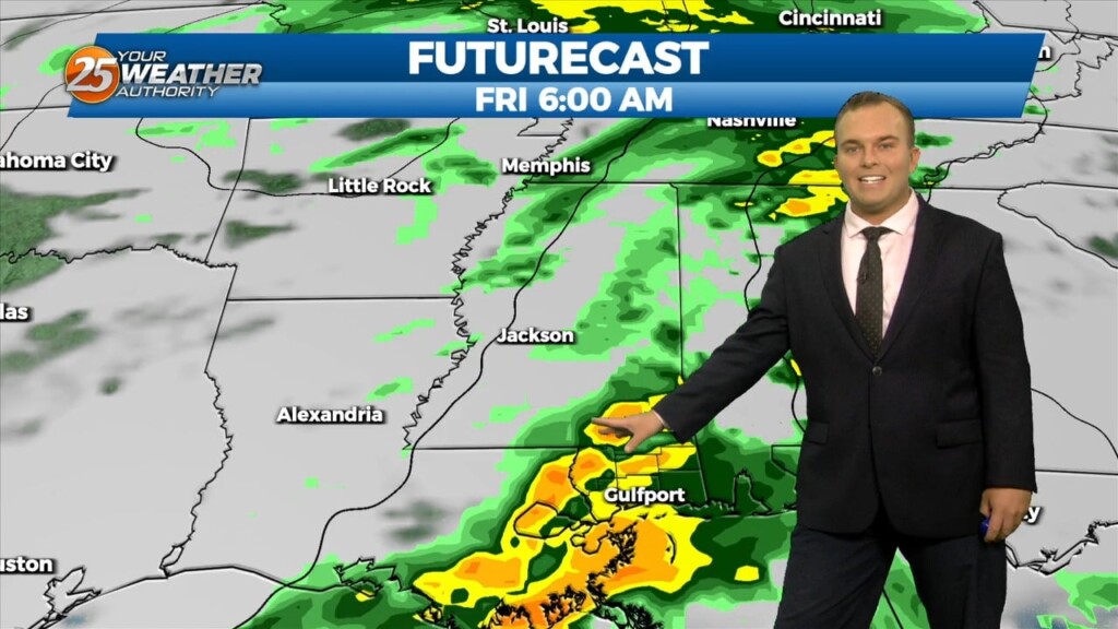
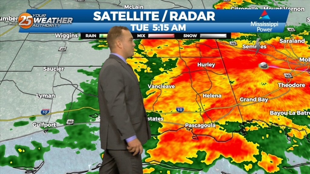
Throughout Thursday, we've been monitoring the changing potential for showers and thunderstorms across Texas, Louisiana, and Mississippi. The day started with three levels of severe risk issued…
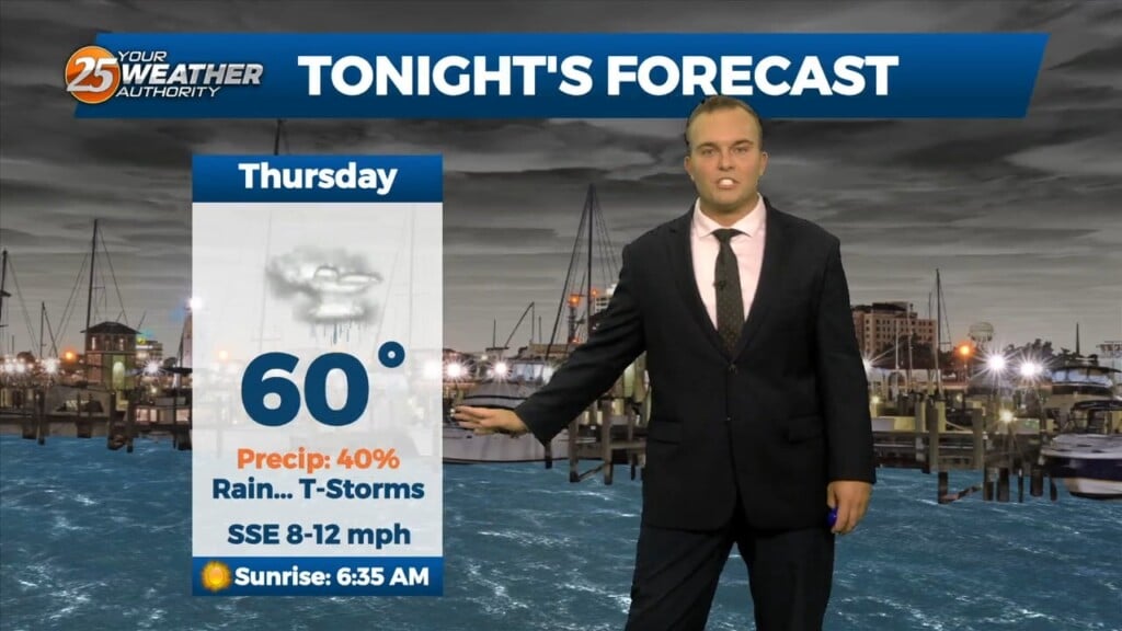
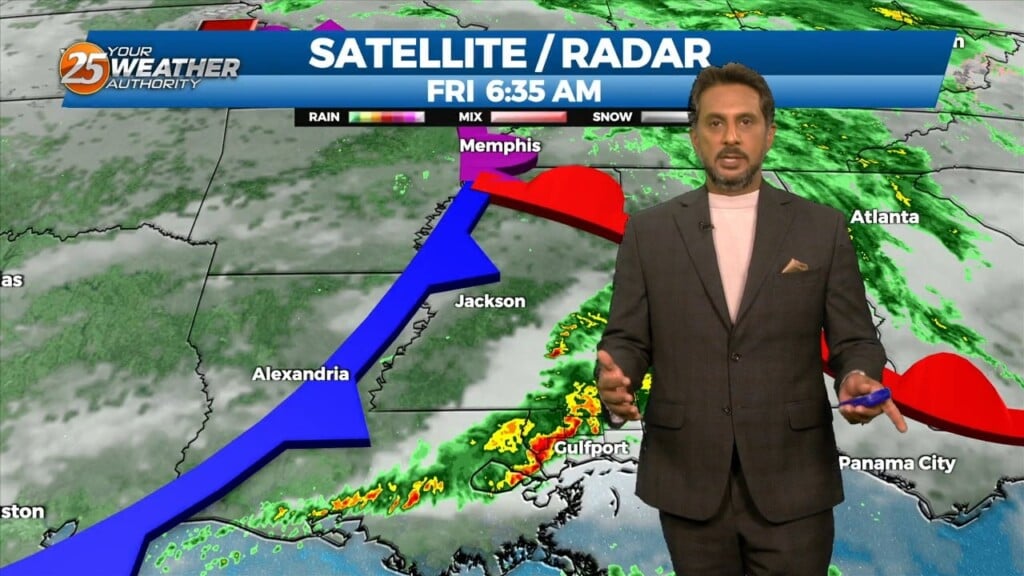
Rain arrives this evening and sticks around for some of tonight. It will be a steady light rain that will not be widespread in coverage. Some dry time…
The transition in our pattern is underway. Gradually, winds will turn southeasterly by this evening as a frontal system makes its way into our region. Moe humidity…
It’s a warmer start this morning but still cold across the region. Surface flow will begin to transition today as the high continues to migrate east and…

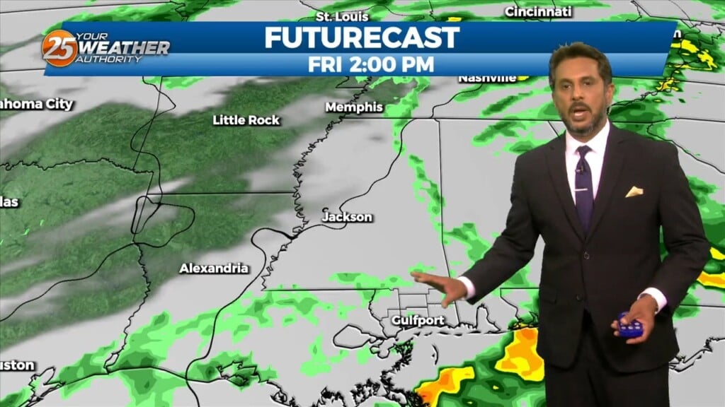
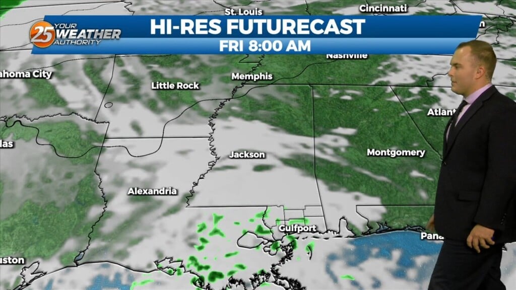
Models are still shifting and disagreeing, about the next 24 hours. Weather models have slightly deviated from a little rain through the midday Friday, with some holding most…
Winds turn southerly this afternoon which will begin the transition in our local weather pattern. Some upper-level clouds move in through this afternoon but otherwise, expect mainly…
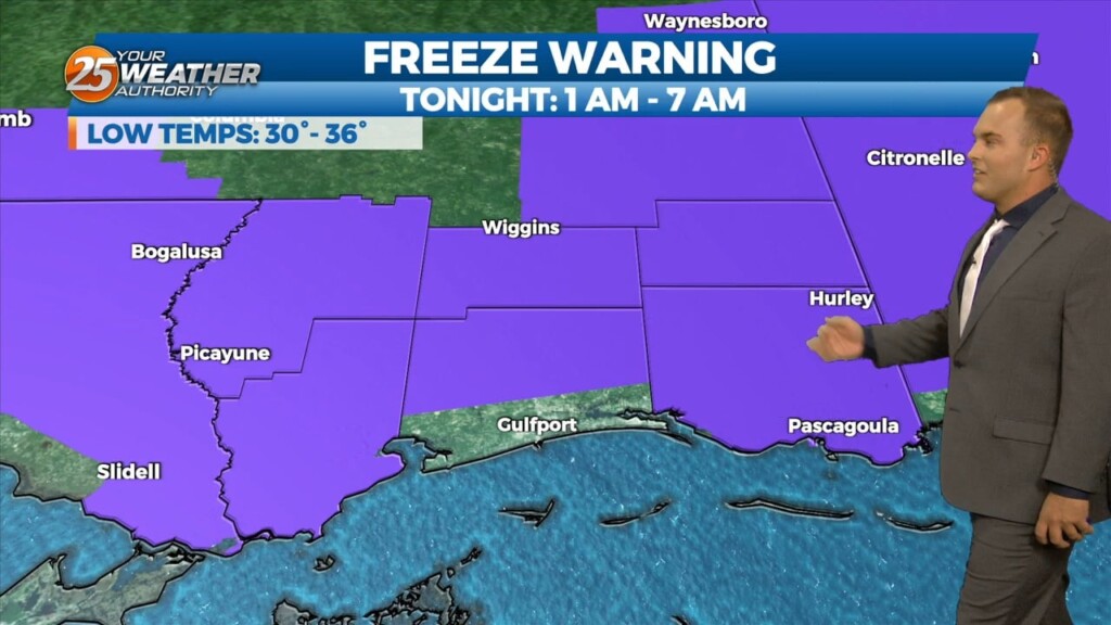
A Freeze Warning remains in effect until 8 AM for our entire area. A frigid start under clear skies will yield to a quick warm-up with lots of…
Temperatures will likely drop like a rock this evening and then a steady slow drop through the night, especially in the drainage areas along the Pearl and Pascagoula…
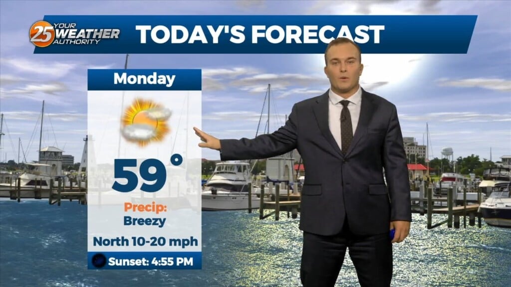
Another cool and breezy afternoon will be in store for us. Temperatures will be similar to yesterday but winds will be slightly more tolerable. Lots of sunshine…
It is another cold start to the day with winds still remaining in play. Temperatures in the upper-30s to lower-40s will have a wind chill factor to…
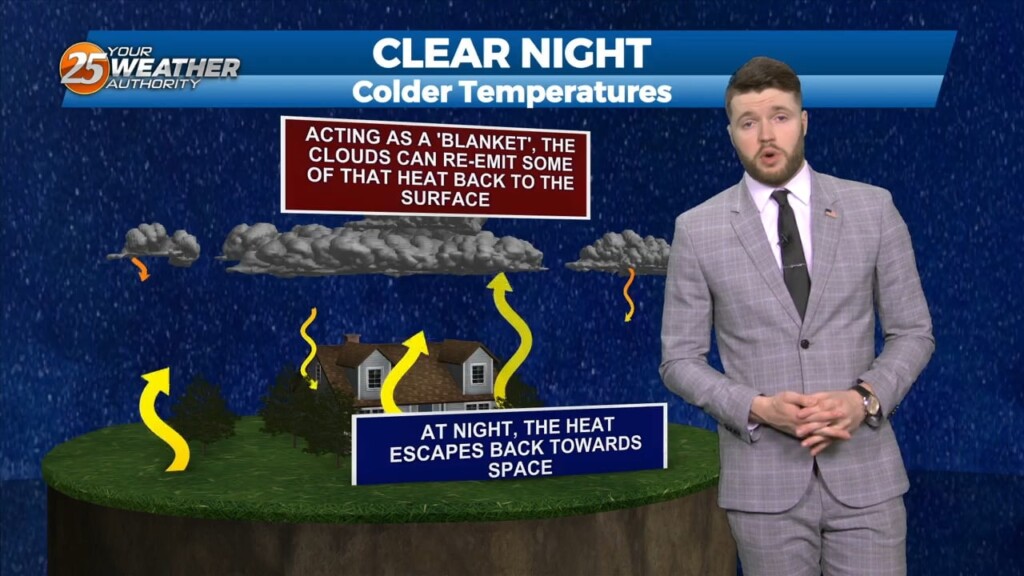
High pressure continues to build into the area tonight and winds will relax. With low dewpoints and light to calm winds, the big question with overnight lows will…
Some thin, upper-level clouds move in this afternoon. Outside of that, sunshine does dominate and expect cool conditions. It will be breezy if not windy at times.…
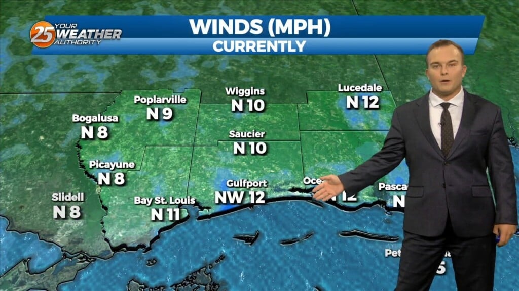
It is a much colder start this morning with temperatures in the 40s and breezy northerly winds behind a cold front. Expect sunshine to dominate early but…
Some opportunities for sunshine return this afternoon and rain chances are out of the equation. Expect cool conditions and a light breeze out of the northeast. Clouds clear…
Cloud cover remains dominant for a lot of Black Friday with a cool and somewhat unsettled pattern around. There will be a 20% chance of…
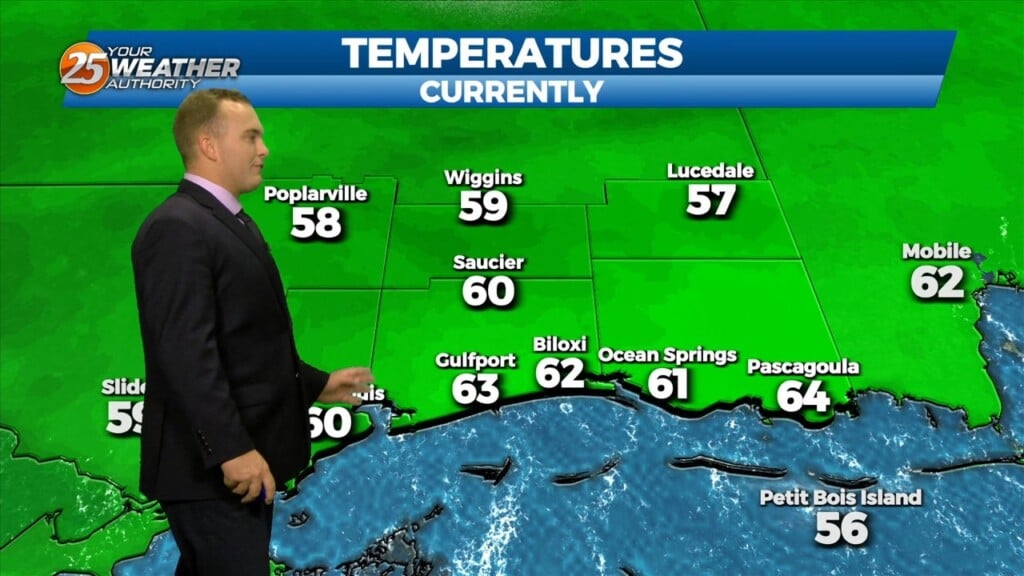
n Wednesday Night: Dewpoints are one of reasons the Mississippi Gulf Coast will be chilly tonight. Overnight lows will be a good bit cooler than Tuesday night. Dewpoints dropped…

High temps will struggle each day through Friday to reach the 60s as colder/drier air continues to move in from the north. The area…
The cold front moved out over the gulf yesterday and cool air has been slowly filtering in behind it. This will continue today keeping high…
The cold front has finally made it though the area with breezy northwest winds in its wake. At the surface, a large area of high pressure is…
Widespread rain chances have pushed to the east this morning as we await the arrival of the associated cold front. Some rainfall will continue shortly after daybreak. Winds…
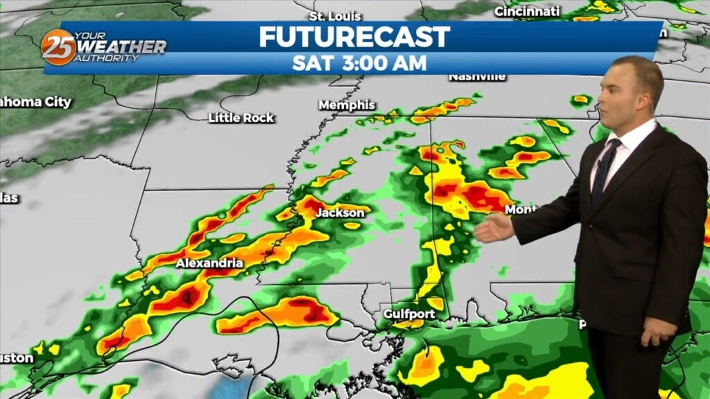
Monday's overnight main area of severe concern appears to be southwest Mississippi and adjacent Louisiana parishes which fits the Enhanced area. Southwest flow aloft will slowly but steadily…