4/2 - Trey Tonnessen's "Quick Moving System" Tuesday Night Forecast
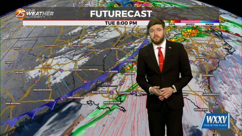
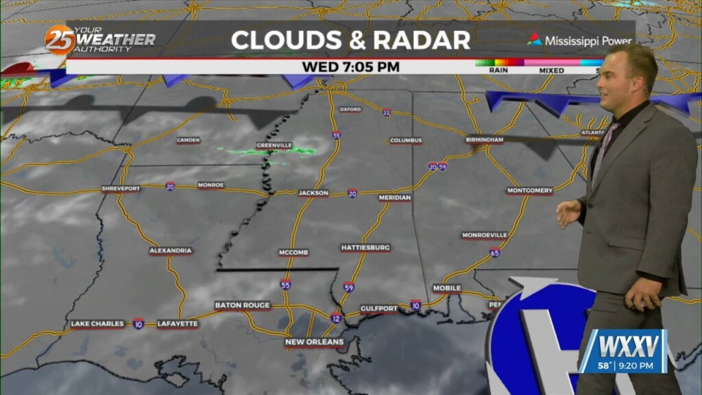
Convection allowing models continue to show slightly more than isolated storms tonight, and most of those prior to 10 PM. If we do get deep…
Convection allowing models continue to show slightly more than isolated storms tonight, and most of those prior to 10 PM. If we do get deep…
An upper trough late this afternoon extended from the western Great Lakes to west Texas, with upper ridging along both the Atlantic and Pacific coasts. At…
High pressure is moving eastward as a trough of low-pressure is progressing into the area, extending from the Great Lakes down through Texas. At…
The southern end of the upper trough will progress eastward overnight and Tuesday, to be near a Chicago-El Paso line at midday Tuesday. It`s going to…
Meteorologists have been watching upper ridging over the southeast quarter of the country this afternoon, with a trough extending from the Dakotas to the Four Corners…
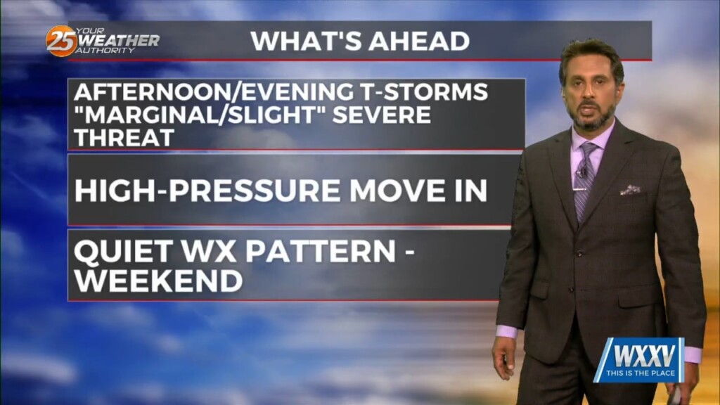
This afternoon will continue to bring breezy conditions from the south...increasing the moisture. Tuesday is still the main forecast issue but honestly it…
No real issues to discuss today. High pressure over the Gulf will continue to dominate the region while low level temps keep slowly stepping up.…
A high pressure center to the south and east is placing our region in a more active southwesterly flow on the northwestern side of a ridge.…
During this time period every year, it is typically difficult to secure clear skies and comfortably widespread for a 24 hour period. Not only will…
High pressure will continue to slide southeastward and be centered over North Florida Friday evening. Little in the way of cloud cover is expected today…
Yesterday morning`s shortwave trough is moving northeastward through the Great Lakes this morning, while the longwave trough axis remains to our west, over west Texas.…
We’ll likely see a period of sunny skies this afternoon and mostly clear skies overnight. However, the upper level support to this feature to the NW won’t…
There are some small indications that the mid level heights could rise a little, but will likely remain steady all night and not actually drop until…
There is a deep surface low moving through the central Plains today combining with a large area of high pressure dominating all of the eastern Seaboard…

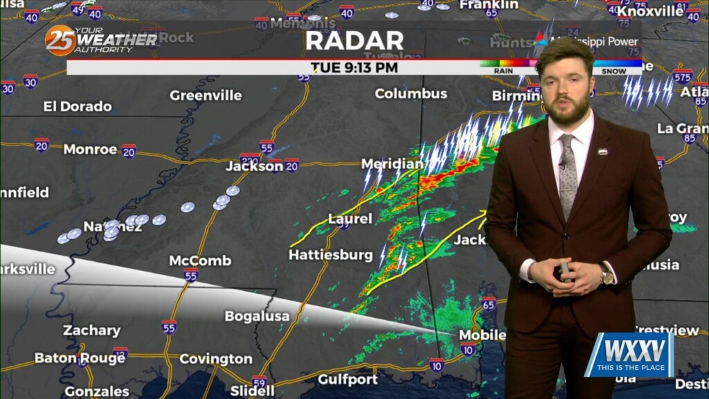
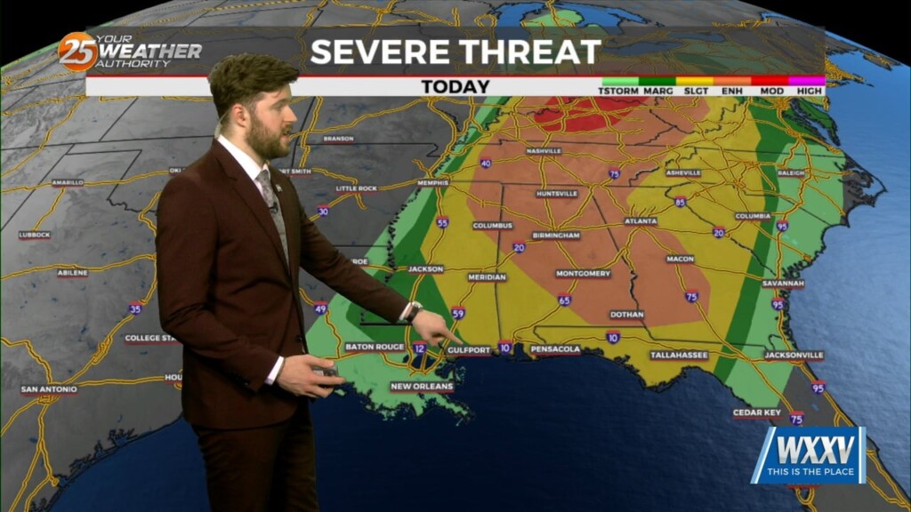
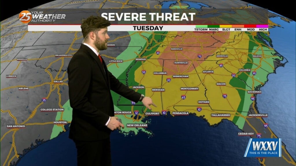
SEVERE THREAT this afternoon/tonight, with multiple potential hazards in the first 24 hours of the forecast before the weather quiets down for a while. A…
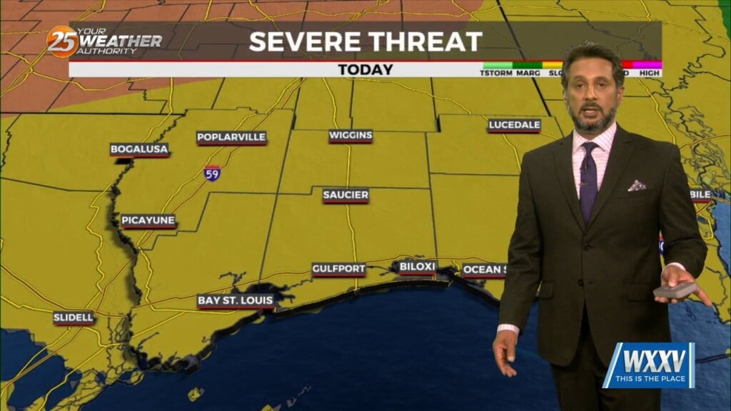
Anticipate multiple potential hazards in the first 24 hours of the forecast before the weather quiets down for a while. Low pressure over western Kansas this…

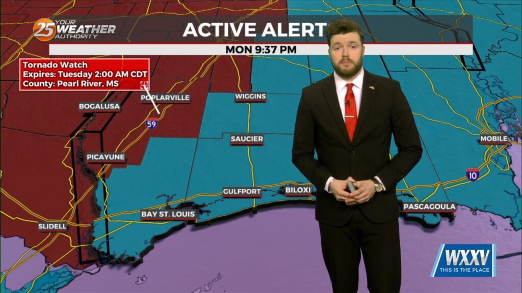
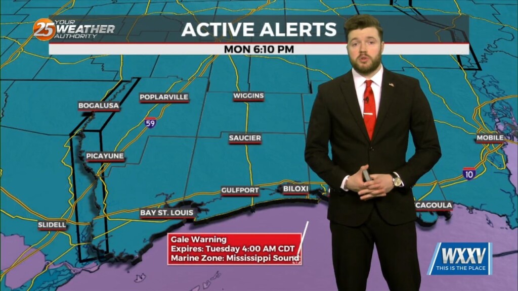
There is a severe weather risk for Louisiana and Mississippi, including the Mississippi Gulf Coast, Monday afternoon into Monday night. Conditions are…
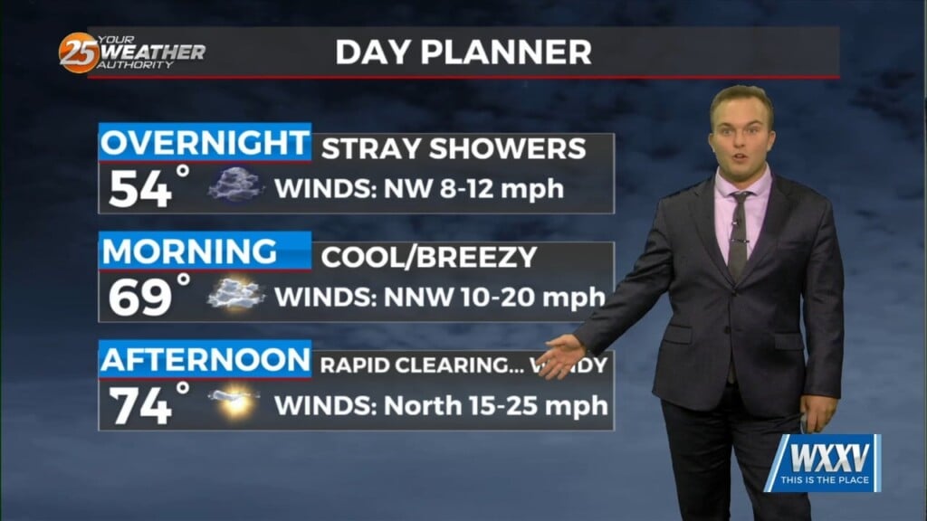
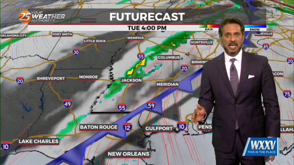
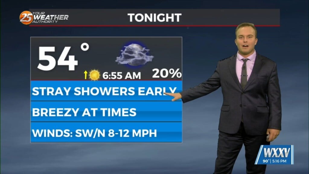
A 20-30% chance of showers cannot be ruled out tonight but any rainfall will be quick in nature. A cold front works through…
Low pressure in the region will help provide for rain chances this evening and overnight with quick-hitting showers. Saturday brings rapid clearing and gusty winds but a…

A system to the west with a warm front to the SW will continue to move E/NE and into the area this morning, crossing the local area…
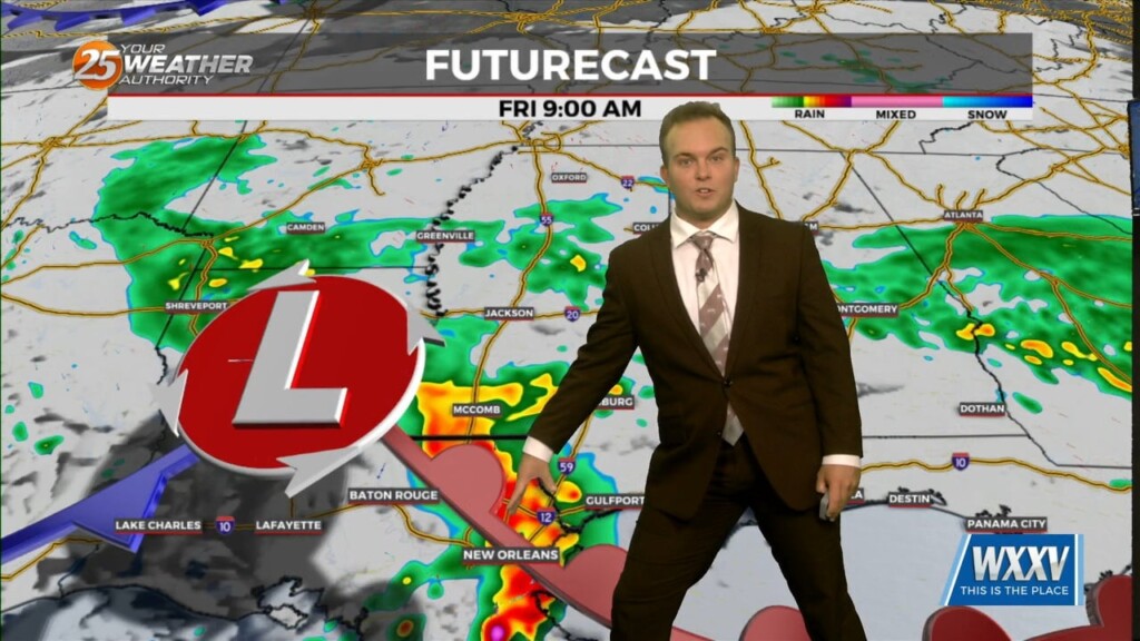
Rain-free conditions before daybreak Friday will eventually fade into the rear-view as a complex of thunderstorms works along the Northern Gulf Coast tomorrow. Heavy rain will be likely…
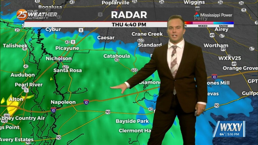
Gloomy conditions early on this evening will give way to light rain moving into the area. Do not expect thunderstorms tonight but expect nuisance rain at times.…
At the surface, high pressure is currently over the northeast Gulf of Mexico with low pressure over the Texas Panhandle. Clouds will continue to…
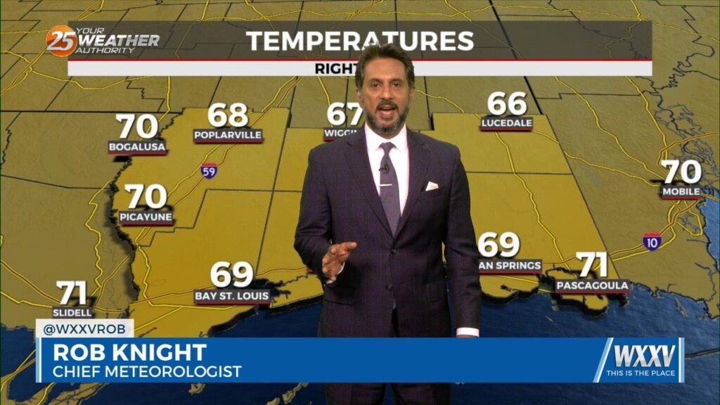
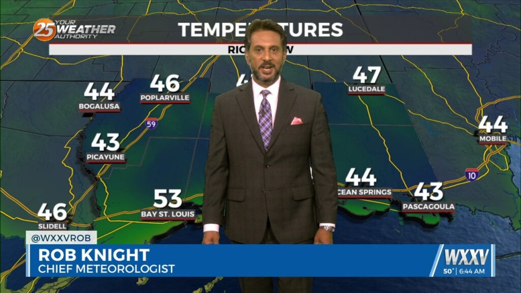
Expect temperatures to be less cold overnight thanks to more clouds working in and more humidity working in. Clouds will increase ahead of daybreak and temperatures…