
4/11 - Trey Tonnessen's "Slow Period" Thursday Evening Forecast
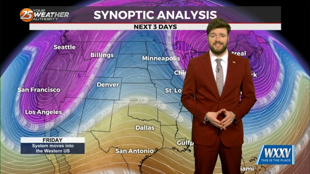
Return flow begins again Saturday and the next frontal system that is on the horizon moves to a Texarkana to Laredo, Texas line, before slowing down.…
Return flow begins again Saturday and the next frontal system that is on the horizon moves to a Texarkana to Laredo, Texas line, before slowing down.…
Now that the most violent weather has moved east, we will now work with the back side of the surface low-pressure that still wants to hang…
Heading into the weekend things will remain quiet with temperatures beginning to moderate however, moisture will struggle to return through the weekend. Northwest flow will…
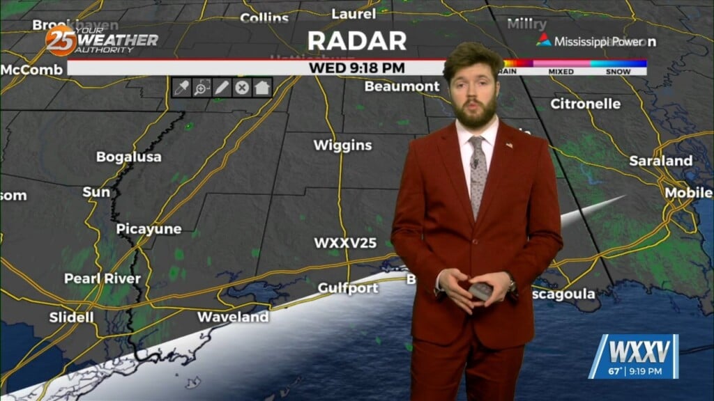
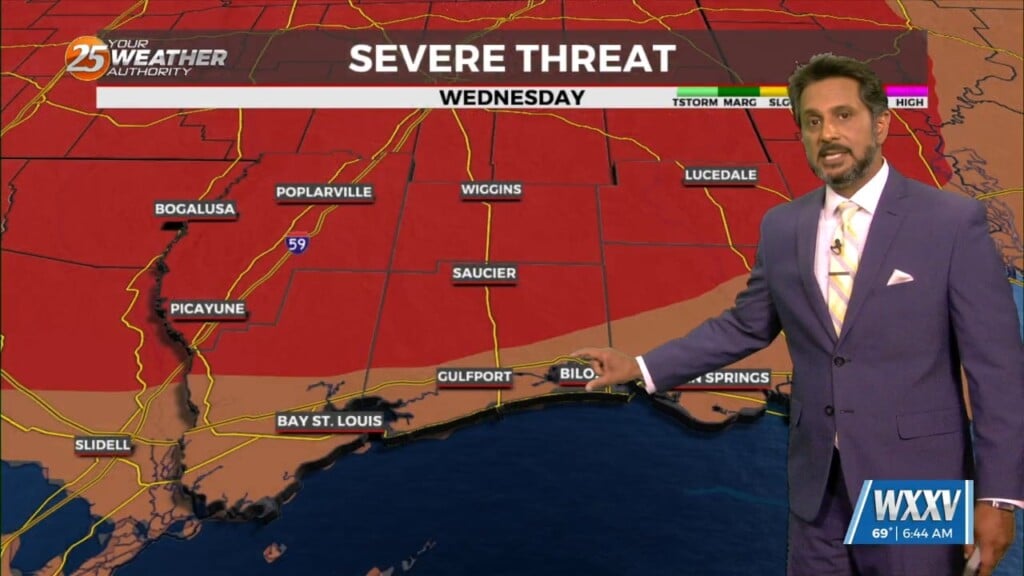
After a very active day things are beginning to calm down, with storms mainly impacting portions of coastal Mississippi and coastal Southeastern Louisiana. The severe threat…
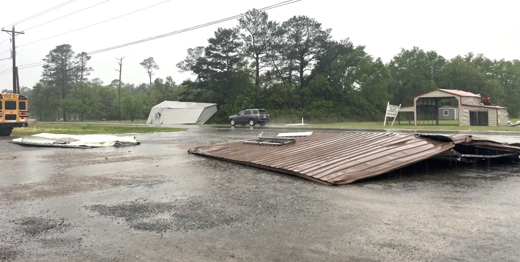
WXXV is gathering flooding and damage reports from around South Mississippi. We'll report them as we get them. If you have damage to report, please send the information to news@wxxv25.com. Gautier reported areas of Old Spanish Trail flooded on Tuesday…
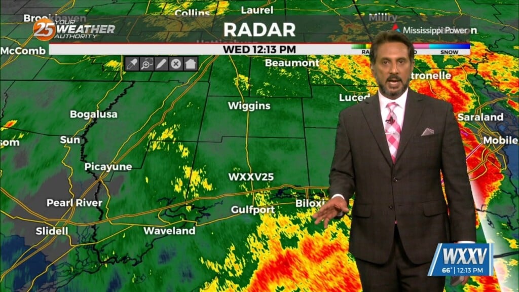
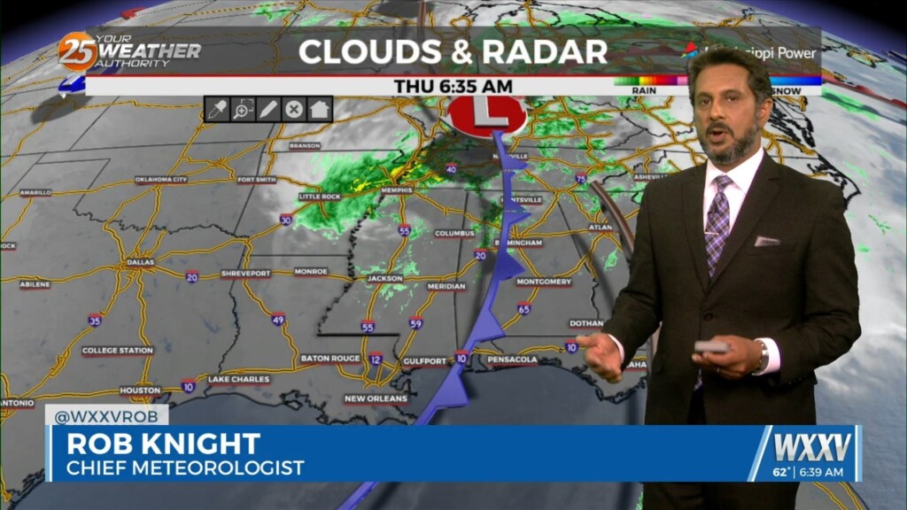
A vigorous storm system continues to move east though the region. Activity from this morning will begin to taper-off…with another batch of energy moving tough the…
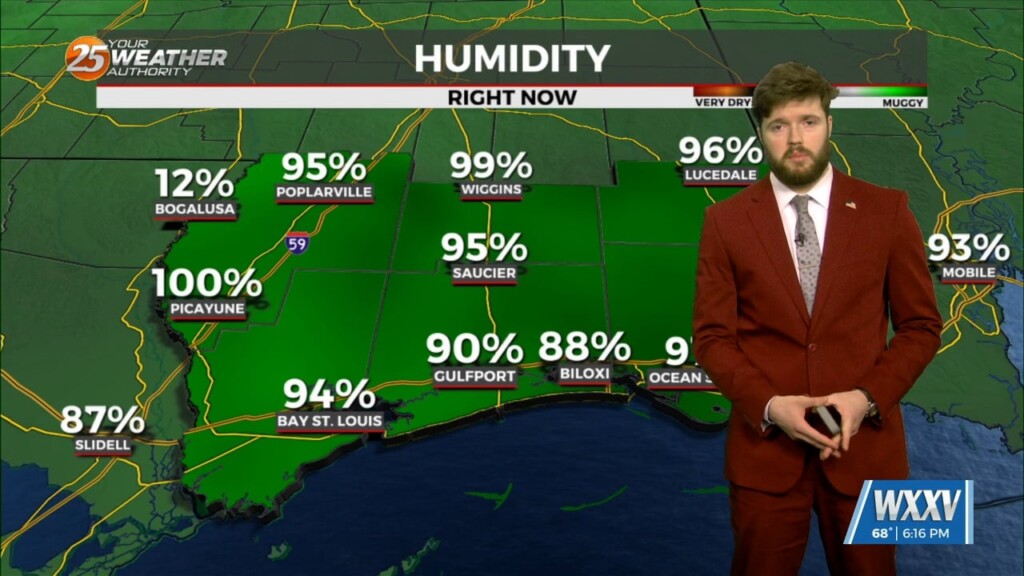
A stable layer in the low-levels of the atmosphere is eroding, Which thus far has protected us so far, but this is currently leaving and…
Wednesday's first main area of concern, showing very strong divergence in the upper levels; will move through first while another area gets started over the west…
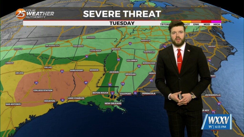
We should see an area of storms begin developing near Laredo, Texas around midnight tonight. These storms will be the main focus for severe weather over…
Again today, we should see showers and a few t-storms around. But as we move forward in time, a few of these storms could become…
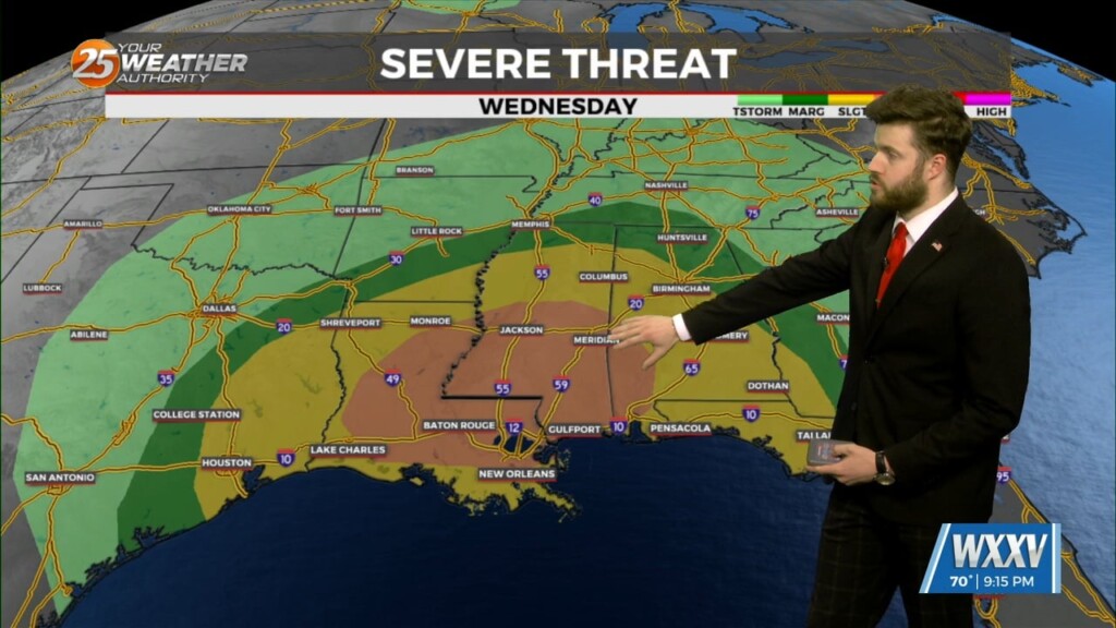
As the surface low deepens late tomorrow night and Wednesday morning, winds in the upper layers will increase from near 35 knots to at or above…
Upper ridging from Florida to the eastern Great Lakes this afternoon. Upper lows over Minnesota and western Arizona. At the surface, high pressure along the Carolina…

Early Wednesday we will see a cold front moving toward the area with very moisture content for this time of year. If this were stalled over the…
Cloud coverage and breezy conditions will increase this morning as an approaching cold front to the west stalls. Early Wednesday we will see a cold front…
Monday will be somewhat of a transition day as an upper trough continues to dig into the southwestern United States, forcing the upper ridge over…
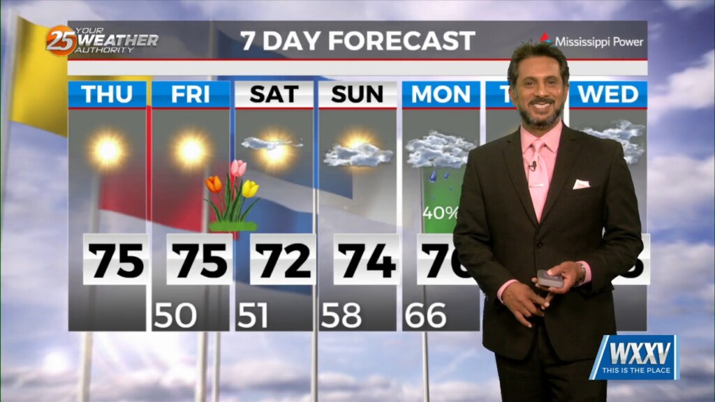
Ridging and zonal flow will build over the area for the next few days. Saturday will mainly be a transition day for the atmosphere as…
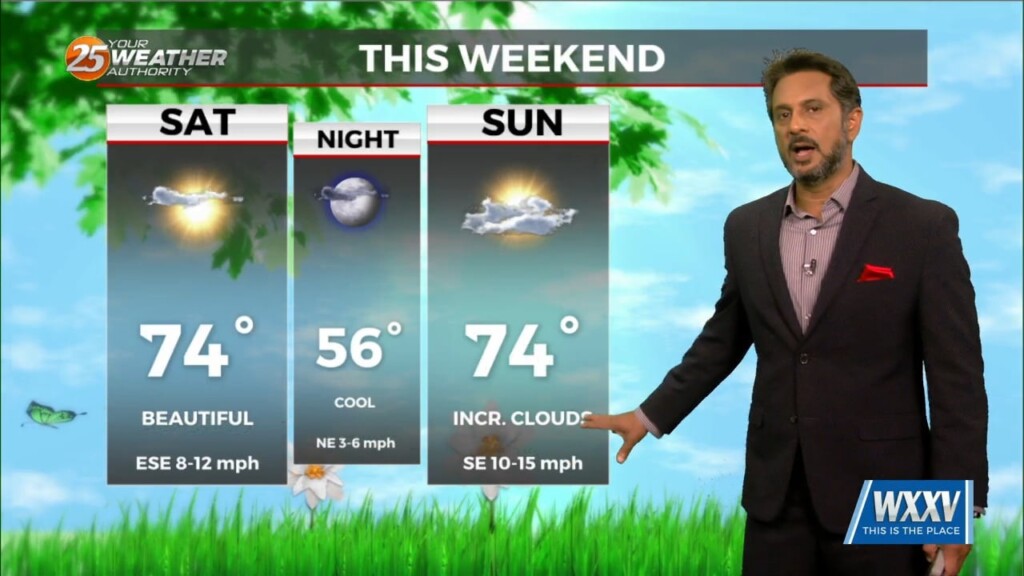
Overall, entire weather pattern is benign with the high pressure bringing moderate temperatures and no precipitation. Northwest flow aloft will give us one more night of cool…
Saturday through Monday, zonal flow and weak ridging will dominate the upper level pattern. Southerly surface winds will help to reintroduce moisture and warmer air back…
Ridging and high pressure will be building over the area tonight through Saturday morning, suppressing rainfall chances for the next couple of days. Northerly surface winds…
The strong solar insolation expected this afternoon will allow highs to climb to near average this afternoon, but low tonight will quickly plunge into the 40s north…
A highly amplified pattern in the mid and upper levels will remain in place through Saturday night across the CONUS. Today into tonight, the forecast area…
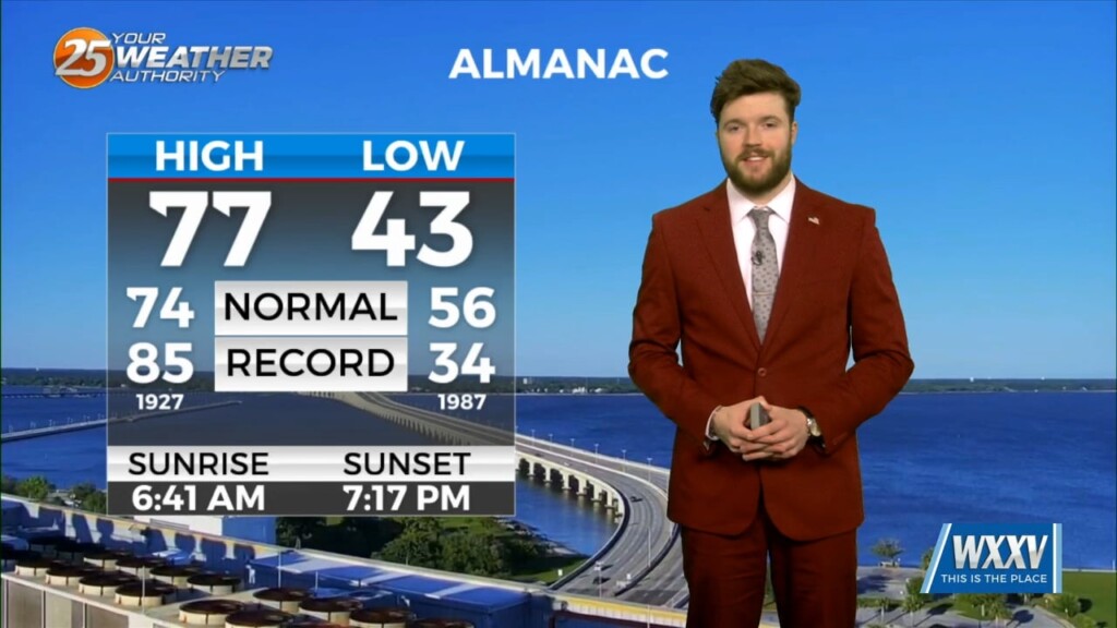
Thursday is looking gorgeous yet again as we climb into the mid to upper 70`s for highs underneath ample sunshine. We will see a reinforcing surge…
As was the case all day Wednesday, we are starting out this evening on the quiet side following a nice and pleasant day! We will…
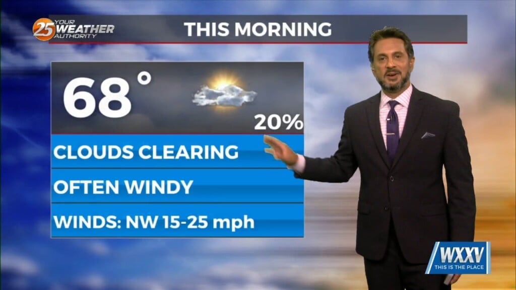
All precipitation has cleared the coast at this point as cloud coverage will continue through mid/late morning. High pressure to the NW will move in…