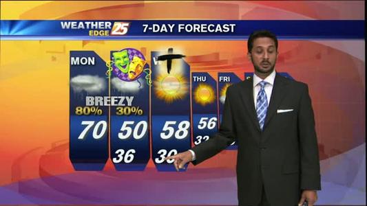
Weekend Forecast
Weekend will be warm and humid with scattered showers
Weekend will be warm and humid with scattered showers
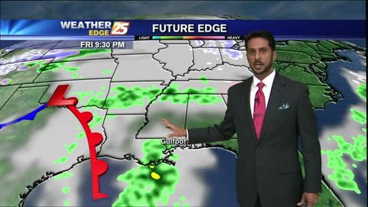
Fog and rain chances for a warm Friday.
After a FRIGID start...a cold day is on-tap with warming temps beginning overnight...
Warmer weather for Friday!
Cold start to the new year!
A FRIGID start with COLDER TEMPS tonight...
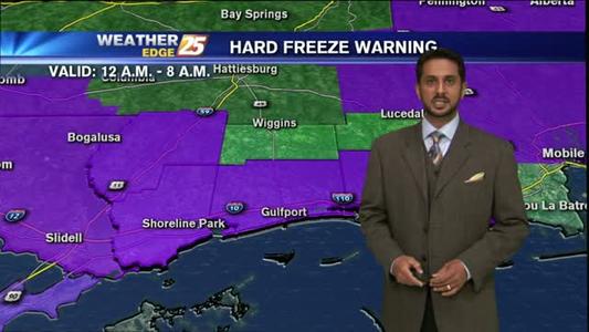
Hard freeze warning Thursday morning.
Cool start for Wednesday before we warm up into the 60s.
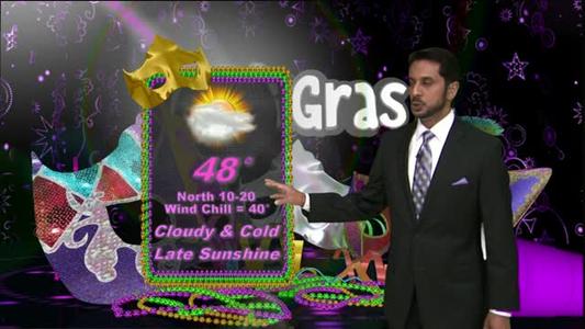
The rain has departed leaving COLD, CLOUDY & WINDY conditions for the Mardi Gras parades.
Cold air remains but sunshine returns
Cold weather moving in from the North
Warm & cloudy with rain moving in...
A cloudy and warm day...with rain moving in.
Cold Mardi Gras expected
A COLD START, with a WARM-UP for the weekend...
Warmer weather for the weekend.
A cool & windy day ahead...
Freezing temperatures moving in
Freezing threat for Mississippi
After a cold start...a sunny and mild day is on-tap.
Mild conditions continue for Thursday
Warm weather continues
A sunny & breezy day ahead...
Cold and clear conditions continue