3/18 - Rob's Hump Day Forecast
A mild start with increasing clouds and rain for this afternoon...
A mild start with increasing clouds and rain for this afternoon...
Mostly cloudy tonight with lows in the lower to middle 60s. Scattered showers and storms return tomorrow.
A beautiful start with a warm day on-tap...
Monday forecast, clear sunny skies, clouds moving in and a chance of thunderstorms moving in Wednesday.
Dry conditions for the final week of Winter...
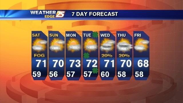
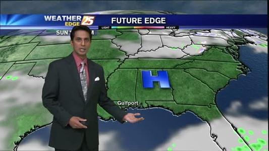
Areas of fog possible late tonight into Saturday.

Heavy rain continues, with major changes for the weekend...
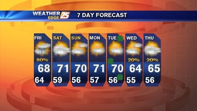
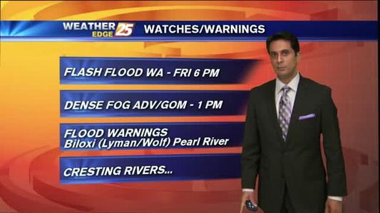
A flash flood watch remains in effect until 6 p.m. Friday. More rain is expect tonight and tomorrow.
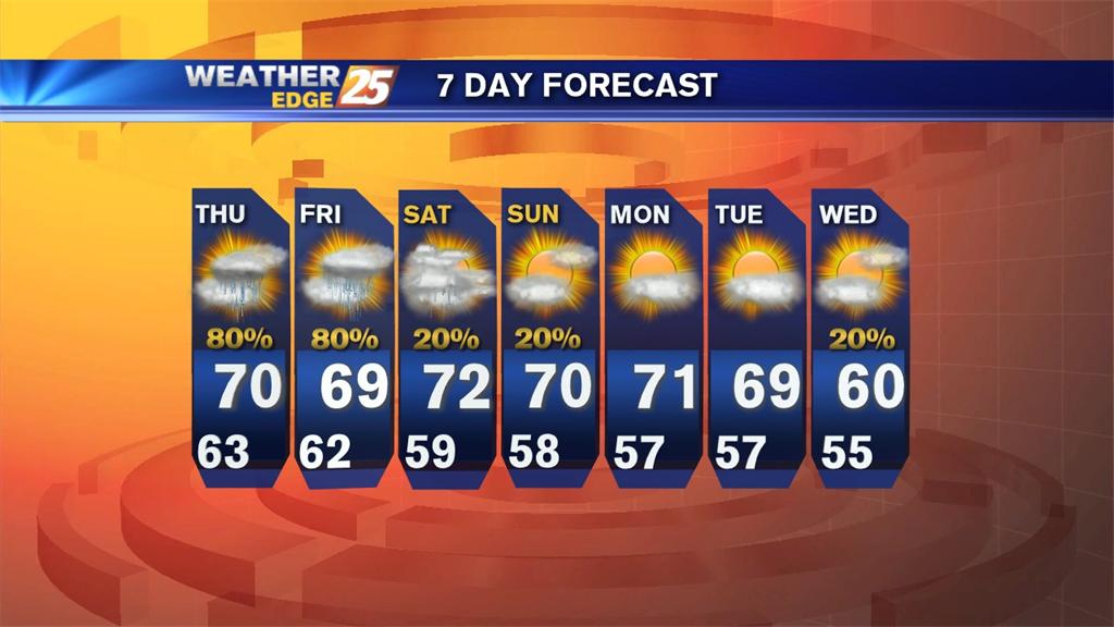
Scattered rain will be possible overnight, along with areas of fog into Thursday morning. Expect overnight lows to drop into the lower to middle 60s with east winds at 5 to 10 mph.
After heavy rain once again yesterday evening, round 3 will begin later today...
A cold front will be bringing in cooler seasonal temperatures along with chances of showers
After close to 3" of rainfall yesterday...RAIN will continue through the workweek.
Wet weather continues through the week.
Cool down on the way
After a SUNNY weekend...expect a cloudy and wet workweek.
Rain Continues through the week
Warmer weather this weekend
Cloudy weekend ahead
A FRIGID start, with warming temps...
Freezing temperatures for Thursday night but a slow warm up for the weekend ahead of showers Sunday.
Brutally cold conditions taking over
A cold front moving through the area will bring MAJOR changes...
Clear and cool weather continues.
A VERY WARM day with major changes ahead...