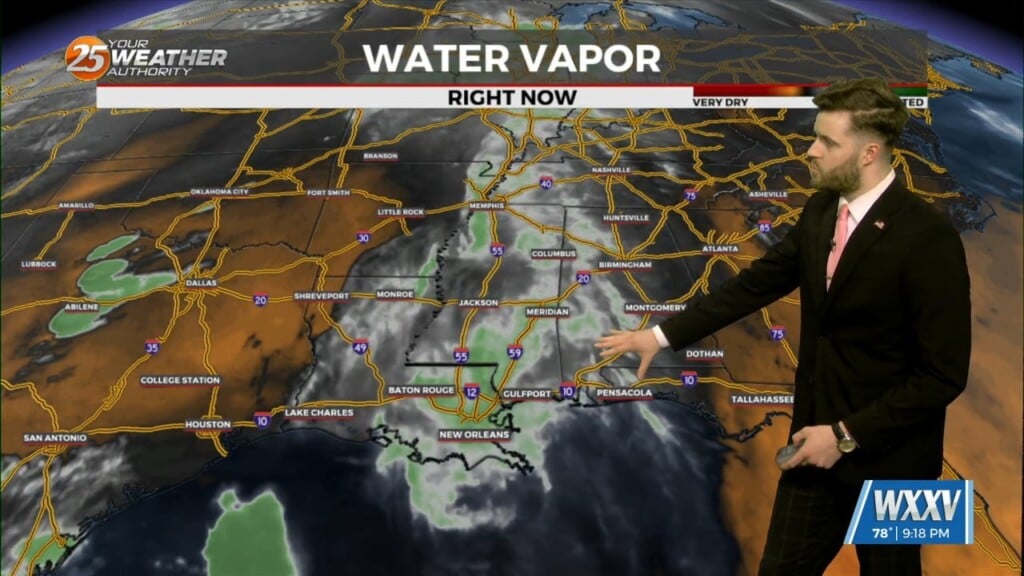
5/2 - Trey Tonnessen's "Moisture Advection" Thursday Night Forecast
Across the Mississippi Gulf coast we have several weather changes in the extended forecast. Multiple weather models are indicating a decent shot of rain for the…
Across the Mississippi Gulf coast we have several weather changes in the extended forecast. Multiple weather models are indicating a decent shot of rain for the…
Wednesday's best mid level forcing has stayed to the west-southwest of the coast. This has allowed some stronger storms to continue to push east, west…
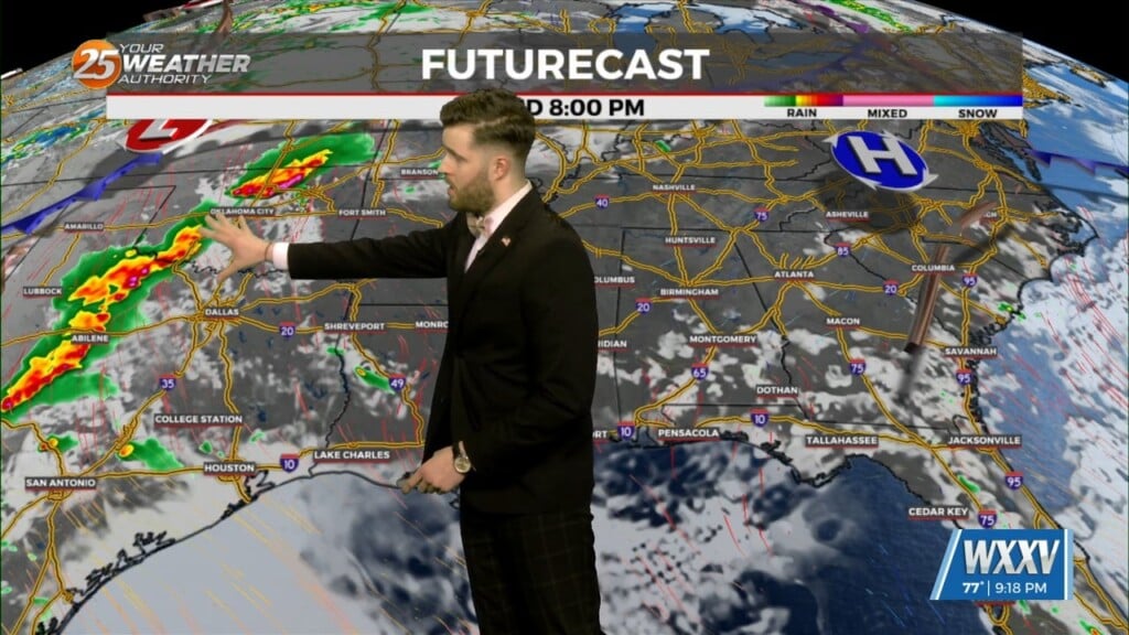
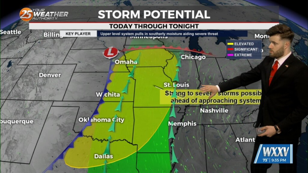
A disturbance along the NE’tern portion of Texas will continue to eject to the NE moving across the extreme NW portion on Mississippi later this afternoon. Friday…
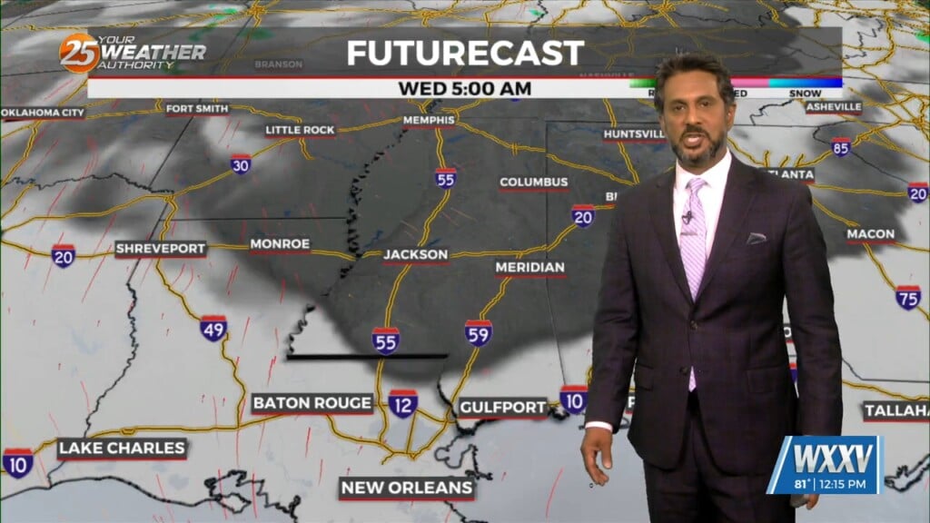
Thursday will see a fast moving shortwave trough axis push towards our region, firstly through Louisiana from Texas. The majority of the forcing with this system…
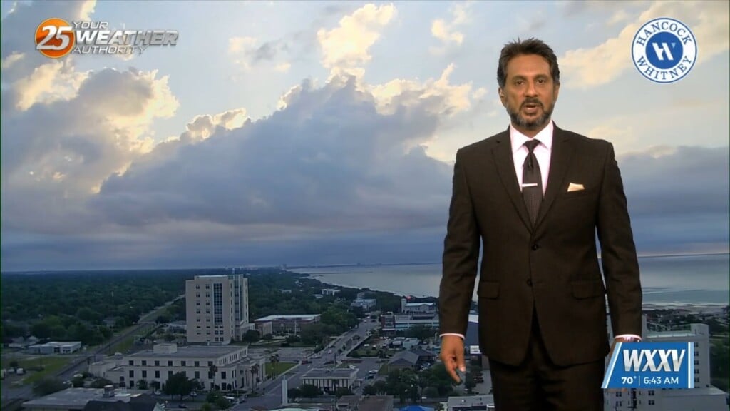
Happy sunny May first! After an April month with many changes in temperature, moisture, and feel; a more familiar climatic feel is on the horizon. A…
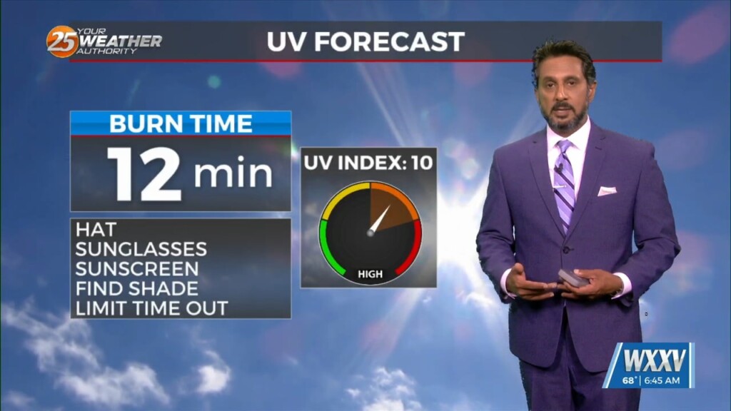
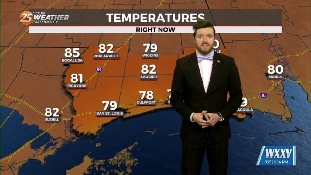
Dense fog should quickly burn off in the following hours after sunrise and temperatures will rapidly warm into the upper 80s to low 90s area…
The Mississippi Gulf Coast is officially locked in to the shifting weather patterns that will eventually start trend towards a more late spring and early summer…
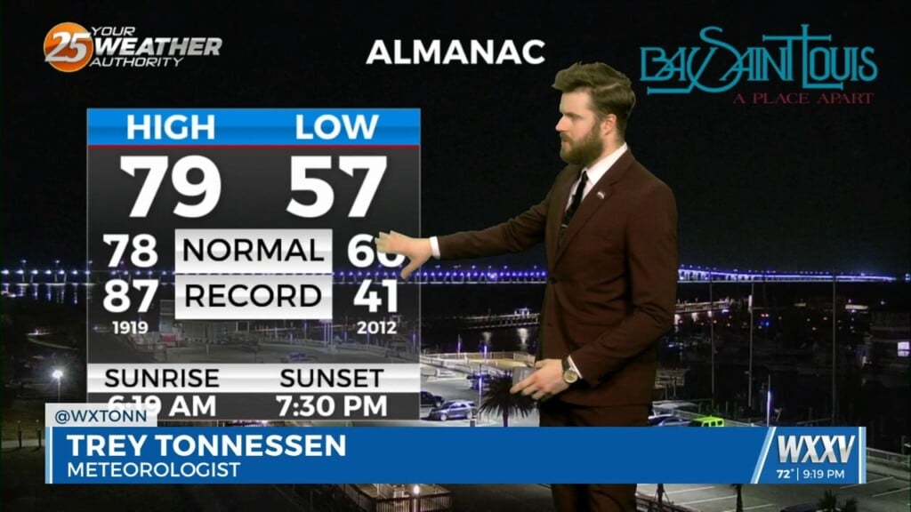
A fairly strong mid to upper level ridge axis will remain in firm control of the area through Wednesday night. Ample subsidence in the mid-level will…
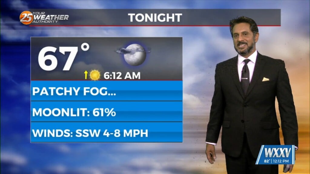
Sunny skies on-tap this afternoon as the cloud cover continues to move to the east. Again tonight, it will be a radiation fog night as well…
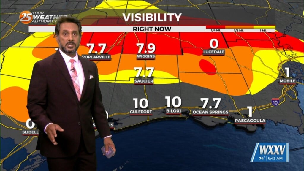
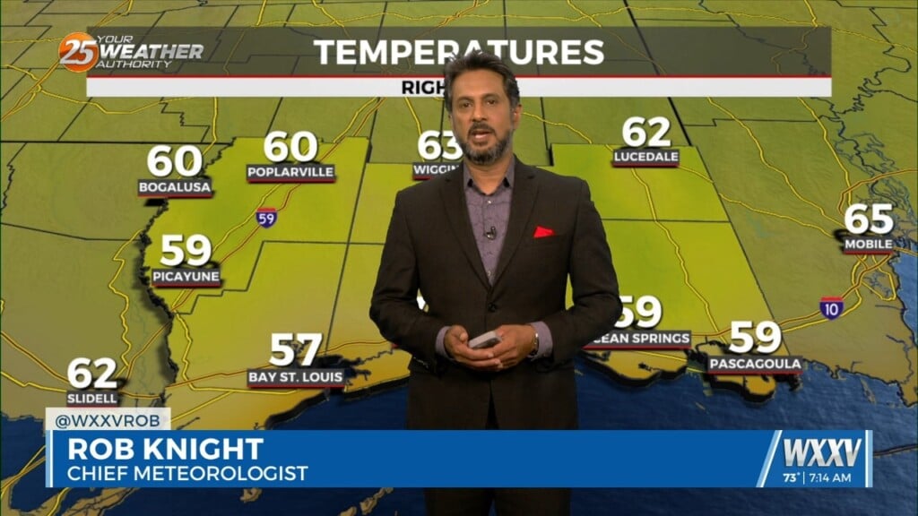
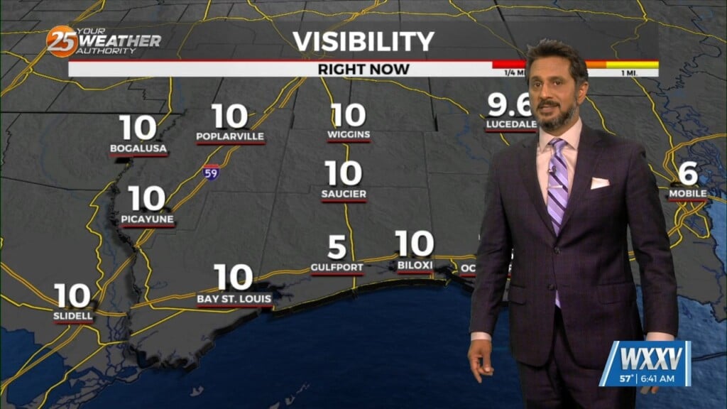
Fog has been an issue this morning and will continue to be a factor through the weekend. The cloudy skies are hanging on over areas where the…
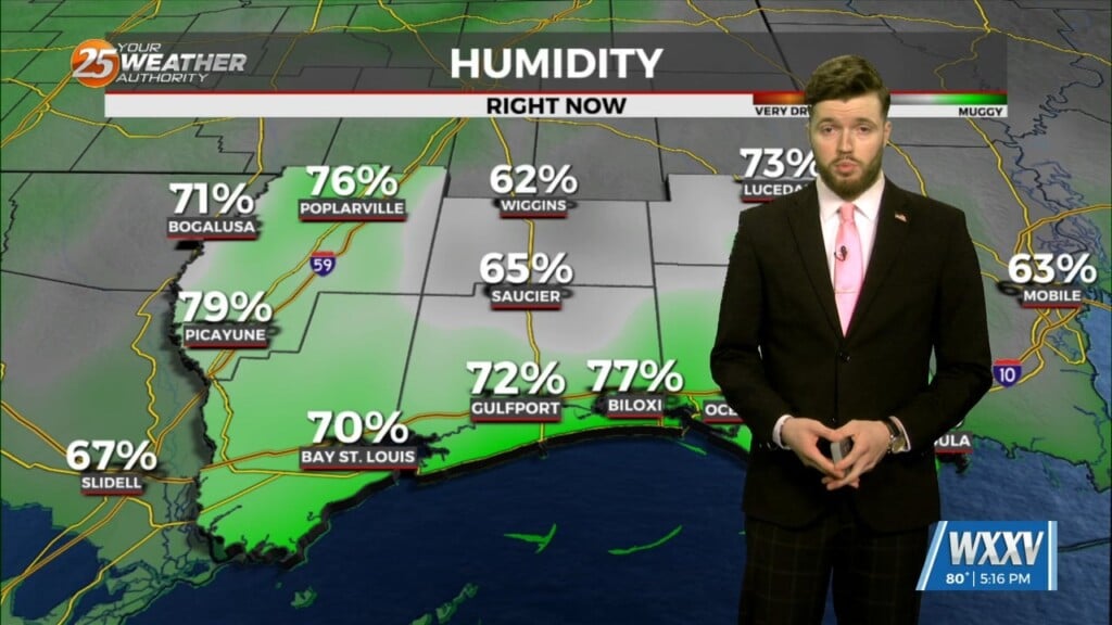
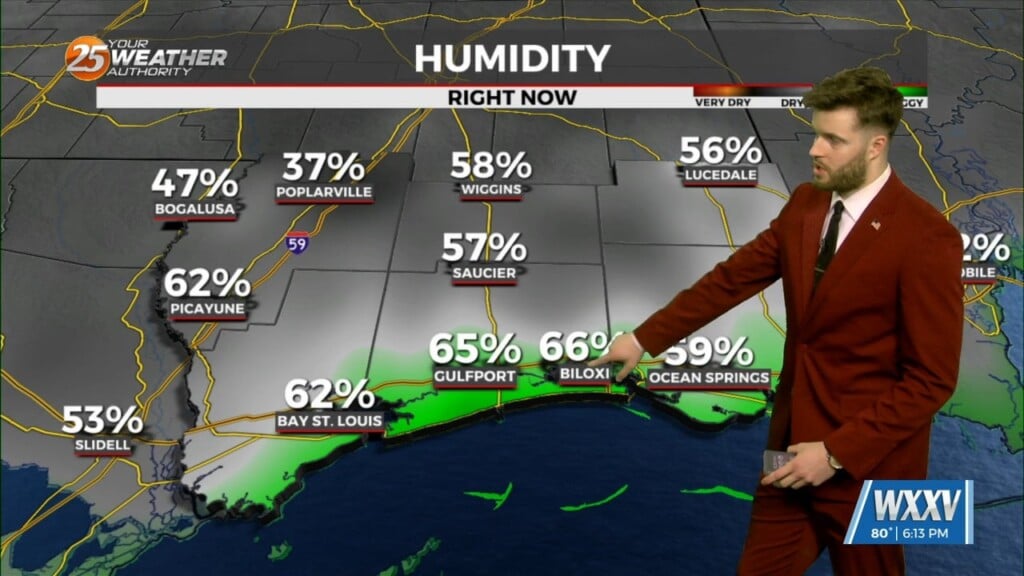
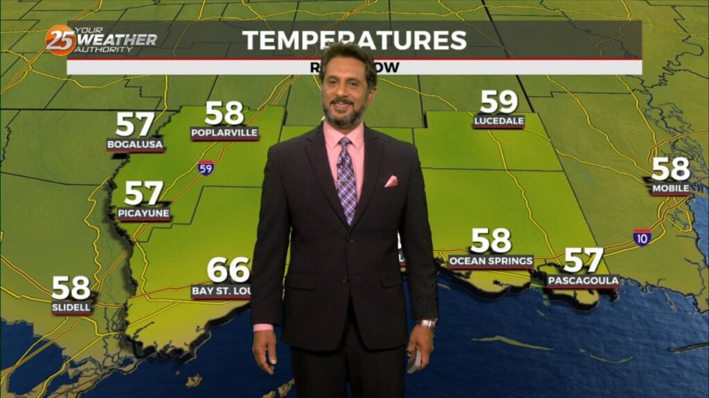
Tuesday morning we will see a shift that should last until at least Wednesday morning. Westerly shifting to southerly winds will help to keep humidity a little…
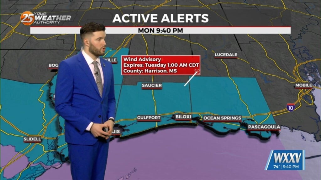
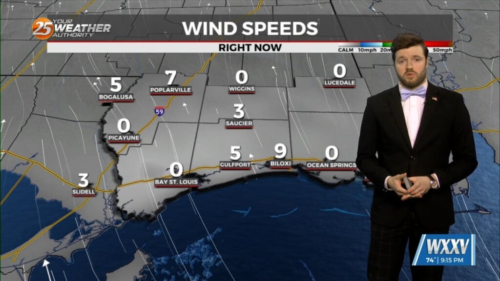
A line of storms moved through our area this afternoon, and a wake low developed on the backside. As a result, winds 25-35 and gusts up to…
Winds will begin to weaken dropping below advisory thresholds this afternoon. But there will still be gusts to 25mph at times and even higher winds up…
Finally…winds will begin to weaken today dropping below advisory thresholds. But there will still be gusts to 25mph at times and even higher winds up…
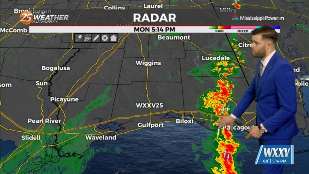
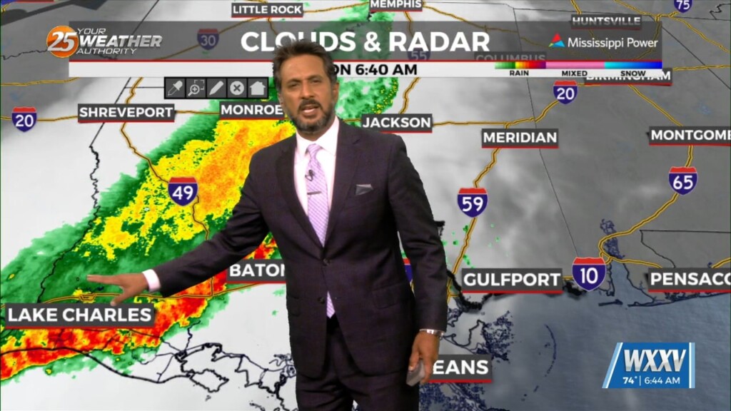
Some isolated showers are ongoing now due to warm advection, but there is not a lot of environmental support for these storms. That means, in our…
Another wonderful day ahead with sun and clouds mixed, with increasing cloud coverage tonight. A tightening gradient will continue to bring breezy conditions to the area…
After a mostly sunny week coast-wide, several folks have been asking how soon into the weekend we will "pay" for the sunshine. To answer that question…
Change is in the cards across the weather community. Gradual changes remain steadily on track to effect the Mississippi Gulf Coast into the weekend. A warm…
For the next few days and through the weekend the word is...WARM. So basically today, April 25th, is probably not the perfect date this year as…
Earlier cloud cover over the northern half of the area has dissipated as expected. Hourly temperature/dew point trends are tracking well at present. Models continue to be…
Northwesterly flow remains over our region as we reside between a shortwave ridge to our west and a modestly amplified trough east of us. With heights…
With high pressure still in control along with a weak cold front to the NW, sunny skies and a zonal/progressive upper flow regime across the…
The second half of our forecast starts out with the stalled front just to our north and east. Again, ahead of the front there could be…

Under sunny skies and a zonal/progressive upper flow regime, temperatures have warmed across the region. With the surface flow veering to a more onshore flow with…