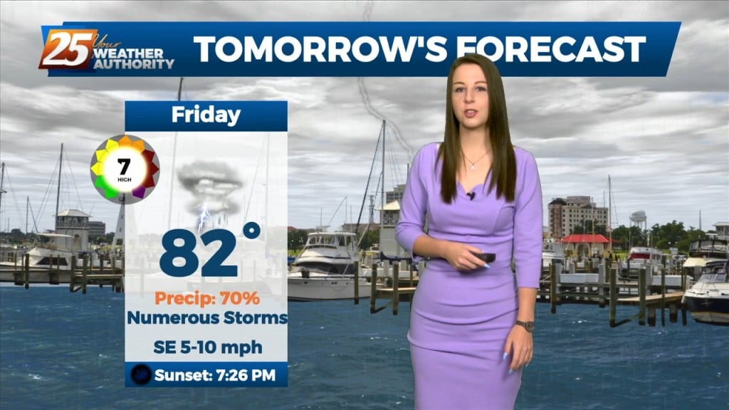
9/1 - Brittany's "Changes Ahead" Thursday Evening Forecast
The dry conditions have been nice for a short time, but the rain will return over the weekend as the pattern changes. Southerly surface winds will act to…
The dry conditions have been nice for a short time, but the rain will return over the weekend as the pattern changes. Southerly surface winds will act to…
The best potential for rainfall, similar to Wednesday looks to be again along and west of the I-55 corridor later this afternoon. With the…
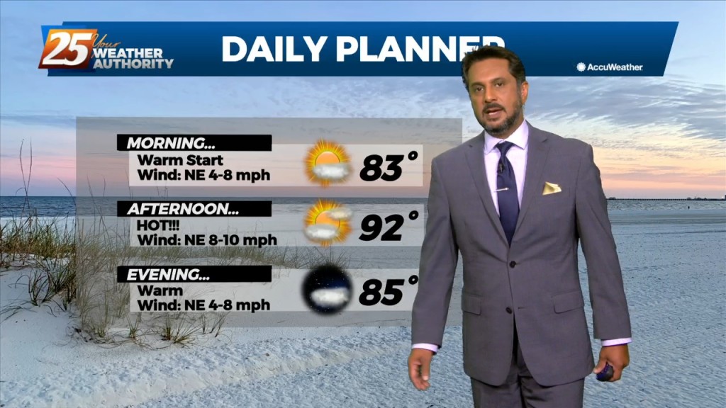
Overall, a fairly quiet day is expected across the area. It should be another lackluster convective day with plenty of dry air aloft. The best potential…
Mid level dry air will remain in place today. This will help cap the environment, making it harder for thunderstorms to get started. There will be…
Mid level dry air will remain in place today. This will help cap the environment, making it harder for thunderstorms to get started. There will be some…
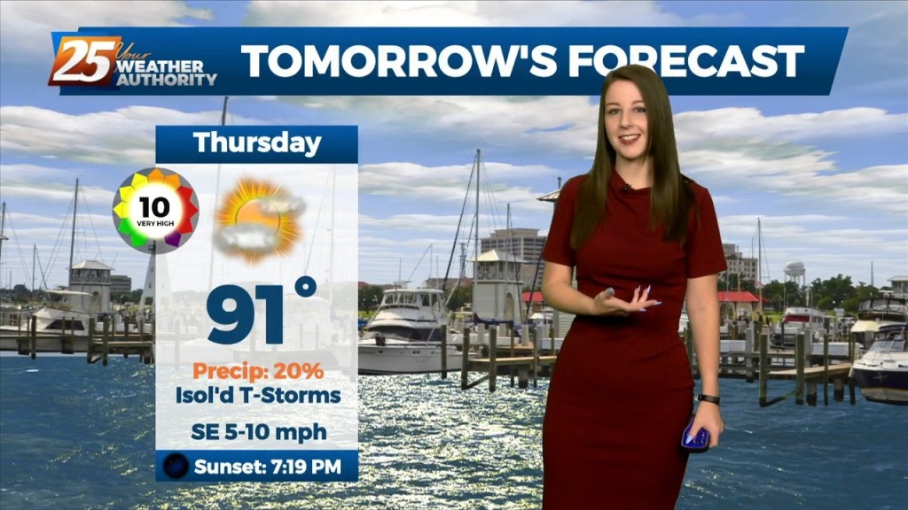
We will tip toe into September Thursday, and some of the area could feel some surface "drier" air filter in. With depth of dry…
Mid level dry air will remain in place today. This will help cap the environment, making it harder for thunderstorms to get started. There will be some…
A frontal boundary is expected to move into the area late tonight and stall over the area by tomorrow afternoon. This front will bring stout mid-level dry air into…
A frontal boundary is expected to move into the area late tonight and stall over the area by tomorrow afternoon. This front will bring stout mid-level dry air into…
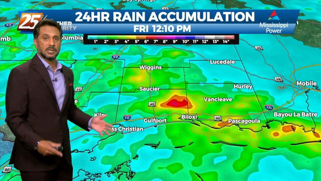
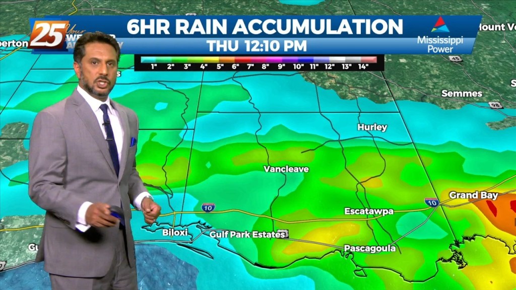
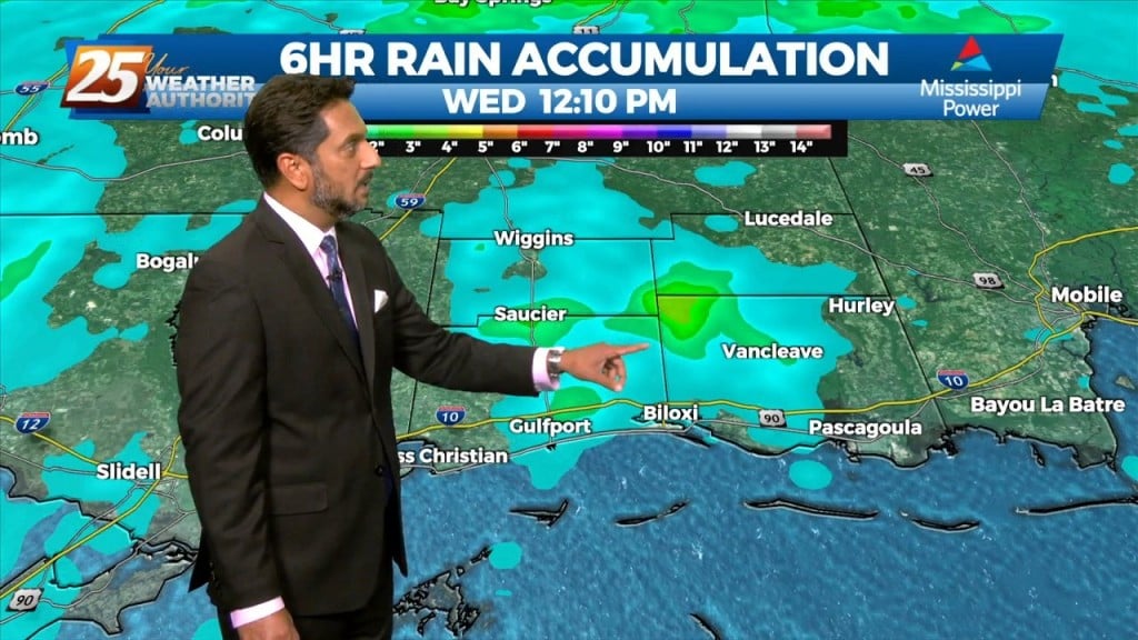
Heavy rainfall wording will remain with us as rates up to 4"/hr will be possible but most of this activity will be moving, so without lingering over an area or training, flooding will be less of an issue. But what could…
A broad ridge of high pressure will remain over the northern gulf through the week promoting onshore flow with showers and thunderstorms expected each day. Tonight through…
A broad ridge of high pressure will remain over the northern gulf through the week promoting onshore flow with showers and thunderstorms expected each day. Tonight through…
A strong surge of tropical moisture and upper diffluence is approaching the north central and NW gulf this morning. The deepest moisture surge will be…
A broad ridge of high pressure will remain over the northern gulf through the week promoting onshore flow with showers and thunderstorms expected each day. Starting out the new…
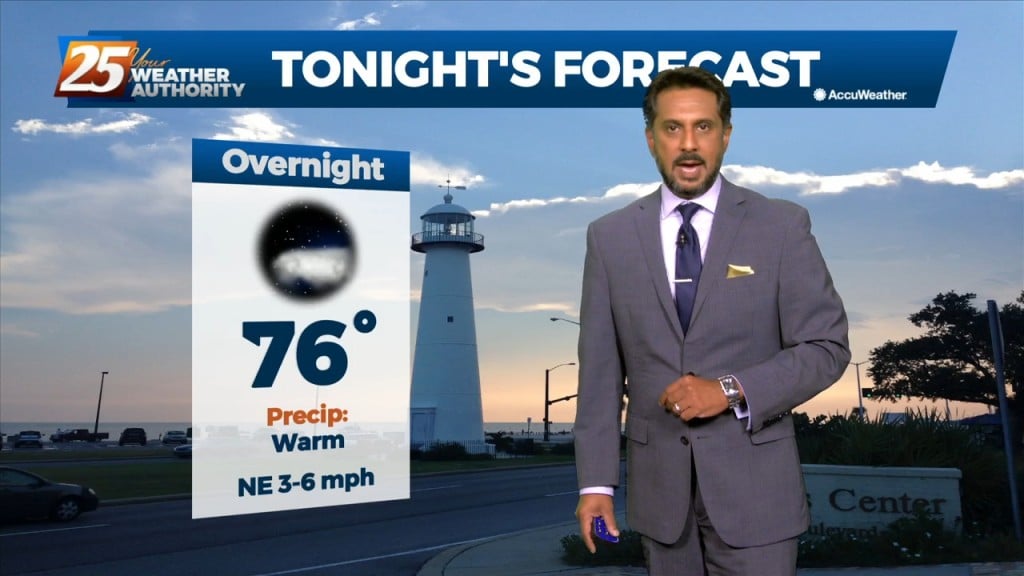
The boundary will lift tonight, and there will not be as much of a focus for rainfall that develops. Southerly surface winds will help to enhance warm air and…
The boundary will lift tonight, and there will not be as much of a focus for rainfall that develops. Southerly surface winds will help to enhance…
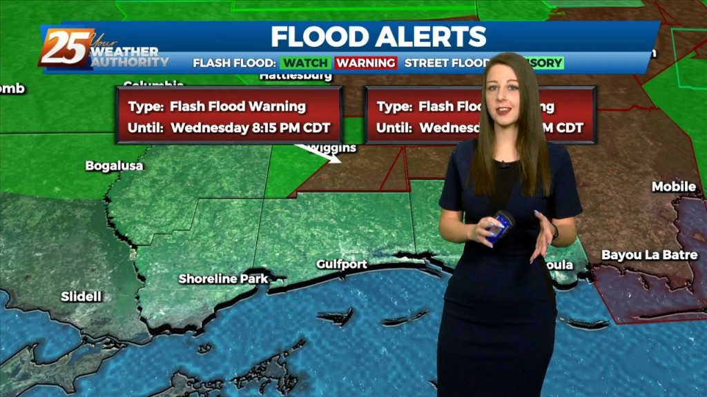
FLOODING ALONG RIVERS; WOLF, BILOXI AND TCHOUTACABOUFFA... A weaker surface low pressure and attendant boundary near or just offshore this afternoon will be the focus for…
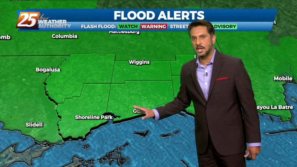
FLASH FLOOD WATCH IN EFFECT - 7 PM... A stalled stationary front overhead will continue to bring the abundant moisture flow to the area. But with…
Will be going up with a flash flood watch for today. This will not be as much of an areawide distribution but moreso a rate driven event. Some…
FLASH FLOOD WATCH IN EFFECT - 7 PM... The threat for pockets of HEAVY RAIN will continue this afternoon. This will not be…
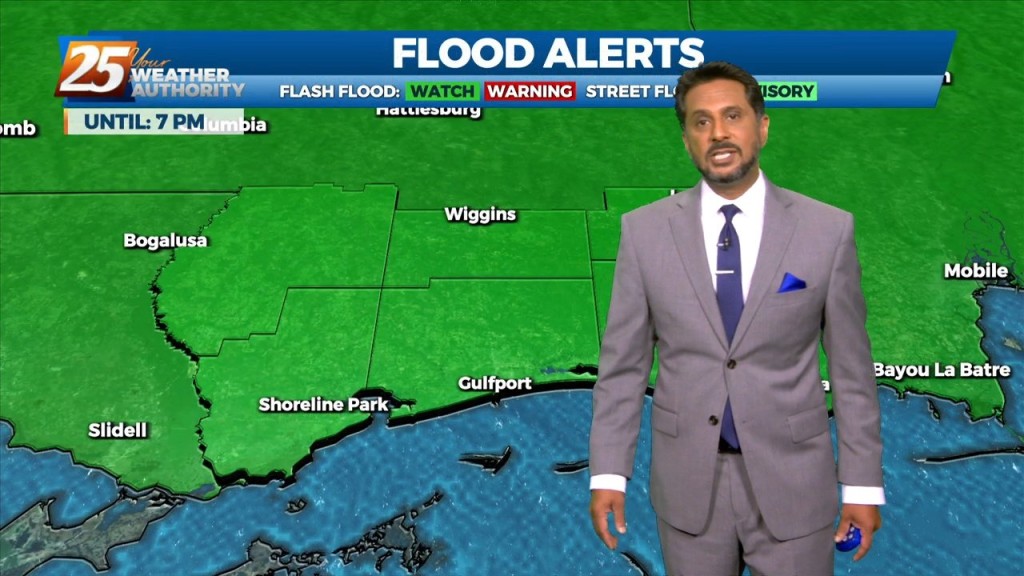
FLASH FLOOD WATCH IN EFFECT - 7 PM... Today through Saturday will continue with the wet pattern. A flash flood watch has…

A stalled surface low and trough north of the coast will keep a higher risk of showers and thunderstorms in place through Friday. The low should slowly…
A stalled surface low and trough north of the coast will keep a higher risk of showers and thunderstorms in place through Friday. The low should slowly dissipate…
Today through Friday, high precip chances along with high rainfall rates will remain the topic along with an environment conducive for waterspouts. The surface…