Another warm night with a better chance for rain on Wednesday
Meteorologist Sam Lucey has a look at the forecast for south Mississippi
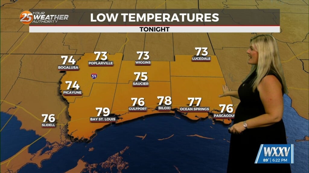
After a few evening showers and thunderstorms tonight, most of South Mississippi will enjoy a quieter overnight period with partly cloudy skies and lows settling into the mid-70s.
Wednesday brings another typical Gulf Coast summer day. Expect plenty of sunshine through the morning before scattered showers and thunderstorms develop during the afternoon. Rain chances sit around 50 percent, meaning not everyone will see rain, but any storm that develops could produce brief heavy downpours and frequent lightning. High temperatures will climb to around 90 degrees.
The unsettled pattern continues into Thursday with isolated to scattered afternoon thunderstorms once again possible. Outside of the storms, skies will remain mostly sunny with afternoon highs in the lower 90s.
Looking ahead to the weekend, the forecast turns even quieter. Sunshine will dominate Friday through Sunday with only a very low chance for an isolated afternoon shower. High temperatures will remain near 90 to 92 degrees each day, while overnight lows stay in the mid-70s.
Early next week looks much the same, with hot, humid afternoons and only a slight chance of a pop-up thunderstorm.