Another round of storms on Saturday before we start drying out
Meteorologist Sam Lucey has a look at the week ahead
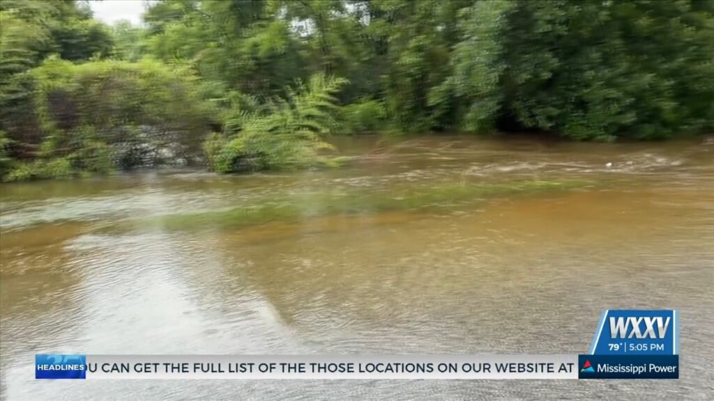
Heavy rain continues to impact South Mississippi Friday night, with torrential downpours leading to areas of flooding across portions of the Coast. Some locations have already picked up several inches of rain, and additional rainfall through the overnight hours could worsen flooding, especially in low-lying and poor drainage areas.
If you’re traveling tonight, use extreme caution. Never drive through flooded roadways. It only takes a small amount of moving water to sweep a vehicle away.
Remember: Turn Around, Don’t Drown!
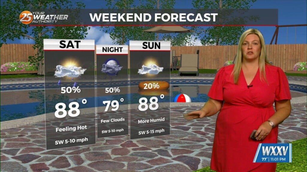
The widespread heavy rain will gradually taper overnight, although a few showers may linger into the early morning hours. Temperatures will remain warm and muggy, with lows around 79 degrees.
Saturday won’t be a washout, but scattered showers and thunderstorms are expected to redevelop during the afternoon as daytime heating combines with lingering tropical moisture. There will also be periods of sunshine, allowing temperatures to climb into the upper 80s before storms develop.
Any thunderstorm that forms could still produce heavy rainfall, frequent lightning, and localized flooding, particularly in areas that receive additional rounds of rain. Saturated ground means it won’t take much additional rainfall to cause water to quickly collect on roads and in low-lying areas.
Sunday brings another improvement, with a mix of sun and clouds and only an isolated afternoon shower or thunderstorm. High temperatures will once again reach the upper 80s.
Next week looks more typical for late June along the Gulf Coast. Expect hot, humid afternoons with highs around 90 to 92 degrees and isolated to scattered afternoon thunderstorms each day. While rain won’t be as widespread as we’ve experienced recently, any storm will be capable of producing brief heavy downpours.