3/14 – Rob Martin’s “Cold’s Gone But..” Monday Evening Forecast”
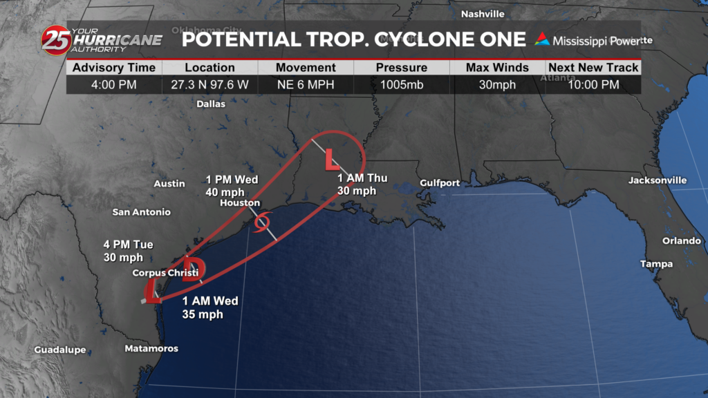
First off…we’re done with this cold snap. Temperatures will be much slower to fall tonight under an easterly breeze (it was cold from the north over the weekend), so we’ll only end up in the mid 50s. The primary forecast concern through Tuesday will be the passage of a potent upper level low-pressure and associated surface cold front across the Lower Mississippi Valley tonight into Tuesday. This strong upper level low will begin to pull east of the area Tuesday night as high pressure moves back in briefly.
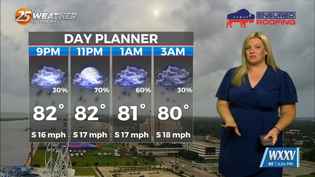
Cloud coverage will linger tonight with showers arriving in the wee hours, followed by a line of heavy rain and embedded thunderstorms by daybreak. This will impact both the early commute and mid-morning hours. A strong to severe storm cannot be ruled out, but most of that activity will stay just west of us in southern Louisiana. morning. However, we could still pick up over an inch of rain with this system.
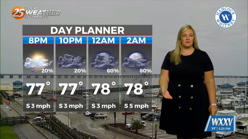
Rain ends Tuesday afternoon as increasing subsidence overspreads the area Tuesday night into Wednesday as high-pressure moves in. We get a nice break in the action Wednesday through Thursday afternoon, The active pattern resumes later in the extended period with another disturbance sliding through the region late Thursday into Friday, and a secondary impulse moving through for Saturday into Saturday night. Temps remain closer to seasonable through the week.