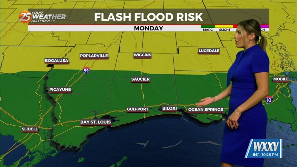
1/20 – Rob’s “Enhanced Threat” Weekend Forecast
After showers and t-storms yesterday afternoon, light fog is in the area this morning with a lull in activity though today. A washed out boundary overhead will flare up overnight as an area of low-pressure to he SW move overhead after midnight through mid-morning Saturday. the Storm Prediction Center (SPC) has the area under an ENHANCED THREAT tonight-Sunday. Another round of potentially SEVERE WEATHER will makes it way through the area Saturday evening/night with VERY WINDY conditions Sunday as the system moves east Sunday afternoon.


Leave a Reply