Rain increases as Isaias pushes toward the coast
Meteorologist Sam Lucey has a look at the week ahead
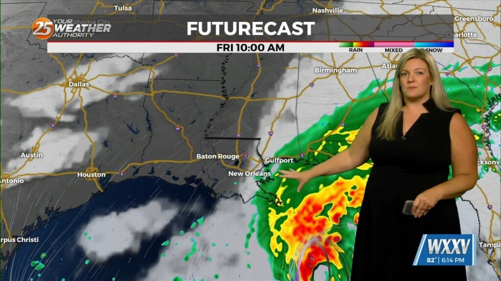
Parts of South Mississippi are in for a breezy, and slightly wet end to the week as Hurricane Isaias approaches the northern Gulf Coast.
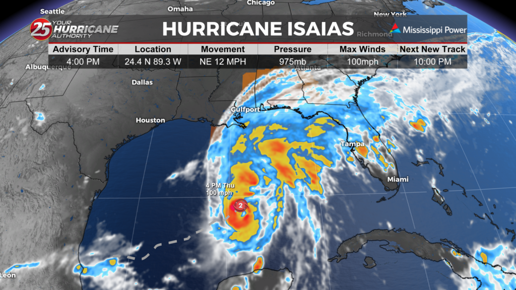
As of Thursday afternoon, Isaias had maximum sustained winds near 100 mph and was moving northeast at 12 mph. The storm is expected to turn north Friday, with landfall forecast near the Pensacola area late Friday or early Saturday.
Rain chances will increase across South Mississippi Friday afternoon as clouds build and winds pick up. High temperatures will reach around 80 degrees, with northeast winds of 15 to 25 mph and gusts up to 35 mph.
The greatest chance for rain comes Friday night, when showers and thunderstorms are expected. Winds could gust up to 40 to 50 mph as the storm approaches, with northeast winds shifting to the northwest after midnight. While widespread heavy rainfall is not currently expected based on forecast amounts, locally higher totals are possible in thunderstorms.
A few showers could linger into Saturday morning before skies clear. Temperatures will reach the upper 70s Saturday, followed by sunny and warmer conditions Sunday.
The quiet weather pattern is expected to continue into next week, with plenty of sunshine and afternoon highs in the middle 80s.
The exact track of Isaias remains important for South Mississippi, as even a storm making landfall farther east or west could change local wind and rainfall impacts.
Residents should continue monitoring forecast updates as the storm moves toward the northern Gulf Coast.