Gabrielle becomes at Category 4 hurricane and forecasters advise Azores to take notice
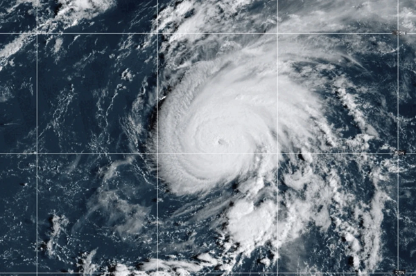
MIAMI (AP) — People in the Azores archipelago were advised Monday to monitor the progress of Hurricane Gabrielle which is now a Category 4 hurricane in the Atlantic Ocean, the National Hurricane Center said.
Gabrielle had maximum sustained winds of 140 mph (220 kph) on Monday afternoon as it skirted to the east-southeast of Bermuda, according to a hurricane center advisory. It was centered 180 miles (290 kilometers) away from Bermuda and moving to the north-northeast at 12 mph (19 kph).
The major hurricane was still over 2,000 miles (3,230 kilometers) west of the Azores, however forecasters project that the system will continue to the north and east over the next several days. The hurricane could approach the islands by the end of the week.
Forecasters said in the advisory that little change in wind strength was expected from Gabrielle on Monday night, and the system could weaken gradually on Tuesday and Wednesday. The system was also expected to increase its forward speed over the next two days.
Gabrielle had become a Category 1 hurricane on Sunday before it underwent rapid intensification in warm Atlantic waters. The storm’s path was taking it east of Bermuda.
Swells from the storm reached Bermuda on Sunday and were impacting the U.S. East Coast, from North Carolina northward to Canada’s Atlantic coast. Forecasters said the swells were likely to cause “life-threatening surf and rip current conditions.”
This year’s Atlantic hurricane season has been relatively quiet and before Gabrielle there was only one named hurricane in that ocean. Experts say there’s a few reasons for that, but it doesn’t mean dangerous systems won’t form later.
The Atlantic hurricane season ends Nov. 30.
In the Pacific, Tropical Storm Narda emerged offshore of Mexico on Sunday. Forecasters said coastal parts of the country could receive up to 4 inches (10 centimeters) of rain Monday night.
The hurricane center said Narda had top sustained winds of about 60 mph (97 kph), but was expected to intensify into a hurricane Tuesday. It was centered about 195 miles (314 kilometers) south of Manzanillo, Mexico, while moving to west-northwest at 13 mph (20 kph).
Narda was expected to take a turn to the west Monday night, heading farther out to sea, the center said.