11/13 – Trey Tonnessen’s “Nature’s Collective Bargaining” Wednesday Night Forecast
Meteorologist Trey Tonnessen
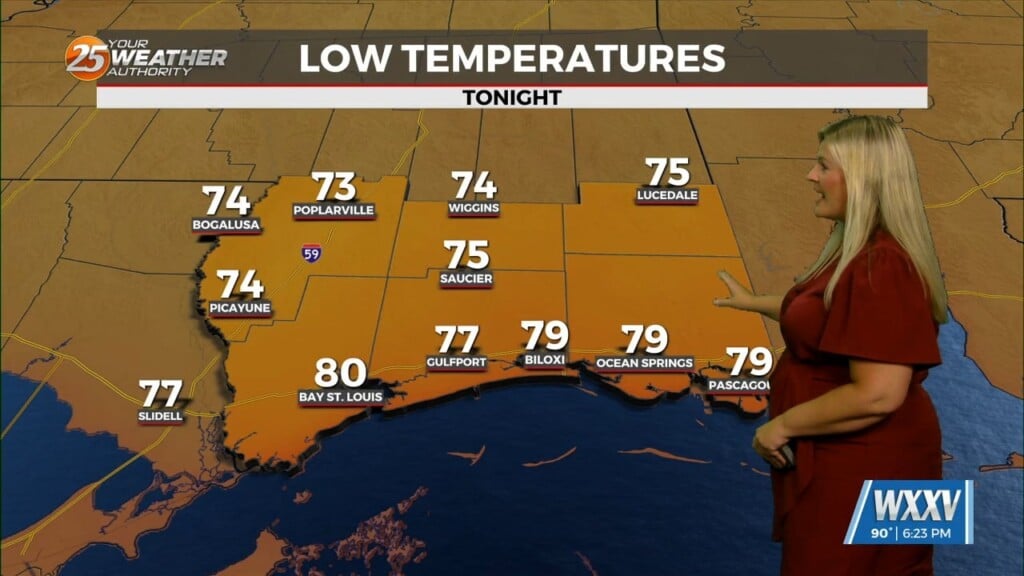
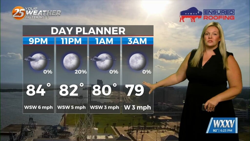
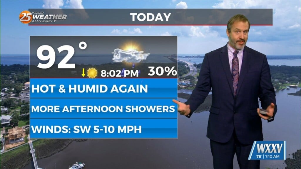
A strong upper trough extends from near Omaha southward to western Louisiana this afternoon with ridging over the East Coast and the Rockies. Frontal boundary extends from near Natchez to the Baton Rouge and Houma areas with scattered strong to severe storms just in advance of the front. Temperatures ranged from the mid 70s to lower 80s in advance of the front with dew points in the mid 70s. Trough should continue to lift northeast with frontal boundary exiting the area prior to midnight. Threat for isolated severe storms continues this evening, ending from west to east by about midnight. Rapid clearing behind the front with considerably drier air for Thursday and Thursday night. With northerly winds expected on Thursday, the Mississippi coast will see the warmest temperatures for highs. Looks like there may be enough mixing Thursday night to not carry colder temperatures in the normal drainage areas, but this can be reassessed tomorrow.