6/10 – Trey Tonnessen’s “Tropical Moisture” Monday Night Forecast
Meteorologist Trey Tonnessen
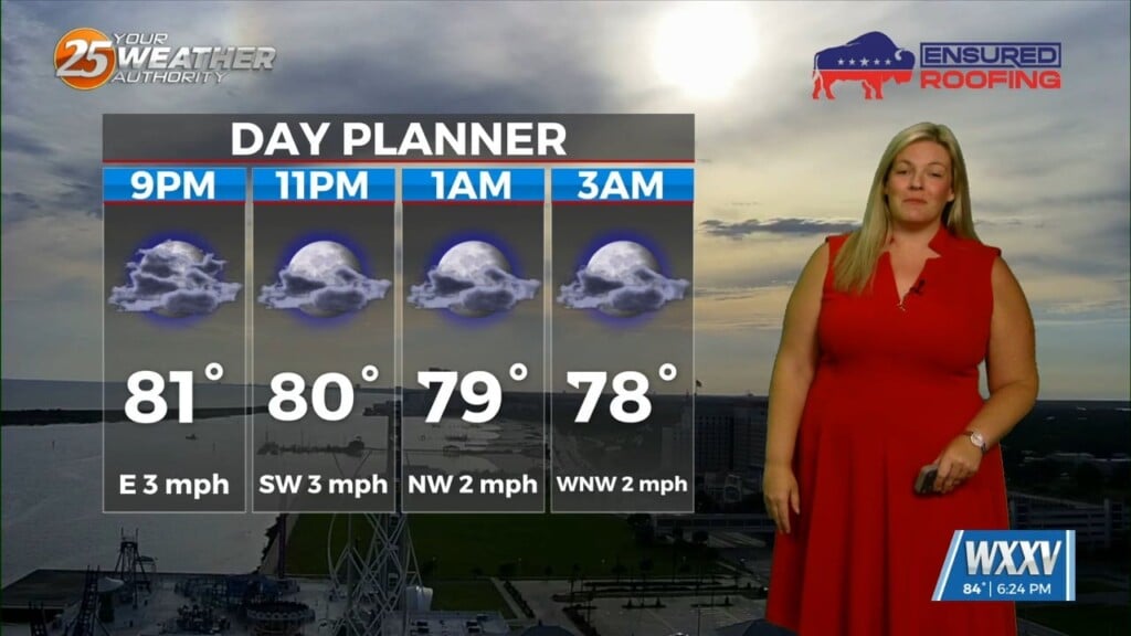
South of the Mississippi Gulf Coast, a frontal boundary remains just offshore for the end of the workweek, with the airmass gradually drying out. By the time we get to Thursday and Friday, precipitable water values fall to about the 10th percentile, around 1.10 inches. With weak offshore flow, that should limit convection significantly. We can`t rule out one or two storms along sea breeze boundaries. Highs the rest of this workweek will be very dependent on precipitation trends, and don`t see that as a confident target of opportunity to diverge from the NBM solution. The center of an upper ridge is forecast to transit Interstate 40 to our north over the weekend. This places the local area under easterly mid and low level flow, but the global models are struggling with the details of how that may impact the local area.