5/28 – Trey Tonnessen’s “Record High” Tuesday Night Forecast
Meteorologist Trey Tonnessen
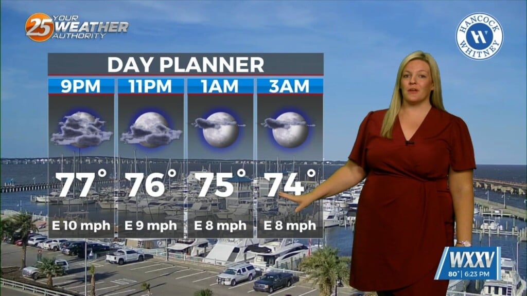
Wednesday and Thursday we will continue to see the possibility of convection and just like today and yesterday it will primarily be driven by what develops overnight upstream across Texas, Red River Valley, and Arkansas. The digging L/W trough over the eastern United States will try to place the area under weak northwest flow and this usually leads to convection being later, sometimes much later in the day. But the ridging over the western Gulf may nudge north into the area and this could suppress convection but the key will be if convection to our northwest dives southeast eroding the s/w ridging or if the ridging is too strong and forces most of the convection more south just off to our west.