5/2 – Trey Tonnessen’s “Moisture Advection” Thursday Night Forecast
Meteorologist Trey Tonnessen
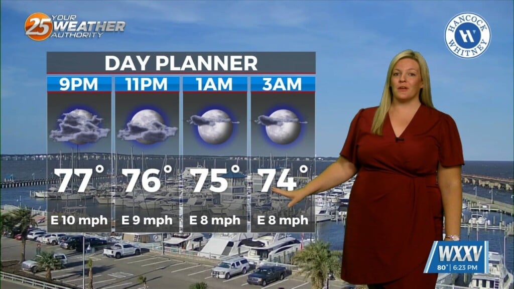
Across the Mississippi Gulf coast we have several weather changes in the extended forecast. Multiple weather models are indicating a decent shot of rain for the western half of the viewing area and are showing things getting going rather early. There is even some indication that there could be pockets of heavy rain. However, I don’t see a large chance for that heavy stuff to continue at that pace. The next best source of lift is located in the mid level jet streaming from the north-central Gulf west southwesterly across Mexico and coming out of the Pacific Ocean, but that next piece of strong lift would get to the Louisiana coast by tonight and that is not it unless convection starts WAY earlier than what any models are hinting at.
As always: A cloudy day is no match for a sunny disposition. Be nice to each other.
-Meteorologist Trey Tonnessen