5/1 – Trey Tonnessen’s “Steadily Warm” Wednesday Night Forecast
Meteorologist Trey Tonnessen
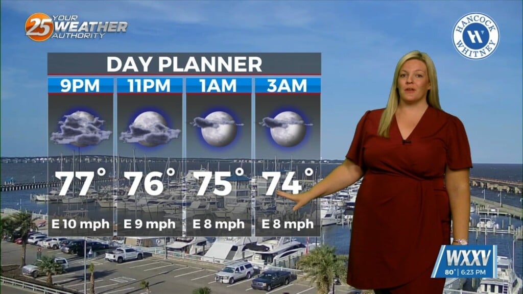
Thursday will see a fast moving shortwave trough axis push towards our region, firstly through Louisiana from Texas. The majority of the forcing with this system will be shunted to the north of South Mississippi due to the strength of the ridge axis aloft, but weakening band of showers may slightly impact the northwest part of the WXXV viewing area tomorrow night. The influence of the ridge and resultant subsidence will be strong enough to keep a mid-level cap in place. This is evident by weak mid-level lapse rates. Weak lapse rates exist across coastal Louisiana and coastal Mississippi. Fortunately, for the places outside of southern Mississippi that could see some convective activity tomorrow afternoon, shear values will remain weak, and severe storms are not expected.
As always: A cloudy day is no match for a sunny disposition. Be nice to each other.
-Meteorologist Trey Tonnessen