11/8 – Trey’s “Fog Horn” Wednesday Night Forecast
Meteorologist Trey Tonnessen
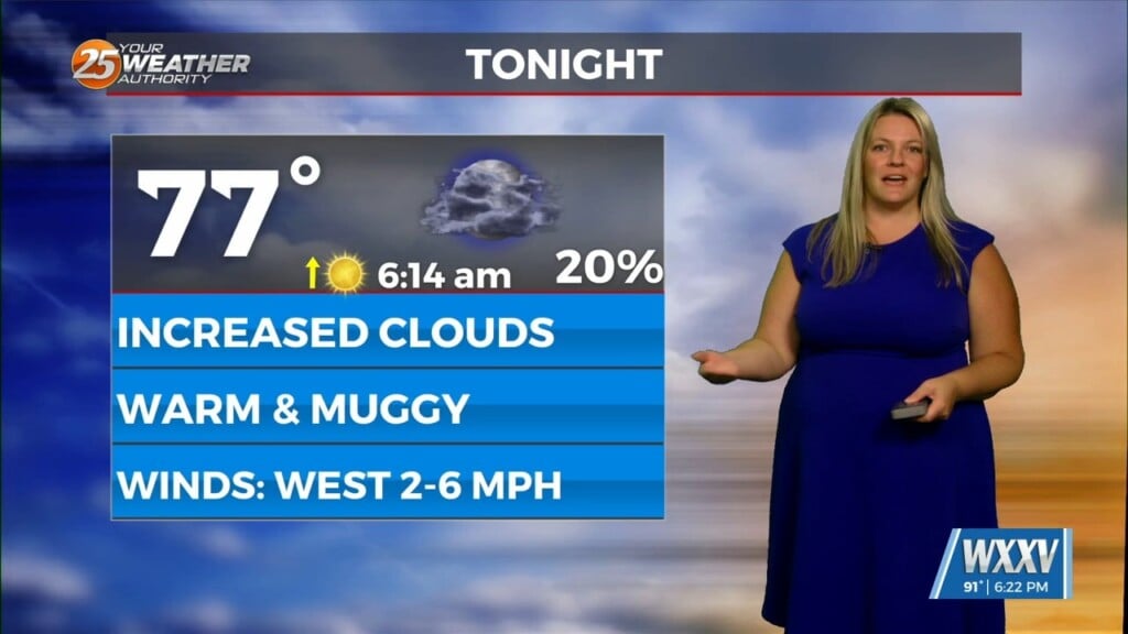
 High pressure continues to sit to the east of Mississippi,
allowing for gradual moisture return and dew point temperatures
that increased statewide. A broad surface trough of low pressure
moving through the Midwest has slightly tightened the pressure gradient,
which is why our daytime wind speeds increased to 15-20 mph but they
are already decreasing as the trough quickly departs and the gradient
weakens tonight. Despite the morning fog and upper-level cirrus, Daytime
highs reached the low to mid 80s from the coast moving north in our area.
The National Weather Service once again has focused tonight on a recently
familiar hazard, because it's basically the only big problem tonight.
That problem is patchy dense fog and straight up dense fog across the coast.
Key Messages:
1. Dense fog is likely to develop again across portions of
southeast LA and southern MS on Thursday morning. Smoke from the
wildfire in New Orleans East could reduce visibility to less than
100 feet across small portions of east Orleans and St. Tammany
parish during morning commute hours.
2. Dense fog potential is much more uncertain on Friday morning as
increasing cloud cover and precipitation ahead of the cold front
could make it more difficult for smoke to get trapped and for
dense fog to form.
As always: A cloudy day is no match for a sunny disposition.
Be nice to each other.
- Meteorologist Trey Tonnessen -
High pressure continues to sit to the east of Mississippi,
allowing for gradual moisture return and dew point temperatures
that increased statewide. A broad surface trough of low pressure
moving through the Midwest has slightly tightened the pressure gradient,
which is why our daytime wind speeds increased to 15-20 mph but they
are already decreasing as the trough quickly departs and the gradient
weakens tonight. Despite the morning fog and upper-level cirrus, Daytime
highs reached the low to mid 80s from the coast moving north in our area.
The National Weather Service once again has focused tonight on a recently
familiar hazard, because it's basically the only big problem tonight.
That problem is patchy dense fog and straight up dense fog across the coast.

Key Messages:
1. Dense fog is likely to develop again across portions of
southeast LA and southern MS on Thursday morning. Smoke from the
wildfire in New Orleans East could reduce visibility to less than
100 feet across small portions of east Orleans and St. Tammany
parish during morning commute hours.

2. Dense fog potential is much more uncertain on Friday morning as
increasing cloud cover and precipitation ahead of the cold front
could make it more difficult for smoke to get trapped and for
dense fog to form.

As always: A cloudy day is no match for a sunny disposition.
Be nice to each other.

- Meteorologist Trey Tonnessen -