1/7 – Rob’s Thursday “Wxxv25 Today” Forecast
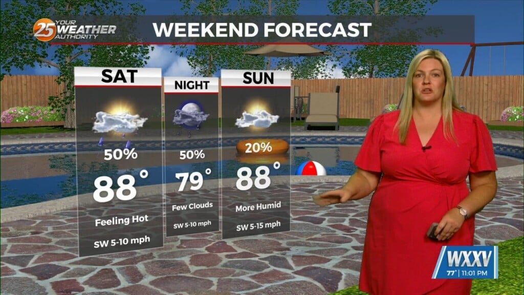
As a trough of low-pressure to the west continues to move east…rain will move across the area through this afternoon, with the heavier activity this morning. A few strikes of lightning along with thunder is possible but more so in the outer coastal waters…on-shore will mainly be rain. Tomorrow will bring areas of patchy fog but for the most part…a dry day. A cold front will provide showers and thunderstorms beginning prior to sunrise Saturday with the activity waning through the afternoon. As this boundary clears the area…the upper-level support will clear skies and push a colder air mass into the gulf south.


Leave a Reply