7/28 – Sam Lucey’s “Warm and Humid” Monday Evening Forecast
Heat Alerts in Effect for Tuesday with Afternoon Storms Returning
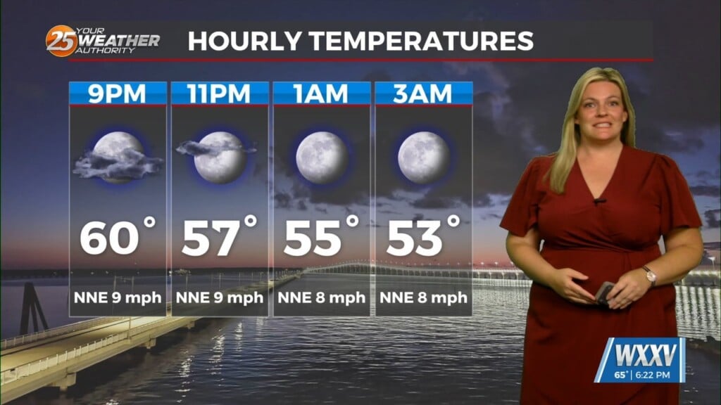
Expect a mostly clear night with temperatures dropping to around 79 and light winds settling down by morning. It’s going to be a hot and humid Tuesday ahead, with highs near 97 and heat index values that could reach up to 110.
A Heat Advisory is in effect until 6 PM Tuesday, for Pearl River, Stone, George, and inland areas of Jackson, Harrison, and Hancock Counties. Coastal areas of Jackson, Harrison, and Hancock are under an Extreme Heat Warning until 7 PM, so take it easy if you’re spending time outdoors.
There’s a 50% chance of showers and storms developing by the early afternoon, with heavier downpours possible in stronger cells. Rain chances stick around through the evening and overnight, with mostly cloudy skies and lows in the upper 70s.
Storms remain in the forecast the next few days.
Expect a mix of sun and clouds with scattered thunderstorms likely on Wednesday and Thursday, especially during the afternoon hours. Highs will stay in the low 90s, and the humidity will keep it feeling even hotter—heat index values could still climb over 105 in some spots. Overnight lows will be warm and muggy, settling into the mid to upper 70s.
Heading into the weekend, expect more of the same: mostly sunny skies, hot afternoons, and scattered thunderstorms each day.