6/21 – The Chief’s “Sunny & Hot 1st Weekend of Summer” Friday Morning Forecast
While the low level circulation of former Tropical Storm Alberto dissipated yesterday afternoon, the mid and upper circulation is still evident with a drier air mass moving in from the NE. The flow between high pressure to the north and low pressure near the Bay of Campeche is not as strong as it has been for much of the week, meaning winds will be quite a bit lighter.
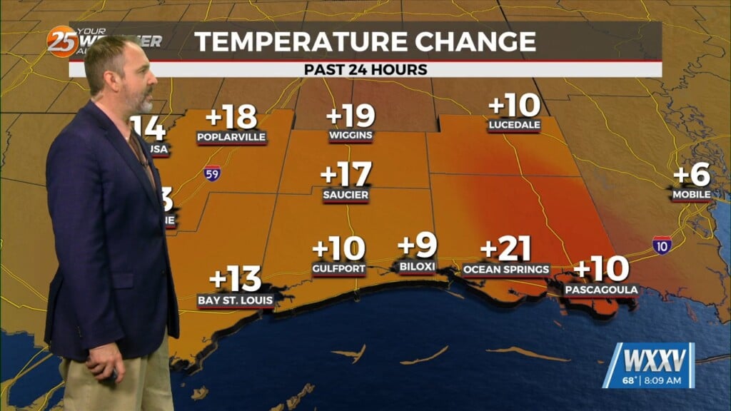
The upper level high pressure will continue to sink south and southwest today and Saturday, with the axis from eastern New Mexico to the Florida Panhandle by Saturday evening. This will continue to gradually dry out the atmosphere. As the atmosphere dries out over the next couple of days, cloud cover will be more limited, and we should heat up a couple of degrees warmer.
As a weakness develops near the Atlantic Coast, that will up the local area in northwesterly mid-level flow by midweek. The eastward extension of the high pressure may keep any thunderstorm development isolated Monday afternoon, but as we get into Tuesday and beyond, moisture levels are likely to become sufficient enough for scattered thunderstorm development. If there is going to be any concern for severe weather or heavy rainfall, it wouldn’t occur much before Wednesday or Thursday.


