5/9 – Trey Tonnessen’s “Proactive” Thursday Evening Forecast
Meteorologist Trey Tonnessen
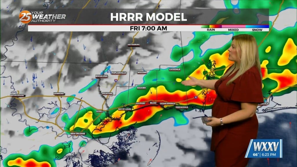
A vigorous vorticity max and associated 100+ knot upper level jet streak is currently moving through Texas this afternoon and will pass through the Lower Mississippi Valley and Gulf South tonight into tomorrow morning. Strong deep layer ascent has been noted with this system over Texas today, and this same ascent will move through the area tonight. This deep layer forcing will tap into a very moist and highly unstable airmass, and this will allow any convection that moves in from Texas to maintain itself through the overnight hours. In terms of moisture and instability, precipitable water values will be near 2 inches tonight and very steep mid-level lapse rates of around 8.0 C/KM will support MLCAPE values at or above 3000 J/KG. That means, there will be no form of capping inversion to inhibit updraft growth and sustainment over the area. Additionally, the steep lapse rates in place will also allow for easier downward transport of stronger winds aloft and this is reflected by very high downdraft CAPE values of 1000 J/KG.
As always: A cloudy day is no match for a sunny disposition. Be nice to each other.
-Meteorologist Trey Tonnessen


