5/2 – Trey Tonnessen’s “More Clouds Today” Thursday Evening Forecast
Meteorologist Trey Tonnessen
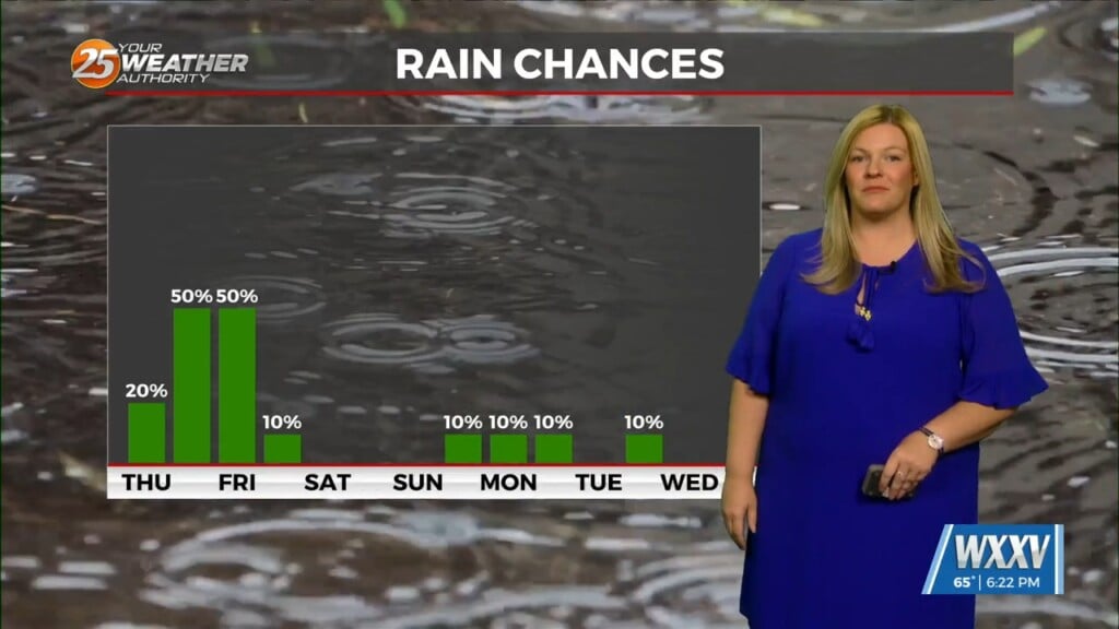
Wednesday’s best mid level forcing has stayed to the west-southwest of the coast. This has allowed some stronger storms to continue to push east, west of our area; but as they worked east they quickly weakened. Weather models have been all over the place. They are all ranging from not having anything over the Mississippi Gulf Coast, to bringing the weakening squall line through the entire area. Fog will be a possibility again tonight but if rain is able to quickly develop during the overnight and early morning hours dense fog should not be as much of a problem but areas of moderate fog with patchy dense can not be ruled out.
As always: A cloudy day is no match for a sunny disposition. Be nice to each other.
-Meteorologist Trey Tonnessen


