4/30 – Trey Tonnessen’s “Quiet Calm” Tuesday Evening Forecast
Meteorologist Trey Tonnessen
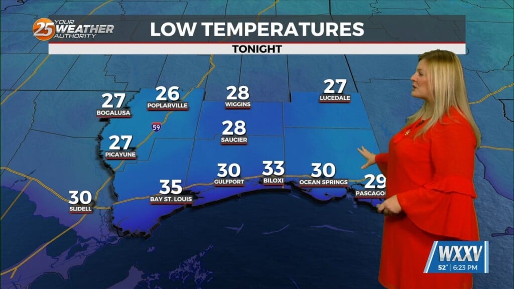
A fairly strong mid to upper level ridge axis will remain in firm control of the area through Wednesday night. Ample subsidence in the mid-level will lead to warmer and drier conditions aloft, and this will help keep a mid-level capping inversion and weak mid- level lapse rates in place. The end result will be a proliferation of fair weather cumulus development tomorrow. Temperatures will be warmer than average due to the deep layer subsidence in place, with highs climbing into the upper 80s over inland areas, and the low to mid 80s along the coast. These values are around 5 degrees above normal. Onshore flow in the low levels will also keep dewpoints elevated, and this will result in overnight lows only dipping into the 60s tonight and Wednesday night.
As always: A cloudy day is no match for a sunny disposition. Be nice to each other.
-Meteorologist Trey Tonnessen