3/25 – Sam’s Wednesday Night Forecast
Meteorologist Sam Lucey has a look at the week ahead
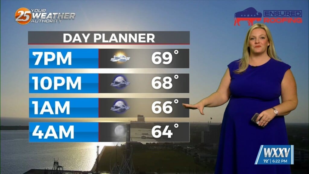
Expect partly cloudy skies with patchy fog developing late overnight tonight as temperatures dip into the low 60s. Skies will gradually clear on Thursday, turning mostly sunny by the afternoon with highs climbing into the upper 70s. Winds remain light, becoming southerly later in the day.
Fog makes another appearance Thursday night into early Friday, but otherwise conditions stay quiet with lows in the low 60s. By Friday, we’re warming up a bit more, with mostly sunny skies and highs reaching the low 80s.
A weak front slides through late Friday night, bringing a wind shift and a brief increase in gusts. That sets up a cooler and breezier Saturday, with sunshine returning and highs dropping back into the mid 70s. North winds could gust up to 25 mph at times.
The weekend stays pleasant overall. Sunday brings slightly cooler temperatures in the low 70s with a mix of sun and clouds and an easterly breeze. Into early next week, temperatures rebound into the mid to upper 70s with partly sunny skies and a steady onshore flow.
By midweek, moisture begins to creep back in, and we could see a slight chance for a few showers or thunderstorms by Wednesday.