3/24 – Trey Tonnessen’s “Severe Weather Upcoming” Sunday Night Forecast
Meteorologist Trey Tonnessen
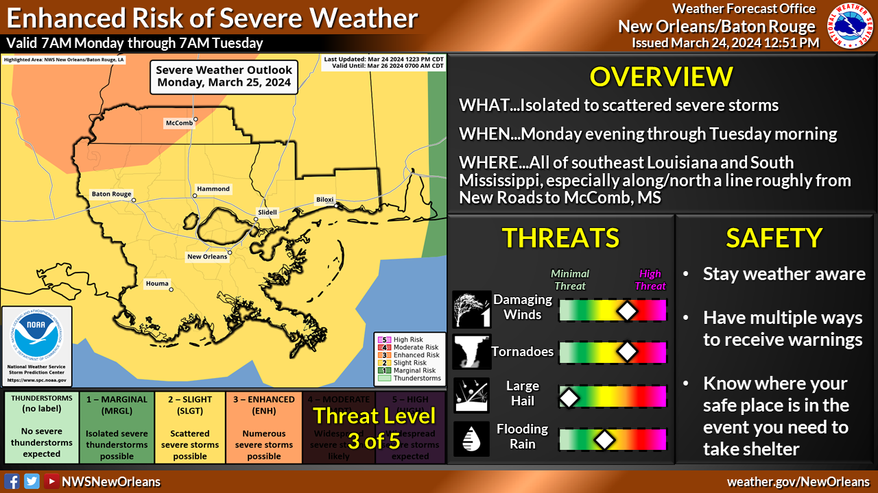
There is a severe weather risk for Louisiana and Mississippi, including the Mississippi Gulf Coast, Monday afternoon into Monday night. Conditions are very favorable for severe storms across the region and some of the severe storms will be capable of producing tornadoes and strong damaging wind gusts. Though here on the coast we find ourselves included in the level 2 out of 5 slight risk for severe weather development; damaging winds are still likely and our tornado risk is definitely not completely zero. The highest threat will be along and north of the I-10 corridor. All of this will be driven by a strong longwave trough ejecting out of Texas from Monday into Tuesday, and taking on a more negatively oriented tilt as an upper level jet streak rounds the base of the trough. A highly difluent pattern aloft will form, and a broad region of upper level lift will develop across the Lower Mississippi Valley by Monday afternoon and evening. In the low to mid-levels, the formation of a 60+ knot low level jet will take place Monday afternoon and this low level jet will induce extremely high shear values over the region through late Monday night.
As always: A cloudy day is no match for a sunny disposition. Be nice to each other.
-Meteorologist Trey Tonnessen


