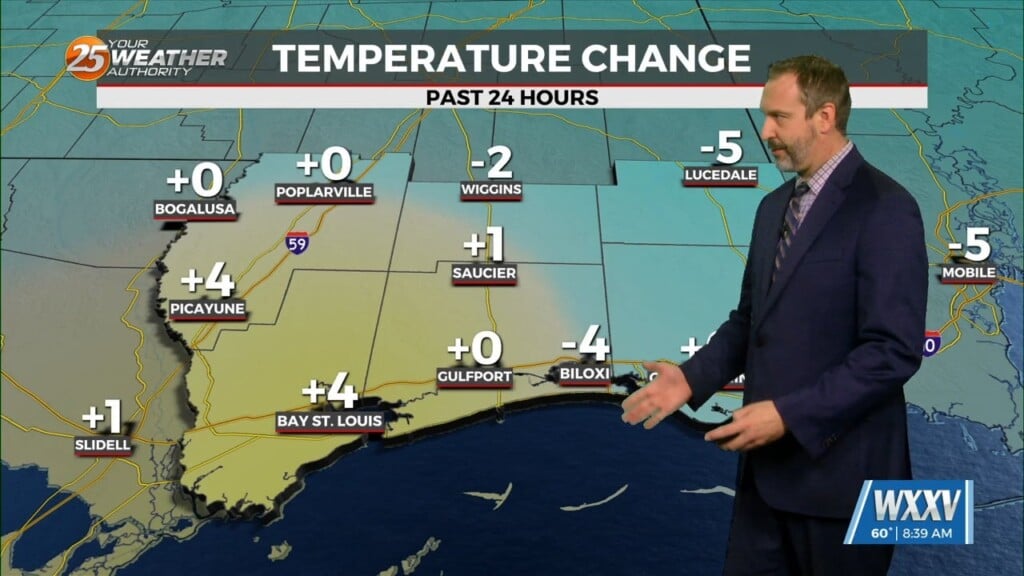
3/13 – Sam Parker’s “Increasing Threats” Thursday Night Forecast
Warm humid weather until we reach the stormy Saturday where the severe risk increases. Sunny, warm, and humid is what I would call Thursday today. Cloudy, warm, and humid is what I will call Friday. There is a small chance to see some Friday night storms but its on the low side. A moderate risk level 4/5 chance of severe weather has been issued for all of south Mississippi. It’s rare to see a moderate threat for severe weather issued three days out. A few strong tornadoes, damaging winds and hail are all possible. The timing right now looks to be in the early afternoon and evening. Once the storms pass it will still feel breezy but a mostly clear Sunday with highs in the low and mid 70s. Make sure you continue to pay attention to the forecast as we get closer and have a severe weather plan in place.