2/20 – Much cooler temperatures on the way
Meteorologist Sam Lucey has a look at your forecast
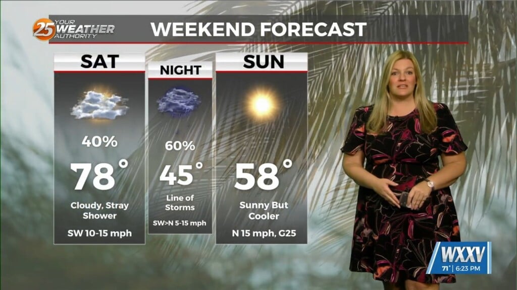
Clouds hang on tonight with patchy fog and lows stay mild near 65.
Saturday brings the chance for a few early showers, then scattered afternoon and evening thunderstorms as a cold front moves through. Highs reach the upper 70s before turning breezy and cooler Saturday night, with lows dropping to the mid 40s.
Sunday will be sunny, breezy, and quite a bit cooler with highs near 60. Dry and chilly conditions continue on Monday and Tuesday with sunny skies and highs in the mid 50s, plus cold nights near 30 and some inland spots in the upper 20s.
Warmer air returns on Wednesday with highs near 70 and increasing clouds. Rain chances move back in late Wednesday into Thursday, followed by slightly cooler, drier weather by the weekend.