2/12 – Trey’s “Cold Nights Return” Monday Night Forecast
Meteorologist Trey Tonnessen

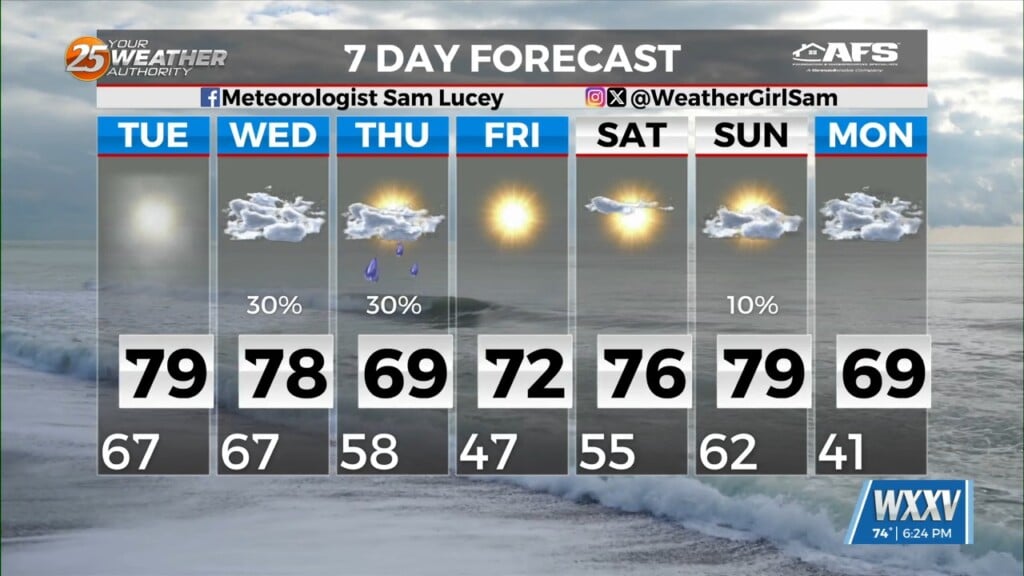
The longer term forecast will see several disturbances rotating around the overall upper low centered over Eastern Canada. An initial fast-moving disturbance will move through the middle part of the country Thursday. The front associated with this will remain well north of the local area, with continued east/southeasterly winds in the low levels across the local area. This will lead to a continued gradual warming trend. By Friday, a more vigorous disturbance will begin diving down the back side of the previously mentioned upper low. Simultaneously a southern stream trough will be moving eastward through northern Mexico. These two systems won`t quite phase with each other as the northern stream trough axis moves east of the local area Saturday but the southern stream trough lags behind until Sunday. What this means for our local weather is that even though another cold front is forecast to move through the area Saturday morning, showers could linger in the area through Saturday night, and clouds may stick around until some time Sunday.
As always: A cloudy day is no match for a sunny disposition. Be nice to each other.
-Meteorologist Trey Tonnessen