2/10 – Foggy start on Wednesday with rain chances returning late
Meteorologist Sam Lucey has a look at your forecast
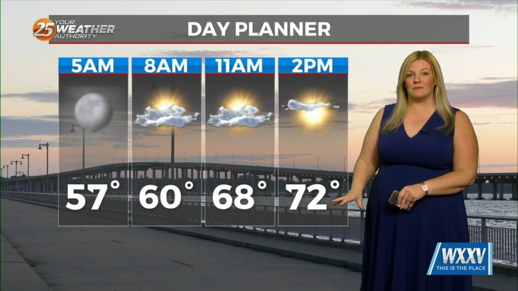
We’ll be dealing with a few foggy mornings over the next couple of days, lasting until 9 or 10 a.m., so plan for some reduced visibility if you are heading out early to work or school. Once the fog dissipates on Wednesday, highs climb into the lower 70s, with just a small chance of a late-day shower as a weak cold front pushes through in the evening.
Following that cold front, we can expect temperatures to top out in the upper 60s to near 70 on Thursday and Friday with a mix of clouds and sun throughout the afternoon.
Rain chances start to increase again heading into the weekend. Showers become more likely Saturday afternoon, and we could see thunderstorms develop Saturday night. Sunday may begin with lingering showers and storms before gradually drying out later in the day. Temperatures stay near 70 through the weekend, but it will feel more unsettled at times.
The good news is sunshine returns for your Monday and continues into Tuesday, with highs near 70 and much calmer conditions to start next week.