12/15 – Another Cold Start Tuesday Then Warming Up
Meteorologist Sam Lucey has a look at your forecast
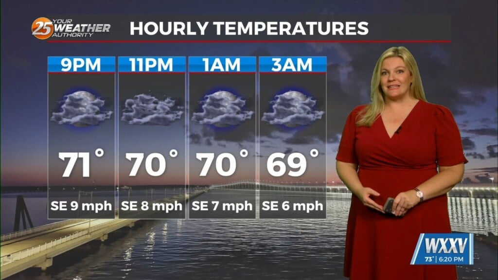
Our cold start to the week continues tonight with widespread frost developing after 10 p.m. and lows falling into the upper 20s inland or low 30s along the coast. Sunshine returns Tuesday, helping temperatures rebound to near 60 before clouds increase Tuesday night.
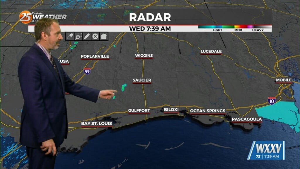
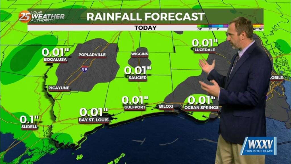
Midweek turns more unsettled as moisture moves back in. Wednesday stays mostly cloudy with a few showers possible by afternoon, along with patchy fog later in the day. Rain chances increase Wednesday night into Thursday, when scattered showers and thunderstorms are possible and highs climb into the upper 60s.
Slightly cooler air settles in by Friday with sunshine and comfortable temperatures in the low 60s, but the weekend looks to be another warm one. We’re looking at plenty of sunshine Saturday and highs reaching the upper 60s to low 70s by Sunday. Early next week stays a bit warmer with partly sunny skies and temperatures hovering near 70.