10/22 – Rob’s Thursday Morning Forecast
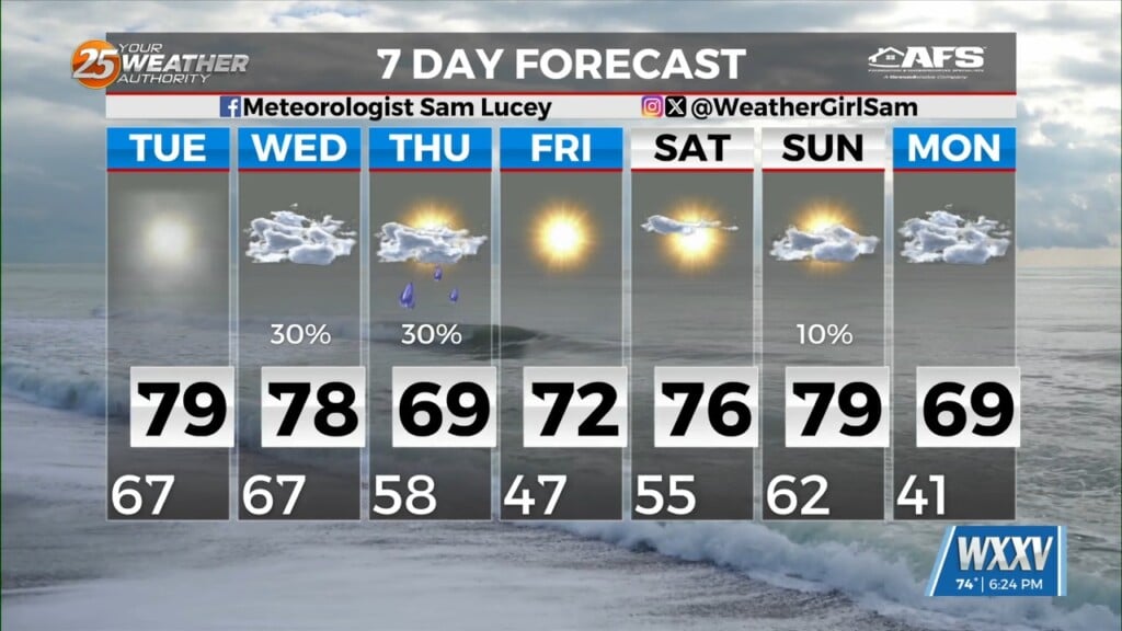
A Pacific low-pressure system is coming together for a strong system to develop in central Texas. This surface low will move NE through the plains and finally over Hudson bay while a second stronger surface low develops over the western gulf Saturday night. This secondary low-pressure area will move NE as it continues to feed from Gulf moisture. Once the gulf low moves north…it will finally drag a front through the area Wednesday. Cloudy skies with rain potential will continue until the secondary surge of dry cold air moves in behind a much stronger Canadian cold front on Thursday/Friday of next week.


Leave a Reply