1/9 – Chance for storms continues into Saturday morning
Meteorologist Sam Lucey has a look at your forecast
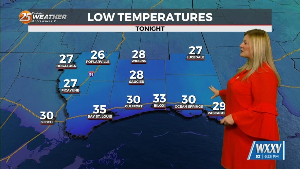
Showers and thunderstorms will be widespread tonight through Saturday, bringing periods of heavy rain and unsettled conditions across the area. Rain gradually tapers off late Saturday as a cold front moves through, shifting winds to the north and allowing cooler air to settle in. Temperatures will drop noticeably on Saturday night, marking the start of a much cooler pattern.
Sunday will be mostly sunny but breezy and much cooler, with highs nearly 20 degrees cooler than this afternoon. Dry weather continues into next week, paired with chilly mornings that could bring areas of frost. Afternoon temperatures will mainly stay in the mid 50s to low 60s, with only a slight chance of showers returning around midweek.